Maps of East Hampshire

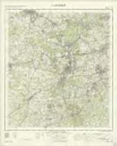
Aldershot - OS One-Inch Map
1 : 63360 Topographic maps Ordnance Survey Ordnance Survey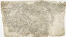
Odiham
1 : 31680 The most striking feature of this drawing is the triangulation web covering a large area around the East Hampstead Plain. According to manuscript sources, the different ground levels in this region made it an ideal case study for assistant engineers training for the Ordnance Survey under the tuition of Robert Dawson, the surveyor of this plan. Two circles on the main road through Hartford Bridge Flats represent triangulation points. Dawson, Robert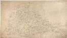
Alton
1 : 31680 This map depicts a part of Hampshire's North Downs, particularly the chalk hills to the south of Basingstoke. Buildings appear infilled and blocked in red ink at the main settlements of Basingstoke, at the top of the plan, and Alton, at the bottom. Hewitt, John
Estates at Windsor, Berkshire
This is a manuscript map of the area surrounding Windsor in Berkshire. It forms part of an atlas that belonged to William Cecil Lord Burghley, Elizabeth I’s Secretary of State. Burghley used this atlas to illustrate domestic matters. Burghley was in charge of administration for the Royal Estate of Windsor. The Royal Estates were notoriously slackly administered, a flaw that no official involved was keen to remedy as there were considerable personal advantages to be gained from inadequacies in the system. The map is drawn to scale with a scale bar of 5.5 - 6 miles. The many parks are shown by enclosure symbols, an important feature of any landscape for military purposes as it was in parks that troops could rest and horses graze. Communication routes such as roads and pathways are indicated by double or single broken lines and the rivers and the points at which they are bridged are also shown. The waterways were a vital communication route at the time, especially in this area where the Thames provides direct access to the centre of London.
Map of Hampshire, including the Isle of Wight, 2
1 Blatt : 55 x 70 cm s.n.
London passenger transport map
Ordnance Survey
Selborne
1 : 31680 .Turnpike roads in faded ochre run from Guildford at the top of the map through Witley, at the centre left, on to 'Aldfold' at the bottom left., The mileage appears along the route in black-ink figures., Tollgates are marked 'TG'., Open dotting is used to depict the untilled agricultural land predominant around the river valleys., The hill shading and attention to communication routes conform to the military and cartographic standards employed by the Ordnance Survey. Budgen, Thomas
Godalming
1 : 31680 .This map is in excellent condition and has retained its colour through two centuries. The turquoise wash, used to indicate water, remains particularly bright and vibrant. Commonland is the most prominent topographical feature in the drawing, denoted by open dotting. Large commons are shown at Frensham, Fernham, Thursley, Witley and Hinkley. Commons were carefully detailed by the surveyors, with a view to their possible use as military encampments. Although illustrating archaeological features did not become obligatory until 1816, this map notes a Bronze Age structure called the Devil's Jump, near Elstead at the centre of the map. Budgen, Thomas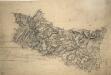
Chiddingfold
1 : 31680 .A turnpike road, coloured ochre yellow, forms a boundary from Hascombe at the top right of the map to 'Aldfold' at the bottom. Common land and dense woodland dominate the region to the left around Hindhead Valley and the Devil's Punchbowl.Commonland is indicated by open dotting. Woods and trees could provide hindrance or cover for the movement of a regiment, so these are recorded in painstaking detail. Individual trees are depicted with a small vertical stem and a shadow at the base. There are also more general representations of groups of treetops. Budgen, Thomas
Chobham
1 : 31680 .This map is in poor repair. Its edges are dirty and damaged, and a join is visible where the drawing has been torn. Triangulation points can be seen at the map's boundaries, along with a series of stitch holes. Silk tape was wound through these holes to protect the map in the field. .The drawing details a large number of commons, including Pirbright, Ham Haw and Ockham. These are depicted by patterns of open dotting. Basingstoke Canal also features. It was completed in 1794, only a few years before this map was drawn. Blue washes, used to depict water, have faded. The town of Chertsey appears towards the top right, along with the ruins of Chertsey Abbey. The abbey was founded in AD666, as a house for the Benedictine Order, and dissolved in 1537. Budgen, Thomas
Frogle
1 : 31680 This rough field sketch was drawn on three pieces of paper, subsequently joined and mounted on stiff card. Featuring corrections in black and red ink, it provides a good contrast with more finished drawings. The draughtsman has recorded relief and the layout of the settlements. An avenue of trees near Henwood is represented by individual trees drawn with their shadows falling to the right. "T.P.G" is written on some roads to indicate a turnpike gate.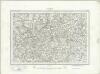
Haslemere (Outline) - OS One-Inch Revised New Series
1 : 63360 Topographic maps Ordnance Survey Ordnance Survey
Haslemere (Hills) - OS One-Inch Revised New Series
1 : 63360 Topographic maps Ordnance Survey Ordnance Survey
Aldershot (Hills) - OS One-Inch Revised New Series
1 : 63360 Topographic maps Ordnance Survey Ordnance Survey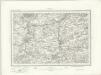
Aldershot (Outline) - OS One-Inch Revised New Series
1 : 63360 Topographic maps Ordnance Survey Ordnance Survey
The second sheet of an actual survey of Berkshire
1 Blatt : 68 x 52 cm John Rocque
The first sheet of an actual survey of Berkshire
1 Blatt : 68 x 52 cm publish'd according to act of parliament by John Rocque chorographer to their royal Highnesses the late and present Prince of Wales etc. in the Strand
Basingstoke (Hills) - OS One-Inch Revised New Series
1 : 63360 Topographic maps Ordnance Survey Ordnance Survey
Basingstoke (Outline) - OS One-Inch Revised New Series
1 : 63360 Topographic maps Ordnance Survey Ordnance Survey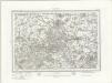
Windsor (Outline) - OS One-Inch Revised New Series
1 : 63360 Topographic maps Ordnance Survey Ordnance Survey
Windsor (Hills) - OS One-Inch Revised New Series
1 : 63360 Topographic maps Ordnance Survey Ordnance Survey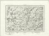
Alresford (Outline) - OS One-Inch Revised New Series
1 : 63360 Topographic maps Ordnance Survey Ordnance Survey
Alresford (Hills) - OS One-Inch Revised New Series
1 : 63360 Topographic maps Ordnance Survey Ordnance Survey
Midhurst 8
1 : 31680 The counties of Hampshire, Surrey and Sussex are separated by a red dashed boundary line in this map of the South Downs and the River Rother Valley. Archaeological details are recorded at Duncton Beacon and Irons Barrow even though such documentation did not become obligatory until 1816. Trees and woodland dominate this undulating landscape. Individual trees with a small vertical stem and a shadow at the base are painstakingly drawn, as well as more general, stippled representations of tree tops en masse. The detailed representation of woodland highlights the military emphasis of the survey: trees could hinder or hide the movement of a regiment. The paper bears the watermark '1903.' Budgen, Charles
The third sheet of an actual survey of Berkshire
1 Blatt : 68 x 52 cm John Rocque
Alresford 7
Pencil rays radiate from the centre of several circles on this plan. These were used to measure the distance between fixed points in the surveyed area. Calculations are faintly visible on the left edge of the drawing. The paper is watermarked "E & P", Standing for Edmeads and Pine. The numerical annotations running alongside the main road indicate the distance in miles from Alresford to Bishop's Sutton. Like all major communications routes in the Survey, This road is tinted yellow.
Reading (Hills) - OS One-Inch Revised New Series
1 : 63360 Topographic maps Ordnance Survey Ordnance Survey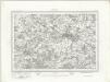
Reading (Outline) - OS One-Inch Revised New Series
1 : 63360 Topographic maps Ordnance Survey Ordnance Survey
Bentworth
1 : 31680 This is a rough plot, or field sketch, of the chalk hills to the south of Basingstoke, part of Hampshire's North Downs. Buildings appear infilled and blocked in red ink at the settlements of Bighton and Chawton, at the bottom of the plan, and in black ink, at Bentworth, above Chawton. The map is drawn on an irregularly cut sheet that is pieced together with detail extending over the joins. The paper carries the watermark '1794.'