Maps of Daventry

Northampton - OS One-Inch Map
1 : 63360 Topographic maps Ordnance Survey Ordnance Survey
Northampton
1 : 31680 This drawing covers part of the Nene Valley as the river meanders through farmland and the industries of Northamptonshire. Mills are depicted throughout the area, especially along the river's course. The staples of Northamptonshire's industry at the beginning of the 19th century were wool, lace, silk and shoemaking. With no indigenous coal supply, local industrialists relied principally upon natural resources for industrial processing, particularly wind and water. Hyett, William
Market Harborough (Hills) - OS One-Inch Revised New Series
1 : 63360 Topographic maps Ordnance Survey Ordnance Survey
Market Harborough (Outline) - OS One-Inch Revised New Series
1 : 63360 Topographic maps Ordnance Survey Ordnance Survey
Northampton (Outline) - OS One-Inch Revised New Series
1 : 63360 Topographic maps Ordnance Survey Ordnance Survey
Northampton (Hills) - OS One-Inch Revised New Series
1 : 63360 Topographic maps Ordnance Survey Ordnance Survey
Kettering
1 : 31680 This finished drawing covers parts of Northamptonshire and Leicestershire, with Rockingham Forest to the north represented by stippled treetops. Situated between the Welland and Nene valleys, and the towns of Stamford and Kettering, the forest's varied landscape includes farmland, open pasture, villages and pockets of woodland. Boughton Hall is depicted in the middle of the sheet. Formerly a monastery, it was transformed into one of the great houses of Europe in the 17th century. Hyett, William
Welford
1 : 31680 This drawing depicts the boundary of Leicestershire and Northamptonshire. The county border is indicated at top left by a pecked line following the course of the River Avon. Relative relief is depicted by brushwork interlining ('hachuring') and ink wash. A section of the Watling Street is shown at bottom left. This Roman road ran from London to Wroxeter in Wales, via St. Albans and Leicester (where it intersected the Fosse Way, the Roman road from Exeter to Lincoln). Triangulation points and pencil rays used to plot the survey of the region are clearly visible at the top of the sheet. Stevens, Henry
Burton Overy
1 : 31680 Light brushwork interlining ('hachuring')is used to represent the gently undulating clay vales and ridges that make up much of the area covered by this drawing. Enclosed farmland dominates the landscape. There are only small areas of woodland, indicated by dark green washes. Leicester is shown at middle left along the Fosse Way, the Roman road from Exeter to Lincoln, via Bath, Cirencester, and Leicester. Stevens, Henry
Wellingborough (Outline) - OS One-Inch Revised New Series
1 : 63360 Topographic maps Ordnance Survey Ordnance Survey
Wellingborough (Hills) - OS One-Inch Revised New Series
1 : 63360 Topographic maps Ordnance Survey Ordnance Survey
Oakham
1 : 31680 .Burley Park, at the top of the plan, and Normanton Park, at middle right ,are interesting examples of the 17th-century development of formal park landscape, characterised by regular hedgerows and fishponds. At the top of the map, north of Oakham, is the Oakham Canal. An entirely manmade waterway, this circuitous canal was opened in 1803, and passes by many Rutland villages on its way from Melton Wharf to Oakham. Boyce
SP89 - OS 1:25,000 Provisional Series Map
1 : 25000 Topographic maps Ordnance Survey Ordnance Survey
SP88 - OS 1:25,000 Provisional Series Map
1 : 25000 Topographic maps Ordnance Survey Ordnance Survey
SP87 - OS 1:25,000 Provisional Series Map
1 : 25000 Topographic maps Ordnance Survey Ordnance Survey
SP79 - OS 1:25,000 Provisional Series Map
1 : 25000 Topographic maps Ordnance Survey Ordnance Survey
SP86 - OS 1:25,000 Provisional Series Map
1 : 25000 Topographic maps Ordnance Survey Ordnance Survey
SP78 - OS 1:25,000 Provisional Series Map
1 : 25000 Topographic maps Ordnance Survey Ordnance Survey
SP85 - OS 1:25,000 Provisional Series Map
1 : 25000 Topographic maps Ordnance Survey Ordnance Survey
SP77 - OS 1:25,000 Provisional Series Map
1 : 25000 Topographic maps Ordnance Survey Ordnance Survey
SP69 - OS 1:25,000 Provisional Series Map
1 : 25000 Topographic maps Ordnance Survey Ordnance Survey
SP76 - OS 1:25,000 Provisional Series Map
1 : 25000 Topographic maps Ordnance Survey Ordnance Survey
SP68 - OS 1:25,000 Provisional Series Map
1 : 25000 Topographic maps Ordnance Survey Ordnance Survey
SP75 - OS 1:25,000 Provisional Series Map
1 : 25000 Topographic maps Ordnance Survey Ordnance Survey
SP67 - OS 1:25,000 Provisional Series Map
1 : 25000 Topographic maps Ordnance Survey Ordnance Survey
SP66 - OS 1:25,000 Provisional Series Map
1 : 25000 Topographic maps Ordnance Survey Ordnance Survey
SP65 - OS 1:25,000 Provisional Series Map
1 : 25000 Topographic maps Ordnance Survey Ordnance Survey
Buckinghamshire II (inset III) - OS Six-Inch Map
1 : 10560 Topographic maps Ordnance Survey Ordnance Survey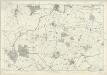
Buckinghamshire IV (inset I) - OS Six-Inch Map
1 : 10560 Topographic maps Ordnance Survey Ordnance Survey