Maps of West Midlands

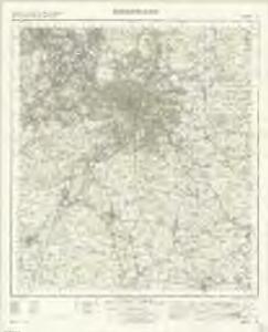
Birmingham - OS One-Inch Map
1 : 63360 Topographic maps Ordnance Survey Ordnance Survey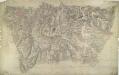
Birmingham 24
1 : 31680 This drawing is attributed to Robert Dawson. Different shades of green are employed to distinguish different land uses, and darker tones to describe the bold undulation of the landscape. Birmingham is depicted top left, at the centre of a network of toll roads and canals. Prominently featured on the plan is the Grand Junction Canal. This waterway was at the heart of the Industrial Revolution in this region at the beginning of the 19th century, carrying raw materials to mills and industrial centres, and finished goods to markets throughout Britain. Dawson, Robert
Ordnance Survey of England. Sheet 168, Birmingham
1 : 63360 Ordnance survey. GB Southampton : Ordnance Survey Office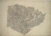
Henley-in-Arden
1 : 31680 This plan covers parts of Warwickshire and Worcestershire. Hill contours are described by brushwork interlining ('hachuring') combined with shaded bands of colour wash, which graduate to almost colourless at the summits. The order of ascending heights is expressed by rising numbers, a technique that became known as 'relative command'. Colour washes and symbols distinguish woods, meadows, common and arable land. Dawson, Robert
Birmingham (Hills) - OS One-Inch Revised New Series
1 : 63360 Topographic maps Ordnance Survey Ordnance Survey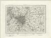
Birmingham (Outline) - OS One-Inch Revised New Series
1 : 63360 Topographic maps Ordnance Survey Ordnance Survey
Redditch (Hills) - OS One-Inch Revised New Series
1 : 63360 Topographic maps Ordnance Survey Ordnance Survey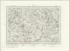
Redditch (Outline) - OS One-Inch Revised New Series
1 : 63360 Topographic maps Ordnance Survey Ordnance Survey
Stourbridge
1 : 31680 This plan covers parts of Worcestershire and Warwickshire. Hills and reliefs are illustrated by a combination of brushwork interlining ('hachures'), layering of colour washes and the use of aerial perspective. Tollroads are highlighted in buff and milestones noted along their routes. Stevens, Henry
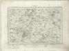
Tardebigge
1 : 31680 .This map covers part of Worcestershire., The right-hand boundary of the plan is formed by a Roman road, Ikenild Street., Another such road, the Salt Way, is drawn across the middle of the sheet., In Roman times, this road connected the salt mines at Droitwich,,near the top right, with Alcester, at the bottom. .Outside Alcester is Ragley Hall, designed in 1680 by Robert Hooke (1635-1703), the eminent natural philosopher and Surveyor of the City of London after the Great Fire of 1666., The landscaped gardens were added in the 18th century by Lancelot 'Capability' Brown (1716-1783) - so called because he often told prospective clients that their gardens had "great capabilities"., Brown and his followers revolutionised parkland design, virtually inventing the English parkland as we know it today, with carefully planned vistas of grassland, trees and lakes. Dawson, Robert
Sutton Coldfield
1 : 31680 This drawing of the area north-east of Birmingham was executed by Robert Dawson, who used different shades of green to distinguish land uses. Sutton Coldfield is depicted at lower right. Now a residential suburb of Birmingham, it was originally a market town with Sutton Park. The 970-hectare site was a private estate and one of Henry VIII's favourite hunting grounds. Areas of woodland, heathland and wetland make up the landscape of the park. Dawson, Robert
Wolverhampton 10
1 : 31680 This plan covers part of the English Midland plateau. The Staffordshire and Worcestershire Canal is depicted down the left side. Opened for traffic in May 1772, the canal was built by engineer James Brindley as part of his 'Grand Cross', a far-sighted scheme to link the ports of Hull, Liverpool and Bristol by connecting the rivers Mersey, Trent and Severn. Work on a second waterway, the Birmingham Canal, started a year later to facilitate the transport of coal from the pits of the Black Country to Birmingham. The Industrial Revolution saw over 180 miles of canals and 216 locks built. Part of this network is visible on the plan highlighted in blue. Dawson, Robert
Stratford on Avon (Outline) - OS One-Inch Revised New Series
1 : 63360 Topographic maps Ordnance Survey Ordnance Survey
Stratford on Avon (Hills) - OS One-Inch Revised New Series
1 : 63360 Topographic maps Ordnance Survey Ordnance Survey
SP29 - OS 1:25,000 Provisional Series Map
1 : 25000 Topographic maps Ordnance Survey Ordnance Survey
SP28 - OS 1:25,000 Provisional Series Map
1 : 25000 Topographic maps Ordnance Survey Ordnance Survey
SP27 - OS 1:25,000 Provisional Series Map
1 : 25000 Topographic maps Ordnance Survey Ordnance Survey
SP19 - OS 1:25,000 Provisional Series Map
1 : 25000 Topographic maps Ordnance Survey Ordnance Survey
SP26 - OS 1:25,000 Provisional Series Map
1 : 25000 Topographic maps Ordnance Survey Ordnance Survey
SP18 - OS 1:25,000 Provisional Series Map
1 : 25000 Topographic maps Ordnance Survey Ordnance Survey
SP25 - OS 1:25,000 Provisional Series Map
1 : 25000 Topographic maps Ordnance Survey Ordnance Survey
SP17 - OS 1:25,000 Provisional Series Map
1 : 25000 Topographic maps Ordnance Survey Ordnance Survey
SO99 - OS 1:25,000 Provisional Series Map
1 : 25000 Topographic maps Ordnance Survey Ordnance Survey
SP09 - OS 1:25,000 Provisional Series Map
1 : 25000 Topographic maps Ordnance Survey Ordnance Survey
SP16 - OS 1:25,000 Provisional Series Map
1 : 25000 Topographic maps Ordnance Survey Ordnance Survey
SO98 - OS 1:25,000 Provisional Series Map
1 : 25000 Topographic maps Ordnance Survey Ordnance Survey
SP08 - OS 1:25,000 Provisional Series Map
1 : 25000 Topographic maps Ordnance Survey Ordnance Survey
SP15 - OS 1:25,000 Provisional Series Map
1 : 25000 Topographic maps Ordnance Survey Ordnance Survey