Mapa catalogado
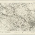
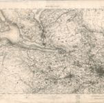
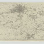
Glasgow - OS One-Inch Map
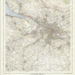

Título completo:Glasgow - OS One-Inch Map
Año de ilustración:1945
Fecha de publicación:1957
Editorial:Ordnance Survey
Tamaño físico:20 x 30 cm
Escala del mapa:1:63 360
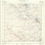
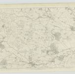
NS36 - OS 1:25,000 Provisional Series Map
1949
Ordnance Survey
1:25k
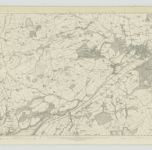
NS46 - OS 1:25,000 Provisional Series Map
1938
Ordnance Survey
1:25k
Ayrshire, Sheet V - OS 6 Inch map
1855
Ordnance Survey
1:11k
Ayrshire, Sheet V - OS 6 Inch map
1855
Ordnance Survey
1:11k
Renfrewshire, Sheet VII - OS 6 Inch map
1857
Ordnance Survey
1:11k
Renfrewshire, Sheet XI - OS 6 Inch map
1857
Ordnance Survey
1:11k
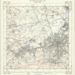
Glasgow - OS One-Inch map
1902
Ordnance Survey
1:63k
Glasgow - OS One-Inch map
1895
Ordnance Survey
1:63k
Glasgow - OS One-Inch map
1861
Ordnance Survey
1:63k
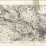
Renfrewshire, Sheet XII - OS 6 Inch map
1858
Ordnance Survey
1:11k