Maps of Greenock
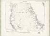
Dunoon & Loch Fyne (65) - OS One-Inch map
1 : 63360 Topographic maps Ordnance Survey Ordnance Survey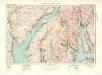
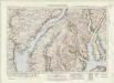
Dunoon & Loch Fyne (65) - OS One-Inch map
1 : 63360 Topographic maps Ordnance Survey Ordnance Survey
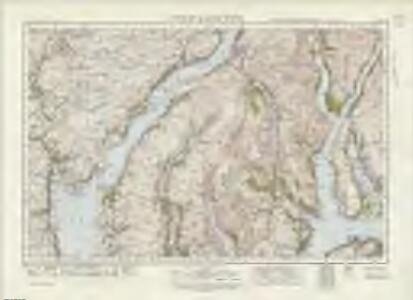
Inveraray - OS One-Inch map
1 : 63360 Topographic maps Ordnance Survey Ordnance Survey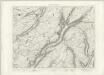
Inveraray - OS One-Inch map
1 : 63360 Topographic maps Ordnance Survey Ordnance Survey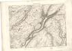
Inveraray - OS One-Inch map
1 : 63360 Topographic maps Ordnance Survey Ordnance Survey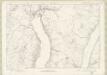
Dunbartonshire Sheet n VI - OS 6 Inch map
1 : 10560 Topographic maps Ordnance Survey Ordnance Survey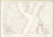
Dunbartonshire Sheet n IX - OS 6 Inch map
1 : 10560 Topographic maps Ordnance Survey Ordnance Survey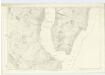
Argyllshire, Sheet CLIII - OS 6 Inch map
1 : 10560 Topographic maps Ordnance Survey Ordnance Survey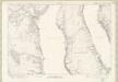
Dunbartonshire Sheet n XII - OS 6 Inch map
1 : 10560 Topographic maps Ordnance Survey Ordnance Survey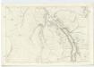
Argyllshire, Sheet CLII - OS 6 Inch map
1 : 10560 Topographic maps Ordnance Survey Ordnance Survey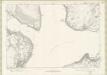
Dunbartonshire Sheet n XVI - OS 6 Inch map
1 : 10560 Topographic maps Ordnance Survey Ordnance Survey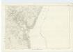
Argyllshire, Sheet CLXIV - OS 6 Inch map
1 : 10560 Topographic maps Ordnance Survey Ordnance Survey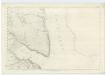
Argyllshire, Sheet CLXXIV - OS 6 Inch map
1 : 10560 Topographic maps Ordnance Survey Ordnance Survey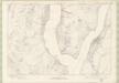
Argyll and Bute Sheet CLIII - OS 6 Inch map
1 : 10560 Topographic maps Ordnance Survey Ordnance Survey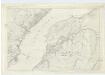
Argyllshire, Sheet CLI - OS 6 Inch map
1 : 10560 Topographic maps Ordnance Survey Ordnance Survey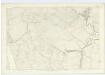
Argyllshire, Sheet CLXXIII - OS 6 Inch map
1 : 10560 Topographic maps Ordnance Survey Ordnance Survey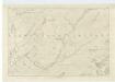
Argyllshire, Sheet CL - OS 6 Inch map
1 : 10560 Topographic maps Ordnance Survey Ordnance Survey
Dumbartonshire, Sheet VII - OS 6 Inch map
1 : 10560 Topographic maps Ordnance Survey Ordnance Survey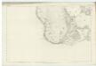
Dumbartonshire, Sheet XVI - OS 6 Inch map
1 : 10560 Topographic maps Ordnance Survey Ordnance Survey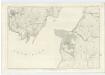
Argyllshire, Sheet CLXXI - OS 6 Inch map
1 : 10560 Topographic maps Ordnance Survey Ordnance Survey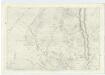
Argyllshire, Sheet CLXIII - OS 6 Inch map
1 : 10560 Topographic maps Ordnance Survey Ordnance Survey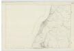
Dumbartonshire, Sheet IX - OS 6 Inch map
1 : 10560 Topographic maps Ordnance Survey Ordnance Survey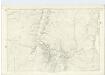
Argyllshire, Sheet CLXXII - OS 6 Inch map
1 : 10560 Topographic maps Ordnance Survey Ordnance Survey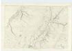
Argyllshire, Sheet CLXII - OS 6 Inch map
1 : 10560 Topographic maps Ordnance Survey Ordnance Survey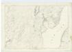
Argyllshire, Sheet CLXI - OS 6 Inch map
1 : 10560 Topographic maps Ordnance Survey Ordnance Survey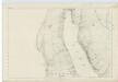
Dumbartonshire, Sheet XII - OS 6 Inch map
1 : 10560 Topographic maps Ordnance Survey Ordnance Survey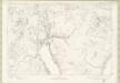
Argyll and Bute Sheet CXLII - OS 6 Inch map
1 : 10560 Topographic maps Ordnance Survey Ordnance Survey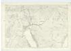
Argyllshire, Sheet CXLII - OS 6 Inch map
1 : 10560 Topographic maps Ordnance Survey Ordnance Survey
Dunbartonshire Sheet n XII.NW & NE - OS 6 Inch map
1 : 10560 Topographic maps Ordnance Survey Ordnance Survey