Maps of Perthshire and Kinross
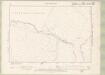
Killin & Loch Rannoch (55) - OS One-Inch map
1 : 63360 Topographic maps Ordnance Survey Ordnance Survey
Killin & Loch Rannoch (55) - OS One-Inch map
1 : 63360 Topographic maps Ordnance Survey Ordnance Survey
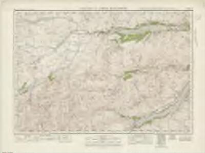
Rannoch - OS One-Inch map
1 : 63360 Topographic maps Ordnance Survey Ordnance Survey
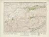
Rannoch - OS One-Inch map
1 : 63360 Topographic maps Ordnance Survey Ordnance Survey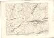
Rannoch - OS One-Inch map
1 : 63360 Topographic maps Ordnance Survey Ordnance Survey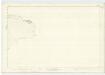
Argyllshire, Sheet XXXIV - OS 6 Inch map
1 : 10560 Topographic maps Ordnance Survey Ordnance Survey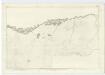
Argyllshire, Sheet XXXIII - OS 6 Inch map
1 : 10560 Topographic maps Ordnance Survey Ordnance Survey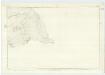
Argyllshire, Sheet LXII - OS 6 Inch map
1 : 10560 Topographic maps Ordnance Survey Ordnance Survey
Argyllshire, Sheet XLVIII - OS 6 Inch map
1 : 10560 Topographic maps Ordnance Survey Ordnance Survey
Perthshire, Sheet XLV - OS 6 Inch map
1 : 10560 Topographic maps Ordnance Survey Ordnance Survey
Argyllshire, Sheet LXXVII - OS 6 Inch map
1 : 10560 Topographic maps Ordnance Survey Ordnance Survey
Perthshire, Sheet LXVI - OS 6 Inch map
1 : 10560 Topographic maps Ordnance Survey Ordnance Survey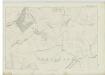
Perthshire, Sheet LV - OS 6 Inch map
1 : 10560 Topographic maps Ordnance Survey Ordnance Survey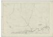
Perthshire, Sheet XLVI - OS 6 Inch map
1 : 10560 Topographic maps Ordnance Survey Ordnance Survey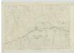
Perthshire, Sheet LXVII - OS 6 Inch map
1 : 10560 Topographic maps Ordnance Survey Ordnance Survey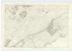
Argyllshire, Sheet LXI - OS 6 Inch map
1 : 10560 Topographic maps Ordnance Survey Ordnance Survey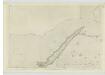
Perthshire, Sheet XXXIV - OS 6 Inch map
1 : 10560 Topographic maps Ordnance Survey Ordnance Survey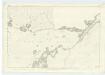
Argyllshire, Sheet XLVII - OS 6 Inch map
1 : 10560 Topographic maps Ordnance Survey Ordnance Survey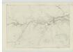
Perthshire, Sheet XXXV - OS 6 Inch map
1 : 10560 Topographic maps Ordnance Survey Ordnance Survey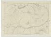
Perthshire, Sheet LVI - OS 6 Inch map
1 : 10560 Topographic maps Ordnance Survey Ordnance Survey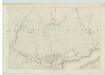
Perthshire, Sheet LXVIII - OS 6 Inch map
1 : 10560 Topographic maps Ordnance Survey Ordnance Survey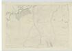
Perthshire, Sheet LVII - OS 6 Inch map
1 : 10560 Topographic maps Ordnance Survey Ordnance Survey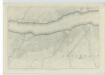
Perthshire, Sheet XXXVI - OS 6 Inch map
1 : 10560 Topographic maps Ordnance Survey Ordnance Survey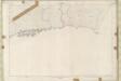
Inverness-shire - Mainland Sheet CLXIX - OS 6 Inch map
1 : 10560 Topographic maps Ordnance Survey Ordnance Survey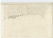
Inverness-shire (Mainland), Sheet CLXIX - OS 6 Inch map
1 : 10560 Topographic maps Ordnance Survey Ordnance Survey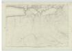
Perthshire, Sheet XXXVII - OS 6 Inch map
1 : 10560 Topographic maps Ordnance Survey Ordnance Survey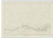
Perthshire, Sheet XLVII - OS 6 Inch map
1 : 10560 Topographic maps Ordnance Survey Ordnance Survey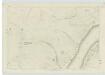
Perthshire, Sheet LVIII - OS 6 Inch map
1 : 10560 Topographic maps Ordnance Survey Ordnance Survey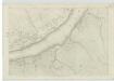
Perthshire, Sheet LXIX - OS 6 Inch map
1 : 10560 Topographic maps Ordnance Survey Ordnance Survey