Maps of Grampian Mountains
Linlithgowshire, Sheet n009.01 - 25 Inch Map
1 : 2500 Topographic maps Ordnance Survey Ordnance Survey
Linlithgowshire, Sheet 007.09 - 25 Inch Map
1 : 2500 Topographic maps Ordnance Survey Ordnance Survey
Linlithgow, Sheet VI.12 (with inset VII.9) (Kirkliston) - OS 25 Inch map
1 : 2500 Topographic maps Ordnance Survey Ordnance Survey
Edinburghshire, Sheet 002.06 - 25 Inch Map
1 : 2500 Topographic maps Ordnance Survey Ordnance Survey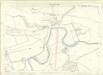
Edinburghshire, Sheet 002.06 - 25 Inch Map
1 : 2500 Topographic maps Ordnance Survey Ordnance Survey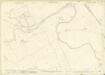
Edinburghshire, Sheet 002.07 - 25 Inch Map
1 : 2500 Topographic maps Ordnance Survey Ordnance Survey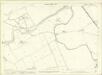
Edinburghshire, Sheet 002.07 - 25 Inch Map
1 : 2500 Topographic maps Ordnance Survey Ordnance Survey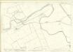
Edinburghshire, Sheet 002.07 - 25 Inch Map
1 : 2500 Topographic maps Ordnance Survey Ordnance Survey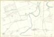
Linlithgowshire, Sheet 006.12 - 25 Inch Map
1 : 2500 Topographic maps Ordnance Survey Ordnance Survey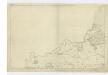
Edinburghshire, Sheet 1 - OS 6 Inch map
1 : 10560 Topographic maps Ordnance Survey Ordnance Survey
Edinburghshire Sheet II.NW - OS 6 Inch map
1 : 10560 Topographic maps Ordnance Survey Ordnance Survey
Edinburghshire Sheet II.NW - OS 6 Inch map
1 : 10560 Topographic maps Ordnance Survey Ordnance Survey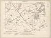
Edinburghshire Sheet II.NE - OS 6 Inch map
1 : 10560 Topographic maps Ordnance Survey Ordnance Survey
Edinburghshire Sheet II.NE - OS 6 Inch map
1 : 10560 Topographic maps Ordnance Survey Ordnance Survey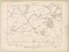
Edinburghshire Sheet II.NE - OS 6 Inch map
1 : 10560 Topographic maps Ordnance Survey Ordnance Survey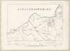
Edinburghshire Sheet II.NE - OS 6 Inch map
1 : 10560 Topographic maps Ordnance Survey Ordnance Survey
Linlithgowshire Sheet VI.SE - OS 6 Inch map
1 : 10560 Topographic maps Ordnance Survey Ordnance Survey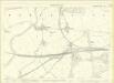
Edinburghshire, Sheet 002.10 - 25 Inch Map
1 : 2500 Topographic maps Ordnance Survey Ordnance Survey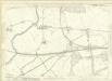
Edinburghshire, Sheet 002.10 - 25 Inch Map
1 : 2500 Topographic maps Ordnance Survey Ordnance Survey
Edinburghshire, Sheet 002.11 - 25 Inch Map
1 : 2500 Topographic maps Ordnance Survey Ordnance Survey
Edinburghshire, Sheet 002.11 - 25 Inch Map
1 : 2500 Topographic maps Ordnance Survey Ordnance Survey
Edinburghshire, Sheet 002.11 - 25 Inch Map
1 : 2500 Topographic maps Ordnance Survey Ordnance Survey
Linlithgow, Sheet VII.5 (Dalmeny, Cramond & Queensferry) - OS 25 Inch map
1 : 2500 Topographic maps Ordnance Survey Ordnance Survey
Linlithgowshire, Sheet 007.05 - 25 Inch Map
1 : 2500 Topographic maps Ordnance Survey Ordnance Survey
Linlithgow, Sheet VII.5 (Kirkliston) - OS 25 Inch map
1 : 2500 Topographic maps Ordnance Survey Ordnance Survey
Linlithgowshire Sheet n IX - OS 6 Inch map
1 : 10560 Topographic maps Ordnance Survey Ordnance Survey
NT17 - OS 1:25,000 Provisional Series Map
1 : 25000 Topographic maps Ordnance Survey Ordnance Survey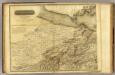
Edinburgh Shire 1 N.
1 : 43000 Knox, James
Firth of Forth: Fisherrow to Edgar
Great Britain. Hydrographic Office