Maps of Edinburgh
Edinburghshire, Sheet 004.01 & 02 - 25 Inch Map
1 : 2500 Topographic maps Ordnance Survey Ordnance Survey
Edinburghshire Sheet IV.NW - OS 6 Inch map
1 : 10560 Topographic maps Ordnance Survey Ordnance Survey
Edinburghshire Sheet IV.NW - OS 6 Inch map
1 : 10560 Topographic maps Ordnance Survey Ordnance Survey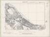
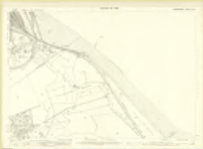
Edinburghshire Sheet IV.NW - OS 6 Inch map
1 : 10560 Topographic maps Ordnance Survey Ordnance Survey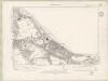
Edinburghshire Sheet IV.NW - OS 6 Inch map
1 : 10560 Topographic maps Ordnance Survey Ordnance Survey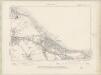
Edinburghshire Sheet IV.NW - OS 6 Inch map
1 : 10560 Topographic maps Ordnance Survey Ordnance Survey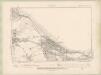
Edinburghshire Sheet IV.NW - OS 6 Inch map
1 : 10560 Topographic maps Ordnance Survey Ordnance Survey
Edinburghshire Sheet IV.NW - OS 6 Inch map
1 : 10560 Topographic maps Ordnance Survey Ordnance Survey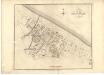
Plan of the Town of Portobello from actual survey.
Wood, John, ca. 1780-1847
Plan of the Town of Portobello from actual survey.
Wood, John, ca. 1780-1847
Portobello
Great Britain. Parliament. House of Commons.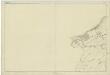
Haddingtonshire, Sheet 8 - OS 6 Inch map
1 : 10560 Topographic maps Ordnance Survey Ordnance Survey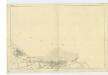
Edinburghshire, Sheet 3 - OS 6 Inch map
1 : 10560 Topographic maps Ordnance Survey Ordnance Survey
NT37 - OS 1:25,000 Provisional Series Map
1 : 25000 Topographic maps Ordnance Survey Ordnance Survey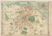
Bartholomew's pocket plan of Edinburgh
1 : 18500 John Bartholomew and Son J. Bartholomew & Son, Ltd.
Environs of Edinburgh - Bartholomew's 'Survey Atlas of Scotland'
1 : 42240 Topographic maps John Bartholomew & Son, Ltd John Bartholomew & Son, Ltd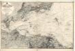
Firth of Forth: Fisherrow to Edgar
Great Britain. Hydrographic Office
Edinburgh environs.
1 : 85000 Society for the Diffusion of Useful Knowledge (Great Britain)
A new description of the shyres Lothian and Linlitquo
1 : 171000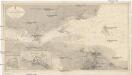
Nordsee
1 : 25000 Severní moře Reichs-Marine-Amt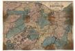
Plan of the Environs of Edinburgh.
Hunter, W. Anderson, J.
Gellatly's New Map of the country 12 miles round Edinburgh.
Johnson, William, fl. 1802-1840 Gellatly, J.
Geological, environs Edinburgh.
1 : 47520 Letts, Son & Co.
Edinburgh - OS One-Inch map
1 : 63360 Topographic maps Ordnance Survey Ordnance Survey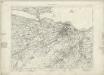
Edinburgh - OS One-Inch map
1 : 63360 Topographic maps Ordnance Survey Ordnance Survey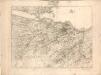
[Edinburgh] - OS One-Inch map
1 : 63360 Topographic maps Ordnance Survey Ordnance Survey
The Environs of Edinburgh
1 : 85000 Davies, Benjamin Rees George Cox
Volume 1: Sheet 32 - Edinburgh
1 : 63360 Farquharson, J.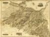
Composite: Edinburgh Shire.
1 : 43000 Thomson, John
Edinburgh (74) - OS One-Inch map
1 : 63360 Topographic maps Ordnance Survey Ordnance Survey