Maps of Greenock
Dumbartonshire, Sheet n017.05 - 25 Inch Map
1 : 2500 Topographic maps Ordnance Survey Ordnance Survey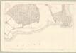
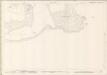
Dumbarton, Sheet XVI.12 (Rosneath) - OS 25 Inch map
1 : 2500 Topographic maps Ordnance Survey Ordnance Survey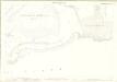
Dumbartonshire, Sheet 016.12 - 25 Inch Map
1 : 2500 Topographic maps Ordnance Survey Ordnance Survey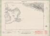
Dunbartonshire Sheet n XVII.NW - OS 6 Inch map
1 : 10560 Topographic maps Ordnance Survey Ordnance Survey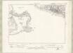
Dunbartonshire Sheet n XVII.NW - OS 6 Inch map
1 : 10560 Topographic maps Ordnance Survey Ordnance Survey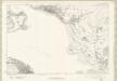
Dunbartonshire Sheet n XVII - OS 6 Inch map
1 : 10560 Topographic maps Ordnance Survey Ordnance Survey
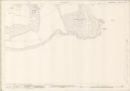
Dumbarton, Sheet XVI.4 (with inset XVII.9) (Rosneath) - OS 25 Inch map
1 : 2500 Topographic maps Ordnance Survey Ordnance Survey
Dumbartonshire, Sheet 017.09 - 25 Inch Map
1 : 2500 Topographic maps Ordnance Survey Ordnance Survey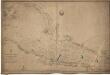
River Clyde, from Greenock to Dumbarton.
Great Britain. Hydrographic Office
Glasgow - OS One-Inch map
1 : 63360 Topographic maps Ordnance Survey Ordnance Survey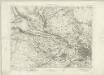
Glasgow - OS One-Inch map
1 : 63360 Topographic maps Ordnance Survey Ordnance Survey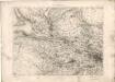
Glasgow - OS One-Inch map
1 : 63360 Topographic maps Ordnance Survey Ordnance Survey
Volume 1: Sheet 30 - Glasgow
1 : 63360 Farquharson, J.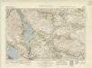
Loch Lomond (66) - OS One-Inch map
1 : 63360 Topographic maps Ordnance Survey Ordnance Survey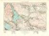
Loch Lomond (66) - OS One-Inch map
1 : 63360 Topographic maps Ordnance Survey Ordnance Survey
Præfectura Renfroana vulgo dicta Baronia
1 Karte : Kupferdruck ; 38 x 52 cm Blaeu; Pont Joan Blaeu
Levinia Vicecomitatus, [or],The Province of Lennox called the Shyre of Dun-Britton / Auct. Timoth. Pont.
Pont, Timothy, 1560?-1614? Blaeu, Joan, 1596-1673
LEVINIA, | VICE COMITATVS. | The Province of LENNOX, | called the Shyre of Dun-Britton.
Auct: Timoth: Pont. [Amsterdam : Joan Blaeu]
Levinia, vice comitatvs
1 Karte : Kupferdruck ; 38 x 52 cm Blaeu; Pont Joan Blaeu
Glasgow (72) - OS One-Inch map
1 : 63360 Topographic maps Ordnance Survey Ordnance Survey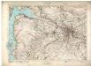
Glasgow (72) - OS One-Inch map
1 : 63360 Topographic maps Ordnance Survey Ordnance Survey
Cvninghamia
1 Karte : Kupferdruck ; 41 x 54 cm Blaeu; Pont Joan Blaeu
The Shire of Lenox [i.e. Lennox] or Dunbarton / by H. Moll.
Moll, Herman, d. 1732
Firth of Clyde - OS One-Inch Map
1 : 63360 Topographic maps Ordnance Survey Ordnance Survey
Loch Lomond - OS One-Inch Map
1 : 63360 Topographic maps Ordnance Survey Ordnance Survey
Buthe insula vulgo the yle of Boot
1 Karte : Kupferdruck ; 38 x 49 cm Blaeu; Pont Joan Blaeu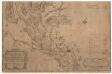
A map of the Shire of Dumbarton.
Ross, Charles, 1722-1806
A map of the Shire of Dumbarton.
Ross, Charles, 1722-1806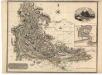
Dumbartonshire.
Thomson, John, 1777- ca. 1840