Maps of Stirling

Economic Map of Central Scotland - Bartholomew's 'Survey Atlas of Scotland'
1 : 316800 Topographic maps John Bartholomew & Son, Ltd John Bartholomew & Son, Ltd
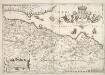
Carte des environs d'Edenburg
1 Karte : Kupferdruck ; 45 x 57 cm Robert de Vaugondy; Arrivet; Fortin; Dussy; Dorret chez le Sr. Fortin ing.r mécanicien du roy rue de la harpe près la rue du Foin
Sheets 75-76. (Cary's England, Wales, and Scotland).
1 : 360000 Cary, John, ca. 1754-1835
Map of the Basin of the Forth.
Knox, James, fl. 1800-1856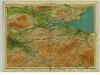
Forth, Sheet 8 - Bartholomew's "Half Inch to the Mile Maps" of Scotland
1 : 126720 Topographic maps John Bartholomew & Son, Ltd John Bartholomew & Son, Ltd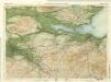
Edinburgh District, Sheet 8 - Bartholomew's "Half Inch to the Mile Maps" of Scotland
1 : 126720 Topographic maps Bartholomew, John George John Bartholomew & Co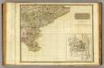
Perthshire SE.
1 : 131000 Storie, James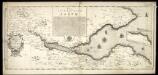
The River and Frith [sic] of Forth ... / Richard Cooper sculpt.
Adair, John, ca. 1650-1722 Cooper, Richard, 1705-1764
Composite: Perthshire.
1 : 131000 Storie, James
Composite: Ayrshire
1 : 78000 Johnson, William, fl. 1806-1840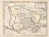
The Shires of Stirling and Clackmannan &c. / by H. Moll.
Moll, Herman, d. 1732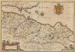
Provincae Lauden seu Lothien et Linlitouo [Karte], in: Novus atlas absolutissimus, Bd. 8, S. 129.
1 Karte aus Atlas Janssonius Offizin
LOTHIAN | and | LINLITQVO
Joh. et Cornelius Blaeu exc.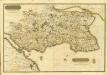
Composite: Fife, Kinross.
1 : 75000 Martin, Alexander
FIFÆ | VICECOMITATVS, | The Sherifdome of FYFE.
[Amsterdam : Joan Blaeu]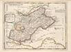
The Shires of Fife and Kinros / by H. Moll.
Moll, Herman, d. 1732
Composite: Ayrshire N.
1 : 78000 Johnson, William, fl. 1806-1840
Composite: Dumfriesshire.
1 : 64000 Crawford & Son
A New Description of the Shyres Lothian und Linlitquo. [Karte], in: Gerardi Mercatoris et I. Hondii Newer Atlas, oder, Grosses Weltbuch, Bd. 1, S. 72.
1 Karte aus Atlas Mercator, Gerhard und Hondius, Jodocus Jansson, Jan
GLOTTIANA PRÆFECTVRA | INFERIOR. | CVM BARONIA GLASCVENSI. | THE NETHER WARDE OF CLYDS-DAIL | AND Baronie of Glasco.
Auct. Timoth. Pont. [Amsterdam : Joan Blaeu]
Fifæ vicecomitatvs
1 Karte : Kupferdruck ; 40 x 51 cm Blaeu Joan Blaeu
TVEDIA | cum vicecomitatu Etterico Forestæ. | etiam Selkirke dictus | TWEE-DAIL | with the Sherifdome of Etterik-Forrest | called also Selkirk
Auct. Tomotheo Pont. [Amsterdam : Joan Blaeu]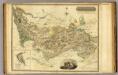
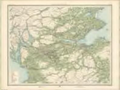
Stirlingshire.
1 : 108000 Thomson, John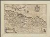
Provincae Lauden seu Lothien et Linlitouo
1 : 160000 [Amstelodami] : [apud Joannem Janssonium]
Ports And Harbours On The East Coast of Scotland.
Fullarton, A. & Co.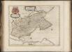
Fifae Vicecomitatus, The Sherifdome of Fyfe.
Gordon, James, 1615?-1686 Blaeu, Joan, 1596-1673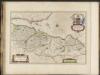
Lothian and Linlitquo / Joh. et Cornelius Blaeu exc.
Blaeu, Joan 1596-1673 Blaeu, Cornelius, d.1644
Map of the three Lothians.
Armstrong, Andrew, 1700-1794 Armstrong, Mostyn, fl. 1769-1791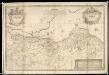
A New and Correct map of the Lothians from Mr. Adair's observations / by John Elphinstone ; Thos. Smith, Edin, sculpsit.
Elphinstone, John, 1706-1753 Smith, Thomas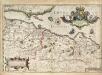
A new description of the shyres Lothian and Linlitquo / T. Pont ; Jodocus Hondius caelavit sumptibus Andrae Hart.
Pont, Timothy, 1560?-1614? Hondius, Hendrik, b. 1573
Map of the three Lothians.
Armstrong, Andrew, 1700-1794 Armstrong, Mostyn, fl. 1769-1791
Map of the three Lothians.
Armstrong, Andrew, 1700-1794 Armstrong, Mostyn, fl. 1769-1791
Map of the three Lothians.
Armstrong, Andrew, 1700-1794 Armstrong, Mostyn, fl. 1769-1791
A map of the environs of Edinburgh.
Kirkwood, Robert, fl. 1806-1828
Map of the three Lothians.
Armstrong, Andrew, 1700-1794 Armstrong, Mostyn, fl. 1769-1791
Map of the three Lothians.
Armstrong, Andrew, 1700-1794 Armstrong, Mostyn, fl. 1769-1791