Maps of Highland

Glenelg, etc. - Bartholomew's 'Survey Atlas of Scotland'
1 : 126720 Topographic maps John Bartholomew & Son, Ltd John Bartholomew & Son, Ltd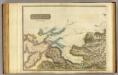
Inverness Shire 4 N.
1 : 128000 Johnson, William, fl. 1806-1840
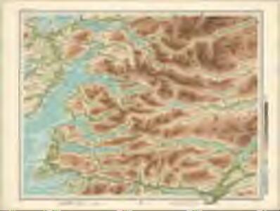
Loch Arkaig - OS One-Inch Map
1 : 63360 Topographic maps Ordnance Survey Ordnance Survey
Sound of Sleat (35) - OS One-Inch map
1 : 63360 Topographic maps Ordnance Survey Ordnance Survey
Sound of Sleat (35) - OS One-Inch map
1 : 63360 Topographic maps Ordnance Survey Ordnance Survey
Glenelg - OS One-Inch map
1 : 63360 Topographic maps Ordnance Survey Ordnance Survey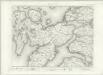
Glenelg - OS One-Inch map
1 : 63360 Topographic maps Ordnance Survey Ordnance Survey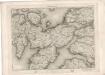
Glenelg - OS One-Inch map
1 : 63360 Topographic maps Ordnance Survey Ordnance Survey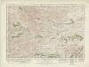
Glen Shiel & Glen Garry (41) - OS One-Inch map
1 : 63360 Topographic maps Ordnance Survey Ordnance Survey
Glen Shiel & Glen Garry (41) - OS One-Inch map
1 : 63360 Topographic maps Ordnance Survey Ordnance Survey
Cluanie - OS One-Inch map
1 : 63360 Topographic maps Ordnance Survey Ordnance Survey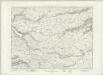
Cluanie - OS One-Inch map
1 : 63360 Topographic maps Ordnance Survey Ordnance Survey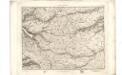
Clunie - OS One-Inch map
1 : 63360 Topographic maps Ordnance Survey Ordnance Survey
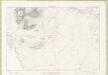
Sleat Sound
Great Britain. Hydrographic Office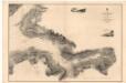
Loch Hourn
Great Britain. Hydrographic Office
Arisaig - OS One-Inch map
1 : 63360 Topographic maps Ordnance Survey Ordnance Survey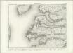
Arisaig - OS One-Inch map
1 : 63360 Topographic maps Ordnance Survey Ordnance Survey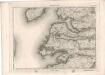
Arisaig - OS One-Inch map
1 : 63360 Topographic maps Ordnance Survey Ordnance Survey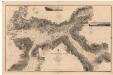
Loch Alsh and Loch Duich
Great Britain. Hydrographic Office
Loch Eil - OS One-Inch map
1 : 63360 Topographic maps Ordnance Survey Ordnance Survey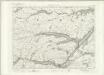
Loch Eil - OS One-Inch map
1 : 63360 Topographic maps Ordnance Survey Ordnance Survey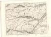
Loch Eil - OS One-Inch map
1 : 63360 Topographic maps Ordnance Survey Ordnance Survey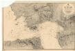
Inverie Bay and Approach
Great Britain. Hydrographic Office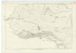
Inverness-shire (Mainland), Sheet LXII - OS 6 Inch map
1 : 10560 Topographic maps Ordnance Survey Ordnance Survey
Ross-shire & Cromartyshire (Mainland), Sheet CXXXIII (with inset of sheet CXXX) - OS 6 Inch map
1 : 10560 Topographic maps Ordnance Survey Ordnance Survey
Inverness-shire (Mainland), Sheet LXXVI - OS 25 Inch map
1 : 2500 Topographic maps Ordnance Survey Ordnance Survey
Inverness-shire - Isle of Skye Sheet XL - OS 6 Inch map
1 : 10560 Topographic maps Ordnance Survey Ordnance Survey
Inverness-shire (Isle of Skye), Sheet XLVI - OS 6 Inch map
1 : 10560 Topographic maps Ordnance Survey Ordnance Survey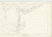
Inverness-shire (Isle of Skye), Sheet LII - OS 6 Inch map
1 : 10560 Topographic maps Ordnance Survey Ordnance Survey