Maps of Midlothian

Edinburgh - Bartholomew's 'Survey Atlas of Scotland'
1 : 126720 Topographic maps John Bartholomew & Son, Ltd John Bartholomew & Son, Ltd
Map of the shire of Edinburgh.
Knox, James, fl. 1800-1856
Map of the county of Edinburgh.
Greenwood, Christopher, 1786-1855 Fowler, William, fl. 1818-1863 Sharp, T.
A plan of the county of Mid-Lothian...
Laurie, John, fl. 1757-1800
Map of the county of Edinburgh.
Greenwood, Christopher, 1786-1855 Fowler, William, fl. 1818-1863 Sharp, T.
Map of the shire of Edinburgh.
Knox, James, fl. 1800-1856
A plan of the county of Mid-Lothian...
Laurie, John, fl. 1757-1800
A plan of the county of Mid-Lothian...
Laurie, John, fl. 1757-1800
Map of the County of Edinburgh shewing the turnpike and statute labour roads... etc.
Forrester, William
Map of the shire of Edinburgh.
Knox, James, fl. 1800-1856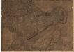
A plan of the county of Mid-Lothian...
Laurie, John, fl. 1757-1800
Map of the shire of Edinburgh.
Knox, James, fl. 1800-1856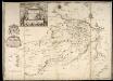
A Map of Midlothian / survey'd by Mr. J. Adair.
Adair, John, ca. 1650-1722 Cooper, Richard, 1705-1764
[Map of Midlothian]
Adair, John, ca. 1650-1722
Tvedia cum vicecomitatu Etterico Forestæ etiam Selkirkæ dictus
1 Karte : Kupferdruck ; 41 x 49 cm Blaeu; Pont Joan Blaeu
Peebles-Shire.
1 : 78000 Thomson, John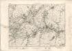
Peebles - OS One-Inch map
1 : 63360 Topographic maps Ordnance Survey Ordnance Survey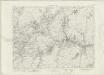
Peebles - OS One-Inch map
1 : 63360 Topographic maps Ordnance Survey Ordnance Survey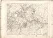
Peebles - OS One-Inch map
1 : 63360 Topographic maps Ordnance Survey Ordnance Survey
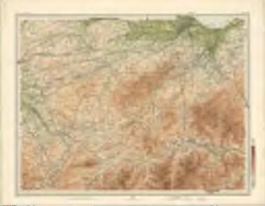
Edinburgh - OS One-Inch Map
1 : 63360 Topographic maps Ordnance Survey Ordnance Survey
Tweddale, alias, The Shire of Peebles &c. / by H. Moll.
Moll, Herman, d. 1732
A new and correct map of the Shire of Peebles or Tweeddale / survey'd by Will. Edgar, 1741 ; R. Cooper sculp.
Edgar, William, fl. 1717-1746 Cooper, Richard, 1705-1764
The Shire of Peebles or Tweeddale.
Edgar, William, fl. 1717-1746
To the... Earl of March and Ruglen... this map of the County of Peebles or Tweedale is... inscribed by... Mostyn Jno. Armstrong
Armstrong, Mostyn, fl. 1769-1791
Peebles-Shire.
Thomson, John, 1777- ca. 1840 Johnson, William, fl. 1806-1840
Falkirk and Lanark - OS One-Inch Map
1 : 63360 Topographic maps Ordnance Survey Ordnance Survey
The Environs of Edinburgh
1 : 85000 Davies, Benjamin Rees George Cox
Falkirk & Motherwell (73) - OS One-Inch map
1 : 63360 Topographic maps Ordnance Survey Ordnance Survey
Falkirk & Motherwell (73) - OS One-Inch map
1 : 63360 Topographic maps Ordnance Survey Ordnance Survey