Maps of Moray
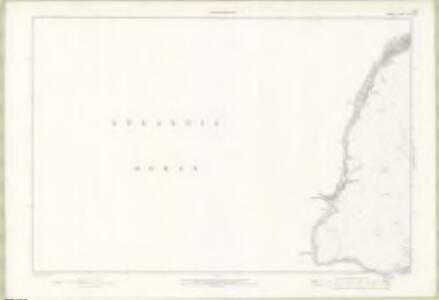
Orkney Sheet CXI - OS 6 Inch map
1 : 10560 Topographic maps Ordnance Survey Ordnance Survey
Orkney, Sheet CXI - OS 6 Inch map
1 : 10560 Topographic maps Ordnance Survey Ordnance Survey
Pentland Firth - OS One-Inch Map
1 : 63360 Topographic maps Ordnance Survey Ordnance Survey
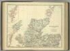
Orkney, Southern - Bartholomew's 'Survey Atlas of Scotland'
1 : 126720 Topographic maps John Bartholomew & Son, Ltd John Bartholomew & Son, Ltd
Dunbeath Harbour to Thurso Bay, Including the Pentland Firth
Great Britain. Hydrographic Office
Die Orkney's oder die Orkadischen Inseln
1 : 410000 Orkneje (Skotsko)
Die Orkneys oder die Orkadischen Inseln
1 : 415000 Orkneje (Skotsko)
A chart of the Orkney Islands.
Aberdeen, William, fl. ca. 1742-1794
The Islands of Orkney / H. Moll, sculp.
Collins, Greenvile, fl. 1669-1698 Moll, Herman, d. 1732.
A chart of the islands of Orkney... with the coast of Scotland.
Eunson, George

Ordnance Survey of Great Britain, Scotland
Ordnance Survey
De noordelijkste kust van Schotland met alle desselfs gelegentheden
Scotland Gerard van Keulen
Orcadum et Schetlandiae Insularum accuratissima descriptio. [Karte, Orcades], in: Novus atlas absolutissimus, Bd. 8, S. 180.
1 Karte aus Atlas Janssonius Offizin
Nieuwe paskaart van de Orcades Eylanden / door Vooght geometra.
Vooght, Claes Janszoon, d. 1696. Keulen, Johannes van, 1654-1715.
Orcadum et Schetlandiae Insularum accuratissima descriptio. [Karte, Orcades], in: Gerardi Mercatoris et I. Hondii Newer Atlas, oder, Grosses Weltbuch, Bd. 1, S. 69.
1 Karte aus Atlas Mercator, Gerhard und Hondius, Jodocus Jansson, Jan
Carte des Isles Orcades.
Depot Generale de la Marine, Paris
A new chart of the north coast of Scotland with... the Orkney Islands.
Bennett, J. Sayer, R.
Extimae Scotiae pars Septentrionalis, in qua Provinciae Rossia, Sutherlandia, Cathenesia, et Strath-Naverniae. [Karte], in: Novus atlas absolutissimus, Bd. 8, S. 166.
1 Karte aus Atlas Janssonius Offizin
Scotland / J. Ainslie, 3
1 Blatt : 67 x 58 cm Ainslie, Faden
[Orkney Islands, Shetland Islands.]
Great Britain. Hydrographic Office
Orcadum et Shetlandiae Insularum accuratissima descriptio.
Blaeu, Willem Janszoon, 1571-1638 Blaeu, Joan, 1596-1673
Scotland NE.
1 : 486830 Stanford, Edward
A large draught of the ISLES of ORKNEY with the north part of SCOTLAND
from The sea-atlas : containing an hydrographical description of most of the sea-coasts of the known parts of the world.
Scotland NE.
1 : 500000 Cary, John, ca. 1754-1835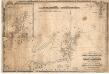
A chart of the north coast of Scotland including the Orkney and Shetland Islands.
Blachford, W.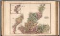
Scotland, northern part.
1 : 518000 Pinkerton, John, 1758-1826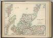
Scotland (northern sheet).
1 : 633600 Johnston, W. & A.K.