Maps of Outer Hebrides
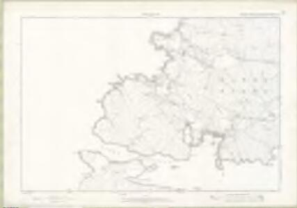
Inverness-shire - Hebrides Sheet LXIV - OS 6 Inch map
1 : 10560 Topographic maps Ordnance Survey Ordnance Survey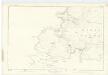
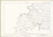
Inverness-shire (Hebrides), Sheet LXIV - OS 6 Inch map
1 : 10560 Topographic maps Ordnance Survey Ordnance Survey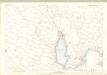
Inverness Hebrides, Sheet LXIV.11 (Barra) - OS 25 Inch map
1 : 2500 Topographic maps Ordnance Survey Ordnance Survey
Inverness-shire - Hebrides, Sheet 064.07 - 25 Inch Map
1 : 2500 Topographic maps Ordnance Survey Ordnance Survey
Inverness-shire - Hebrides, Sheet 064.03 - 25 Inch Map
1 : 2500 Topographic maps Ordnance Survey Ordnance Survey
Inverness-shire - Hebrides, Sheet 064.11 - 25 Inch Map
1 : 2500 Topographic maps Ordnance Survey Ordnance Survey
Inverness Hebrides, Sheet LXIV.3 (Barra) - OS 25 Inch map
1 : 2500 Topographic maps Ordnance Survey Ordnance Survey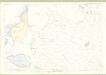
Inverness Hebrides, Sheet LXIV.7 (Barra) - OS 25 Inch map
1 : 2500 Topographic maps Ordnance Survey Ordnance Survey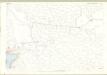
Inverness Hebrides, Sheet LXIV.12 (Barra) - OS 25 Inch map
1 : 2500 Topographic maps Ordnance Survey Ordnance Survey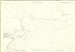
Inverness-shire - Hebrides, Sheet 064.12 - 25 Inch Map
1 : 2500 Topographic maps Ordnance Survey Ordnance Survey
Volume 2: Sheet 58 - Barra
1 : 63360 Farquharson, J.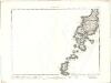
Barra - OS One-Inch map
1 : 63360 Topographic maps Ordnance Survey Ordnance Survey
Benholm - OS One-Inch map
1 : 63360 Topographic maps Ordnance Survey Ordnance Survey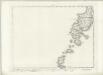
Barra - OS One-Inch map
1 : 63360 Topographic maps Ordnance Survey Ordnance Survey
Benholm - OS One-Inch map
1 : 63360 Topographic maps Ordnance Survey Ordnance Survey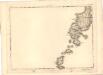
Barra - OS One-Inch map
1 : 63360 Topographic maps Ordnance Survey Ordnance Survey
Benholm - OS One-Inch map
1 : 63360 Topographic maps Ordnance Survey Ordnance Survey
Barra & Mingulay (33) - OS One-Inch map
1 : 63360 Topographic maps Ordnance Survey Ordnance Survey
Barra & Mingulay (33) - OS One-Inch map
1 : 63360 Topographic maps Ordnance Survey Ordnance Survey
Barra - OS One-Inch Map
1 : 63360 Topographic maps Ordnance Survey Ordnance Survey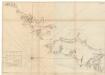
The south part of Long Island from Bara Head to Benbecula I.
Bowen, Thomas
North and South Uist - Bartholomew's 'Survey Atlas of Scotland'
1 : 126720 Topographic maps John Bartholomew & Son, Ltd John Bartholomew & Son, Ltd
Vistvs insvla, vulgo Viist
1 Karte : Kupferdruck ; 44 x 56 cm Blaeu; Pont Joan Blaeu
VISTVS INSVLA, | vulgo VIIST, | cum aliis minoribus | EX ÆBVDARVM NVMERO | ei ad meridiem adjacentibus.
Auct. Timotheo Pont. [Amsterdam : Joan Blaeu]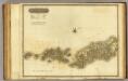
Western Isles S.
1 : 106000 Thomson, John
Hebrides or Western Isles from Barra Head to Scarpa Id.
Great Britain. Hydrographic Office
Scotland / J. Ainslie, 4
1 Blatt : 67 x 58 cm Ainslie, Faden
Scotland[Motoring Map of]
London : "Geographia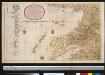
Nieuwe afteekening van de West kust van SchotLandt als mede een gedeelte van de Lewijs Eijlanden en Skie, Mulla, Tijrrif, Col int groot
Scotland Gerard van Keulen