Maps of Highland
Inverness-shire - Mainland Sheet LXIII - OS 6 Inch map
1 : 10560 Topographic maps Ordnance Survey Ordnance Survey
Inverness-shire (Mainland), Sheet LXIII - OS 6 Inch map
1 : 10560 Topographic maps Ordnance Survey Ordnance Survey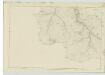
Ross-shire & Cromartyshire (Mainland), Sheet CXXXI - OS 6 Inch map
1 : 10560 Topographic maps Ordnance Survey Ordnance Survey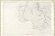
Ross and Cromarty Sheet CXXXI - OS 6 Inch map
1 : 10560 Topographic maps Ordnance Survey Ordnance Survey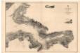
Loch Hourn
Great Britain. Hydrographic Office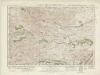
Glen Shiel & Glen Garry (41) - OS One-Inch map
1 : 63360 Topographic maps Ordnance Survey Ordnance Survey
Glen Shiel & Glen Garry (41) - OS One-Inch map
1 : 63360 Topographic maps Ordnance Survey Ordnance Survey
Loch Arkaig - OS One-Inch Map
1 : 63360 Topographic maps Ordnance Survey Ordnance Survey
Glenelg, etc. - Bartholomew's 'Survey Atlas of Scotland'
1 : 126720 Topographic maps John Bartholomew & Son, Ltd John Bartholomew & Son, Ltd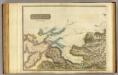
Inverness Shire 4 N.
1 : 128000 Johnson, William, fl. 1806-1840
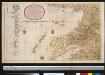
The south part of Sky Island and the adjacent main of Scotland.
Mackenzie, Murdoch (Senior), 1712-1797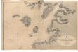
Ardnamurchan Point to Loch Bhreatal, Skye, including the Small Isles and Sleat Sound
Great Britain. Hydrographic Office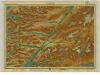
Lochaber, Sheet 15 - Bartholomew's "Half Inch to the Mile Maps" of Scotland
1 : 126720 Topographic maps John Bartholomew & Son, Ltd John Bartholomew & Son, Ltd
Fort-William District, Sheet 15 - Bartholomew's "Half Inch to the Mile Maps" of Scotland
1 : 126720 Topographic maps Bartholomew, John George John Bartholomew & Co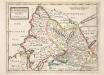
The West Part of Inverness Sh. Lochaber with all the Territories west from it / by H. Moll.
Moll, Herman, d. 1732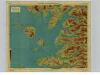
Arisaig & Rum, Sheet 14 - Bartholomew's "Half Inch to the Mile Maps" of Scotland
1 : 126720 Topographic maps John Bartholomew & Son, Ltd John Bartholomew & Son, Ltd
Mallaig, Sheet 14 - Bartholomew's "Half Inch to the Mile Maps" of Scotland
1 : 126720 Topographic maps Bartholomew, John George John Bartholomew & Co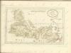
Ross, Cromarty Shires S.
1 : 190000 Craig, John
Composite: Inverness Shire N.
1 : 128000 Johnson, William, fl. 1806-1840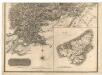
Southern Part of Ross and Cromarty Shires.
Thomson, John, 1777- ca. 1840 Craig, John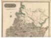
Northern Part of Ross and Cromarty Shires. Southern Part.
Thomson, John, 1777- ca. 1840 Craig, John
Ardnamurchan to Summer Isles, including the Inner Channel and part of the Minch.
Great Britain. Hydrographic Office
Southern Part of Inverness Shire.
Thomson, John, 1777- ca. 1840 Johnson, William, fl. 1806-1840
Northern Part of Inverness Shire.
Thomson, John, 1777- ca. 1840 Johnson, William, fl. 1806-1840
Northern Part of Inverness Shire.
Thomson, John, 1777- ca. 1840 Johnson, William, fl. 1806-1840
Southern Part of Inverness Shire.
Thomson, John, 1777- ca. 1840 Johnson, William, fl. 1806-1840
Scotland / J. Ainslie, 5
1 Blatt : 67 x 57 cm Ainslie, Faden
Composite: Inverness Shire.
1 : 128000 Johnson, William, fl. 1806-1840