Maps of Grampian Mountains
Aberdeenshire Sheet CIV (with inset CIIIa) - OS 6 Inch map
1 : 10560 Topographic maps Ordnance Survey Ordnance Survey
Inverness-shire - Mainland Sheet CXXXIII - OS 6 Inch map
1 : 10560 Topographic maps Ordnance Survey Ordnance Survey
Inverness-shire (Mainland), Sheet CXXXIII - OS 6 Inch map
1 : 10560 Topographic maps Ordnance Survey Ordnance Survey
Perth and Clackmannan Sheet V.NW - OS 6 Inch map
1 : 10560 Topographic maps Ordnance Survey Ordnance Survey
Perthshire, Sheet V (with extension Sheet II) - OS 6 Inch map
1 : 10560 Topographic maps Ordnance Survey Ordnance Survey
Perth and Clackmannan Sheet V.SW - OS 6 Inch map
1 : 10560 Topographic maps Ordnance Survey Ordnance Survey
Perth and Clackmannan Sheet II.SE & V.NE - OS 6 Inch map
1 : 10560 Topographic maps Ordnance Survey Ordnance Survey
Perth and Clackmannan Sheet V.SE - OS 6 Inch map
1 : 10560 Topographic maps Ordnance Survey Ordnance Survey
Perth and Clackmannan Sheet IV.NE - OS 6 Inch map
1 : 10560 Topographic maps Ordnance Survey Ordnance Survey
Perthshire, Sheet IV (Inset Sheet I) - OS 6 Inch map
1 : 10560 Topographic maps Ordnance Survey Ordnance Survey
Perth and Clackmannan Sheet I.SE - OS 6 Inch map
1 : 10560 Topographic maps Ordnance Survey Ordnance Survey
Perth and Clackmannan Sheet IV.SE - OS 6 Inch map
1 : 10560 Topographic maps Ordnance Survey Ordnance Survey
Kingussie - OS One-Inch map
1 : 63360 Topographic maps Ordnance Survey Ordnance Survey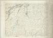
Kingussie - OS One-Inch map
1 : 63360 Topographic maps Ordnance Survey Ordnance Survey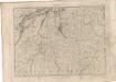
Kingussie - OS One-Inch map
1 : 63360 Topographic maps Ordnance Survey Ordnance Survey
Grampian Mountains & Blair Atholl (49) - OS One-Inch map
1 : 63360 Topographic maps Ordnance Survey Ordnance Survey
Grampian Mountains & Blair Atholl (49) - OS One-Inch map
1 : 63360 Topographic maps Ordnance Survey Ordnance Survey
Kingussie - OS One-Inch Map
1 : 63360 Topographic maps Ordnance Survey Ordnance Survey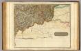
Inverness Shire 7 S.
1 : 128000 Johnson, William, fl. 1806-1840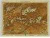
Atholl & Badenoch, Sheet 16 - Bartholomew's "Half Inch to the Mile Maps" of Scotland
1 : 126720 Topographic maps John Bartholomew & Son, Ltd John Bartholomew & Son, Ltd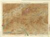
Braemar and Blair Atholl, Sheet 16 - Bartholomew's "Half Inch to the Mile Maps" of Scotland
1 : 126720 Topographic maps Bartholomew, John George John Bartholomew & Co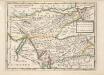
The East Part of the Shire of Inverness with Badenoch &c. / by H. Moll.
Moll, Herman, d. 1732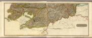
Composite: Inverness Shire S.
1 : 128000 Johnson, William, fl. 1806-1840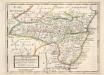
The Shire of Kincairden or Mears with the South Part of Aberdeen Shire &c. / H. Moll.
Moll, Herman, d. 1732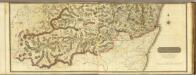
Composite: South Aberdeen, Banff S.
1 : 95000 Thomson, John
A NEW and CORRECTED MAP of PERTHSHIRE
This map was made during the Jacobite Uprising by William Edgar who worked for the Duke of Cumberland's army Maps such as this provided valuable reconnaissance information on roads, forts, river crossings and other strategically important features of the landscape The indication of hills, though conventionalised, gives a useful indication of the mountain terrain Edgar dedicated the map to James, Duke of Athol who was Lord Keeper of the Privy Seal of Scotland Military maps made during the first half of the 18th century provide the first plans of Scottish towns, many of which remained unmapped until a century later William Edgar drew up a map of Edinburgh in the same year as this map of Perthshire Edgar, William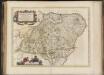
Duo Vicecomitatus Aberdonia & Banfia, una cum Regionibus & terrarum tractibus sub iis comprehensis / Auctore Roberto Gordonio à Straloch. Description of the two Shyres Aberdene and Banf,
Gordon, Robert, 1580-1661 Blaeu, Joan, 1596-1673
A chart of part of the South of Scotland, from Berwick upon Tweed to Skateraw Harbour in the County of Kincardine...
Ainslie, John, 1745-1828
A chart of part of the South of Scotland, from Berwick upon Tweed to Skateraw Harbour in the County of Kincardine...
Ainslie, John, 1745-1828
A chart of part of the South of Scotland, from Berwick upon Tweed to Skateraw Harbour in the County of Kincardine...
Ainslie, John, 1745-1828