Maps of Dumfries and Galloway
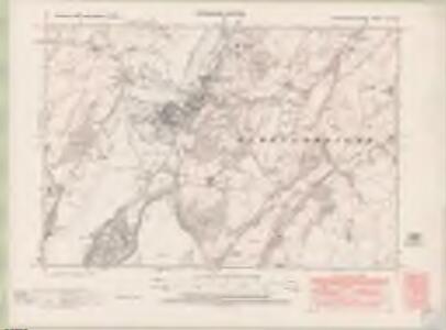
Kirkcudbrightshire Sheet LV.NW - OS 6 Inch map
1 : 10560 Topographic maps Ordnance Survey Ordnance Survey
Kirkcudbrightshire Sheet LV.NW - OS 6 Inch map
1 : 10560 Topographic maps Ordnance Survey Ordnance Survey
Kirkcudbrightshire Sheet LV.NW - OS 6 Inch map
1 : 10560 Topographic maps Ordnance Survey Ordnance Survey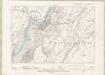
Kirkcudbrightshire Sheet LV.NW - OS 6 Inch map
1 : 10560 Topographic maps Ordnance Survey Ordnance Survey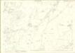
Kirkcudbrightshire, Sheet 055.02 - 25 Inch Map
1 : 2500 Topographic maps Ordnance Survey Ordnance Survey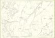
Kirkcudbrightshire, Sheet 055.02 - 25 Inch Map
1 : 2500 Topographic maps Ordnance Survey Ordnance Survey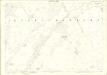
Kirkcudbrightshire, Sheet 055.06 - 25 Inch Map
1 : 2500 Topographic maps Ordnance Survey Ordnance Survey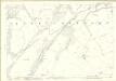
Kirkcudbrightshire, Sheet 055.06 - 25 Inch Map
1 : 2500 Topographic maps Ordnance Survey Ordnance Survey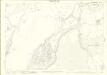
Kirkcudbrightshire, Sheet 055.05 - 25 Inch Map
1 : 2500 Topographic maps Ordnance Survey Ordnance Survey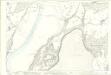
Kirkcudbrightshire, Sheet 055.05 - 25 Inch Map
1 : 2500 Topographic maps Ordnance Survey Ordnance Survey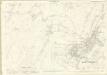
Kirkcudbrightshire, Sheet 055.01 - 25 Inch Map
1 : 2500 Topographic maps Ordnance Survey Ordnance Survey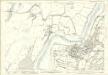
Kirkcudbrightshire, Sheet 055.01 - 25 Inch Map
1 : 2500 Topographic maps Ordnance Survey Ordnance Survey
Plan of the Town of Kirkcudbright.
Wood, John, ca. 1780-1847 James Turner & Co.
Kirkcudbright
Great Britain. Parliament. House of Commons.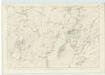
Kirkcudbrightshire, Sheet 50 - OS 6 Inch map
1 : 10560 Topographic maps Ordnance Survey Ordnance Survey
Kirkcudbright Bay
Great Britain. Hydrographic Office
NX65 - OS 1:25,000 Provisional Series Map
1 : 25000 Topographic maps Ordnance Survey Ordnance Survey
Volume 1: Sheet 5 - Kirkcudbright
1 : 63360 Farquharson, J.
Kirkcudbright - OS One-Inch map
1 : 63360 Topographic maps Ordnance Survey Ordnance Survey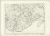
Kirkcudbright - OS One-Inch map
1 : 63360 Topographic maps Ordnance Survey Ordnance Survey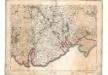
[Kirkcudbright] - OS One-Inch map
1 : 63360 Topographic maps Ordnance Survey Ordnance Survey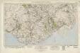
Castle Douglas & Kirkcudbright (92) - OS One-Inch map
1 : 63360 Topographic maps Ordnance Survey Ordnance Survey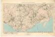
Castle Douglas & Kirkcudbright (92) - OS One-Inch map
1 : 63360 Topographic maps Ordnance Survey Ordnance Survey
The Middle Part of Galloway : Contains The West P. of Kirkcudbright Shire / by H. Moll.
Moll, Herman, d. 1732
The East Part of Galloway : being Part of the Shire of Kirkcudbright / by H. Moll.
Moll, Herman, d. 1732
Præfectvra Kircvbriensis, quæ Gallovidiæ maxime orientalis pars est
1 Karte : Kupferdruck ; 41 x 53 cm Blaeu; Pont Joan Blaeu
Dalbeattie - OS One-Inch Map
1 : 63360 Topographic maps Ordnance Survey Ordnance Survey
Dumfries - OS One-Inch Map
1 : 63360 Topographic maps Ordnance Survey Ordnance Survey
Kirkcudbright - OS One-Inch Map
1 : 63360 Topographic maps Ordnance Survey Ordnance Survey