Maps of Edinburgh
Fife and Kinross Sheet XLIII.NE - OS 6 Inch map
1 : 10560 Topographic maps Ordnance Survey Ordnance Survey
Fife and Kinross Sheet XLIII.NE - OS 6 Inch map
1 : 10560 Topographic maps Ordnance Survey Ordnance Survey
Fife and Kinross Sheet XLIII.NE - OS 6 Inch map
1 : 10560 Topographic maps Ordnance Survey Ordnance Survey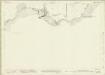
Fifeshire, Sheet 043.03 - 25 Inch Map
1 : 2500 Topographic maps Ordnance Survey Ordnance Survey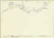
Fifeshire, Sheet 043.03 - 25 Inch Map
1 : 2500 Topographic maps Ordnance Survey Ordnance Survey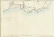
Fifeshire, Sheet 043.03 - 25 Inch Map
1 : 2500 Topographic maps Ordnance Survey Ordnance Survey
Fifeshire, Sheet 043.04 - 25 Inch Map
1 : 2500 Topographic maps Ordnance Survey Ordnance Survey
Linlithgowshire, Sheet n005.02 - 25 Inch Map
1 : 2500 Topographic maps Ordnance Survey Ordnance Survey
Linlithgowshire Sheet n V.NW - OS 6 Inch map
1 : 10560 Topographic maps Ordnance Survey Ordnance Survey
Linlithgowshire Sheet n V.NW - OS 6 Inch map
1 : 10560 Topographic maps Ordnance Survey Ordnance Survey
Linlithgow, Sheet III.10 (Dalmeny, Cramond & Queensferry) - OS 25 Inch map
1 : 2500 Topographic maps Ordnance Survey Ordnance Survey
Linlithgowshire, Sheet 003.10 - 25 Inch Map
1 : 2500 Topographic maps Ordnance Survey Ordnance Survey
Linlithgowshire, Sheet 003.09 - 25 Inch Map
1 : 2500 Topographic maps Ordnance Survey Ordnance Survey
Linlithgow, Sheet III.9 (Dalmeny, Cramond & Queensferry) - OS 25 Inch map
1 : 2500 Topographic maps Ordnance Survey Ordnance Survey
Linlithgowshire, Sheet n005.01 - 25 Inch Map
1 : 2500 Topographic maps Ordnance Survey Ordnance Survey
Linlithgowshire, Sheet 3 - OS 6 Inch map
1 : 10560 Topographic maps Ordnance Survey Ordnance Survey
NT18 - OS 1:25,000 Provisional Series Map
1 : 25000 Topographic maps Ordnance Survey Ordnance Survey
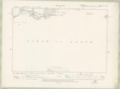
Fife, Sheet 40 - OS 6 Inch map
1 : 10560 Topographic maps Ordnance Survey Ordnance Survey
Fife, Sheet 39 - OS 6 Inch map
1 : 10560 Topographic maps Ordnance Survey Ordnance Survey
Linlithgowshire Sheet n V - OS 6 Inch map
1 : 10560 Topographic maps Ordnance Survey Ordnance Survey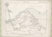
Linlithgowshire Sheet III.SW - OS 6 Inch map
1 : 10560 Topographic maps Ordnance Survey Ordnance Survey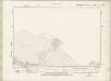
Linlithgowshire Sheet n V.NE - OS 6 Inch map
1 : 10560 Topographic maps Ordnance Survey Ordnance Survey
Linlithgow, Sheet III.11 (Dalmeny, Cramond & Queensferry) - OS 25 Inch map
1 : 2500 Topographic maps Ordnance Survey Ordnance Survey
Linlithgowshire, Sheet 003.11 - 25 Inch Map
1 : 2500 Topographic maps Ordnance Survey Ordnance Survey
Inverkeithing
Great Britain. Parliament. House of Commons.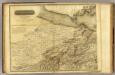
Edinburgh Shire 1 N.
1 : 43000 Knox, James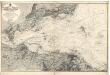
Firth of Forth: Fisherrow to Edgar
Great Britain. Hydrographic Office
Edinburgh environs.
1 : 85000 Society for the Diffusion of Useful Knowledge (Great Britain)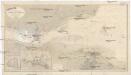
Nordsee
1 : 25000 Severní moře Reichs-Marine-Amt