Maps of Fife
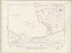
Fife and Kinross Sheet XXVI.NE - OS 6 Inch map
1 : 10560 Topographic maps Ordnance Survey Ordnance Survey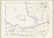
Fife and Kinross Sheet XXVI.NE - OS 6 Inch map
1 : 10560 Topographic maps Ordnance Survey Ordnance Survey
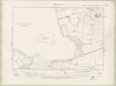
Kinross-shire, Sheet 026.03 - 25 Inch Map
1 : 2500 Topographic maps Ordnance Survey Ordnance Survey
Kinross-shire, Sheet 026.03 - 25 Inch Map
1 : 2500 Topographic maps Ordnance Survey Ordnance Survey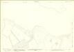
Kinross-shire, Sheet 026.07 - 25 Inch Map
1 : 2500 Topographic maps Ordnance Survey Ordnance Survey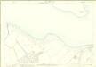
Kinross-shire, Sheet 026.07 - 25 Inch Map
1 : 2500 Topographic maps Ordnance Survey Ordnance Survey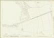
Fifeshire, Sheet 026.08 - 25 Inch Map
1 : 2500 Topographic maps Ordnance Survey Ordnance Survey
Fifeshire, Sheet 026.08 - 25 Inch Map
1 : 2500 Topographic maps Ordnance Survey Ordnance Survey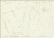
Fifeshire, Sheet 026.04 - 25 Inch Map
1 : 2500 Topographic maps Ordnance Survey Ordnance Survey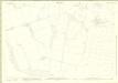
Kinross-shire, Sheet 026.04 - 25 Inch Map
1 : 2500 Topographic maps Ordnance Survey Ordnance Survey
Kinross-shire, Sheet 026.04 - 25 Inch Map
1 : 2500 Topographic maps Ordnance Survey Ordnance Survey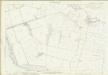
Fifeshire, Sheet 026.04 - 25 Inch Map
1 : 2500 Topographic maps Ordnance Survey Ordnance Survey
NO10 - OS 1:25,000 Provisional Series Map
1 : 25000 Topographic maps Ordnance Survey Ordnance Survey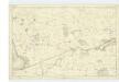
Fife, Sheet 23 - OS 6 Inch map
1 : 10560 Topographic maps Ordnance Survey Ordnance Survey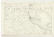
Fife, Sheet 22 - OS 6 Inch map
1 : 10560 Topographic maps Ordnance Survey Ordnance Survey
County of Kinross.
Bell, John, fl. 1792-1833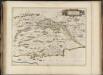
Fifae pars occidentalis, [vulgo], The West Part of Fife.
Blaeu, Joan, 1596-1673
Kinross - OS One-Inch map
1 : 63360 Topographic maps Ordnance Survey Ordnance Survey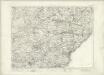
Kinross - OS One-Inch map
1 : 63360 Topographic maps Ordnance Survey Ordnance Survey
[Kinross] - OS One-Inch map
1 : 63360 Topographic maps Ordnance Survey Ordnance Survey
Fife W.
1 : 75000 Martin, Alexander
FIFÆ PARS | OCCIDENTALIS, | THE WEST PART OF FIFE.
[Amsterdam : Joan Blaeu]
Firth of Forth (68) - OS One-Inch map
1 : 63360 Topographic maps Ordnance Survey Ordnance Survey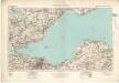
Firth of Forth (68) - OS One-Inch map
1 : 63360 Topographic maps Ordnance Survey Ordnance Survey
Fifæ pars occidentalis
1 Karte : Kupferdruck ; 40 x 52 cm Blaeu Joan Blaeu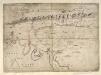
[A map of Strath Devon and the district between the Ochils and the Forth]
Adair, John, ca. 1650-1722
Perth and Alloa - OS One-Inch Map
1 : 63360 Topographic maps Ordnance Survey Ordnance Survey
Fifæ pars orientalis
1 Karte : Kupferdruck ; 40 x 51 cm Blaeu Joan Blaeu
FIFÆ PARS | ORIENTALIS, | THE EAST PART OF FIFE.
[Amsterdam : Joan Blaeu]