Maps of Fife
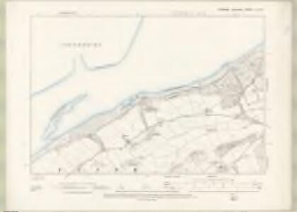
Fife and Kinross Sheet III.SW & IIIa SE - OS 6 Inch map
1 : 10560 Topographic maps Ordnance Survey Ordnance Survey
Fife and Kinross Sheet III.SW - OS 6 Inch map
1 : 10560 Topographic maps Ordnance Survey Ordnance Survey
Perth and Clackmannan Sheet C.NW - OS 6 Inch map
1 : 10560 Topographic maps Ordnance Survey Ordnance Survey
Perth and Clackmannan, Sheet C.5 (Errol) - OS 25 Inch map
1 : 2500 Topographic maps Ordnance Survey Ordnance Survey
Fifeshire, Sheet 003.09 - 25 Inch Map
1 : 2500 Topographic maps Ordnance Survey Ordnance Survey
Fifeshire, Sheet 003.13 - 25 Inch Map
1 : 2500 Topographic maps Ordnance Survey Ordnance Survey
Fifeshire, Sheet 003.13 - 25 Inch Map
1 : 2500 Topographic maps Ordnance Survey Ordnance Survey
Fifeshire, Sheet 003.14 - 25 Inch Map
1 : 2500 Topographic maps Ordnance Survey Ordnance Survey
Fifeshire, Sheet 003.14 - 25 Inch Map
1 : 2500 Topographic maps Ordnance Survey Ordnance Survey
Fifeshire, Sheet 003.10 & 09 - 25 Inch Map
1 : 2500 Topographic maps Ordnance Survey Ordnance Survey
Fifeshire, Sheet 003.10 - 25 Inch Map
1 : 2500 Topographic maps Ordnance Survey Ordnance Survey
Perth and Clackmannan, Sheet C.1 (Errol) - OS 25 Inch map
1 : 2500 Topographic maps Ordnance Survey Ordnance Survey
Perth and Clackmannan, Sheet C.1 (Inchture) - OS 25 Inch map
1 : 2500 Topographic maps Ordnance Survey Ordnance Survey
Perth and Clackmannan, Sheet XCIX.8 (Errol) - OS 25 Inch map
1 : 2500 Topographic maps Ordnance Survey Ordnance Survey
Fife, Sheet 5 - OS 6 Inch map
1 : 10560 Topographic maps Ordnance Survey Ordnance Survey
Perthshire, Sheet C - OS 6 Inch map
1 : 10560 Topographic maps Ordnance Survey Ordnance Survey
NO32 - OS 1:25,000 Provisional Series Map
1 : 25000 Topographic maps Ordnance Survey Ordnance Survey
Perth and Clackmannan Sheet XCIX.NE - OS 6 Inch map
1 : 10560 Topographic maps Ordnance Survey Ordnance Survey
Perth and Clackmannan, Sheet XCIX.12 (Errol) - OS 25 Inch map
1 : 2500 Topographic maps Ordnance Survey Ordnance Survey
Perth and Clackmannanshire, Sheet 099.04 - 25 Inch Map
1 : 2500 Topographic maps Ordnance Survey Ordnance Survey
Perth and Clackmannan, Sheet XCIX.4 (with insets C.2 and C.5) (Inchture) - OS 25 Inch map
1 : 2500 Topographic maps Ordnance Survey Ordnance Survey
Perth and Clackmannan, Sheet XCIX.4 (Errol) - OS 25 Inch map
1 : 2500 Topographic maps Ordnance Survey Ordnance Survey
Perth - OS One-Inch map
1 : 63360 Topographic maps Ordnance Survey Ordnance Survey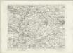
Perth - OS One-Inch map
1 : 63360 Topographic maps Ordnance Survey Ordnance Survey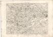
Perth - OS One-Inch map
1 : 63360 Topographic maps Ordnance Survey Ordnance Survey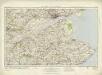
Dundee & St Andrews (64) - OS One-Inch map
1 : 63360 Topographic maps Ordnance Survey Ordnance Survey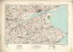
Dundee & St Andrews (64) - OS One-Inch map
1 : 63360 Topographic maps Ordnance Survey Ordnance Survey
Fife E.
1 : 75000 Martin, Alexander
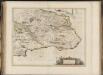
The East Part of Fife / surveyed & designed be [i.e. by] John Adair.
Adair, John, ca. 1650-1722