Maps of South Lanarkshire
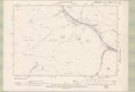
Dumfriesshire Sheet VIII.NE - OS 6 Inch map
1 : 10560 Topographic maps Ordnance Survey Ordnance Survey
Lanarkshire Sheet L.SE - OS 6 Inch map
1 : 10560 Topographic maps Ordnance Survey Ordnance Survey
Lanarkshire Sheet L.SE - OS 6 Inch map
1 : 10560 Topographic maps Ordnance Survey Ordnance Survey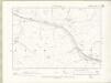
Lanarkshire Sheet L.NE - OS 6 Inch map
1 : 10560 Topographic maps Ordnance Survey Ordnance Survey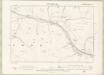
Lanarkshire Sheet L.NE - OS 6 Inch map
1 : 10560 Topographic maps Ordnance Survey Ordnance Survey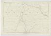
Lanarkshire, Sheet L - OS 6 Inch map
1 : 10560 Topographic maps Ordnance Survey Ordnance Survey
NS91 - OS 1:25,000 Provisional Series Map
1 : 25000 Topographic maps Ordnance Survey Ordnance Survey
NT01 - OS 1:25,000 Provisional Series Map
1 : 25000 Topographic maps Ordnance Survey Ordnance Survey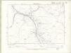
Lanarkshire Sheet LI.SW - OS 6 Inch map
1 : 10560 Topographic maps Ordnance Survey Ordnance Survey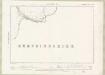
Lanarkshire Sheet LI.SW - OS 6 Inch map
1 : 10560 Topographic maps Ordnance Survey Ordnance Survey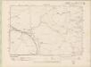
Peebles-shire Sheet XXV.SW - OS 6 Inch map
1 : 10560 Topographic maps Ordnance Survey Ordnance Survey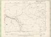
Peebles-shire Sheet XXV.SW - OS 6 Inch map
1 : 10560 Topographic maps Ordnance Survey Ordnance Survey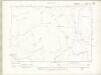
Lanarkshire Sheet LI.NW - OS 6 Inch map
1 : 10560 Topographic maps Ordnance Survey Ordnance Survey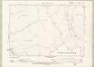
Lanarkshire Sheet LI.NW - OS 6 Inch map
1 : 10560 Topographic maps Ordnance Survey Ordnance Survey
Nithsdale & Moffat (84) - OS One-Inch map
1 : 63360 Topographic maps Ordnance Survey Ordnance Survey
Nithsdale & Moffat (84) - OS One-Inch map
1 : 63360 Topographic maps Ordnance Survey Ordnance Survey
Glottiana præfectvra svperior
1 Karte : Kupferdruck ; 38 x 52 cm Blaeu; Pont Joan Blaeu
Biggar Moffat and Sanquhar - OS One-Inch Map
1 : 63360 Topographic maps Ordnance Survey Ordnance Survey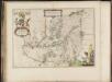
Nithia Vicecomitatus, The Shirifdome of Nidis-dail / auctore Timotheo Pont.
Pont, Timothy, 1560?-1614? Blaeu, Joan, 1596-1673
Moffat - Bartholomew's 'Survey Atlas of Scotland'
1 : 126720 Topographic maps John Bartholomew & Son, Ltd John Bartholomew & Son, Ltd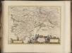
Glottiana Praefectura Superior, [vel], The Upper Ward of Clyds-dayl / Auct. Timoth. Pont.
Pont, Timothy, 1560?-1614? Blaeu, Joan, 1596-1673
The Shire of Dumfries or Nithisdale / by H. Moll.
Moll, Herman, d. 1732
GLOTTANIA | PRÆFECTVRA | SVPERIOR. [=] THE VPPER WARD | of | CLYDS-DAYL.
Auct. Timoth: Pont. [Amsterdam : Joan Blaeu]
Map of Dumfries-shire.
Crawford, William, fl. 1774-1828
Map of Dumfries-shire.
Crawford, William, fl. 1774-1828
Map of Dumfries-shire.
Crawford, William, fl. 1774-1828
Map of Dumfries-shire.
Crawford, William, fl. 1774-1828
Dumfriesshire.
Thomson, John, 1777- ca. 1840 Crawford, William & Son
Dumfriesshire.
Thomson, John, 1777- ca. 1840 Crawford, William & Son
Dumfriesshire.
Thomson, John, 1777- ca. 1840 Crawford, William & Son