Maps of East Ayrshire
Ayrshire Sheet XIII.NW - OS 6 Inch map
1 : 10560 Topographic maps Ordnance Survey Ordnance Survey
Ayrshire Sheet XIII.NW - OS 6 Inch map
1 : 10560 Topographic maps Ordnance Survey Ordnance Survey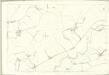
Ayr, Sheet XIII.2 (Stewarton) - OS 25 Inch map
1 : 2500 Topographic maps Ordnance Survey Ordnance Survey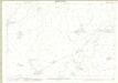
Ayrshire, Sheet 013.02 - 25 Inch Map
1 : 2500 Topographic maps Ordnance Survey Ordnance Survey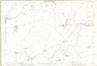
Ayrshire, Sheet 013.02 - 25 Inch Map
1 : 2500 Topographic maps Ordnance Survey Ordnance Survey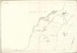
Ayr, Sheet XIII.1 (Stewarton) - OS 25 Inch map
1 : 2500 Topographic maps Ordnance Survey Ordnance Survey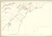
Ayr, Sheet XIII.1 (With inset XIII.5) (Dunlop) - OS 25 Inch map
1 : 2500 Topographic maps Ordnance Survey Ordnance Survey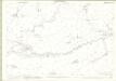
Ayrshire, Sheet 013.06 - 25 Inch Map
1 : 2500 Topographic maps Ordnance Survey Ordnance Survey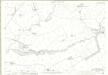
Ayrshire, Sheet 013.06 - 25 Inch Map
1 : 2500 Topographic maps Ordnance Survey Ordnance Survey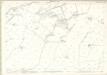
Ayrshire, Sheet 013.01 - 25 Inch Map
1 : 2500 Topographic maps Ordnance Survey Ordnance Survey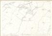
Ayrshire, Sheet 013.01 - 25 Inch Map
1 : 2500 Topographic maps Ordnance Survey Ordnance Survey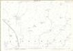
Ayrshire, Sheet 013.05 - 25 Inch Map
1 : 2500 Topographic maps Ordnance Survey Ordnance Survey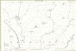
Ayrshire, Sheet 013.05 - 25 Inch Map
1 : 2500 Topographic maps Ordnance Survey Ordnance Survey
Ayr, Sheet XIII.6 (Fenwick) - OS 25 Inch map
1 : 2500 Topographic maps Ordnance Survey Ordnance Survey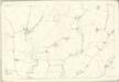
Ayr, Sheet XIII.5 (Stewarton) - OS 25 Inch map
1 : 2500 Topographic maps Ordnance Survey Ordnance Survey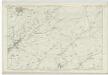
Ayrshire, Sheet XIII - OS 6 Inch map
1 : 10560 Topographic maps Ordnance Survey Ordnance Survey
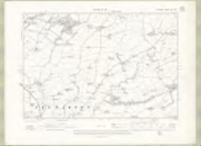
NS44 - OS 1:25,000 Provisional Series Map
1 : 25000 Topographic maps Ordnance Survey Ordnance Survey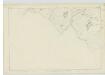
Renfrewshire, Sheet XVIII - OS 6 Inch map
1 : 10560 Topographic maps Ordnance Survey Ordnance Survey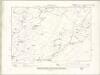
Renfrewshire Sheet XVIII.NW - OS 6 Inch map
1 : 10560 Topographic maps Ordnance Survey Ordnance Survey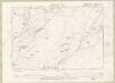
Renfrewshire Sheet XVIII.NW - OS 6 Inch map
1 : 10560 Topographic maps Ordnance Survey Ordnance Survey
Ayrshire 2 N.
1 : 78000 Johnson, William, fl. 1806-1840
Kilmarnock - OS One-Inch map
1 : 63360 Topographic maps Ordnance Survey Ordnance Survey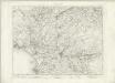
Kilmarnock - OS One-Inch map
1 : 63360 Topographic maps Ordnance Survey Ordnance Survey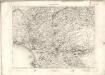
Kilmarnock - OS One-Inch map
1 : 63360 Topographic maps Ordnance Survey Ordnance Survey
Map of the County of Renfrew.
Ainslie, John, 1745-1828
Map of the County of Renfrew.
Ainslie, John, 1745-1828
Renfrew Shire.
Thomson, John, 1777- ca. 1840
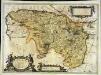
PRÆFECTURA | RENFROANA | Vulgo dicta | BARONIA | THE BARONIE OF | RENFROW
Timotheus Pont Auctor. [Amsterdam : Joan Blaeu]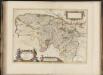
Praefectura Renfroana, vulgo, dicta Baronia. The Baronie of Renfrow / Timotheus Pont Auctor.
Pont, Timothy, 1560?-1614? Blaeu, Joan, 1596-1673