Maps of North Ayshire
Ayrshire Sheet X.NE - OS 6 Inch map
1 : 10560 Topographic maps Ordnance Survey Ordnance Survey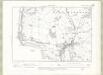
Ayrshire Sheet X.NE - OS 6 Inch map
1 : 10560 Topographic maps Ordnance Survey Ordnance Survey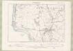
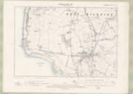
Ayrshire Sheet X.NE - OS 6 Inch map
1 : 10560 Topographic maps Ordnance Survey Ordnance Survey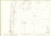
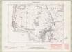
Ayrshire, Sheet 010.03 - 25 Inch Map
1 : 2500 Topographic maps Ordnance Survey Ordnance Survey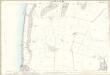
Ayrshire, Sheet 010.03 - 25 Inch Map
1 : 2500 Topographic maps Ordnance Survey Ordnance Survey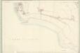
Ayr, Sheet X.7 (West Kilbride) - OS 25 Inch map
1 : 2500 Topographic maps Ordnance Survey Ordnance Survey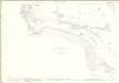
Ayrshire, Sheet 010.07 - 25 Inch Map
1 : 2500 Topographic maps Ordnance Survey Ordnance Survey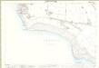
Ayrshire, Sheet 010.07 - 25 Inch Map
1 : 2500 Topographic maps Ordnance Survey Ordnance Survey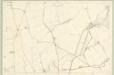
Ayr, Sheet X.4 (West Kilbride) - OS 25 Inch map
1 : 2500 Topographic maps Ordnance Survey Ordnance Survey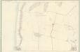
Ayr, Sheet X.3 (West Kilbride) - OS 25 Inch map
1 : 2500 Topographic maps Ordnance Survey Ordnance Survey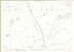
Ayrshire, Sheet 010.04 - 25 Inch Map
1 : 2500 Topographic maps Ordnance Survey Ordnance Survey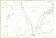
Ayrshire, Sheet 010.04 - 25 Inch Map
1 : 2500 Topographic maps Ordnance Survey Ordnance Survey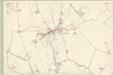
Ayr, Sheet X.8 (West Kilbride) - OS 25 Inch map
1 : 2500 Topographic maps Ordnance Survey Ordnance Survey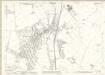
Ayrshire, Sheet 010.08 - 25 Inch Map
1 : 2500 Topographic maps Ordnance Survey Ordnance Survey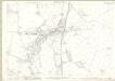
Ayrshire, Sheet 010.08 - 25 Inch Map
1 : 2500 Topographic maps Ordnance Survey Ordnance Survey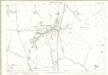
Ayrshire, Sheet 010.08 - 25 Inch Map
1 : 2500 Topographic maps Ordnance Survey Ordnance Survey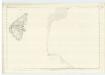
Argyllshire, Sheet CCXXVIII - OS 6 Inch map
1 : 10560 Topographic maps Ordnance Survey Ordnance Survey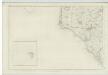
Ayrshire, Sheet X (with inset of sheet XV) - OS 6 Inch map
1 : 10560 Topographic maps Ordnance Survey Ordnance Survey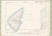
Argyll and Bute Sheet CCXXVIII.NW & SW - OS 6 Inch map
1 : 10560 Topographic maps Ordnance Survey Ordnance Survey
Arran - OS One-Inch map
1 : 63360 Topographic maps Ordnance Survey Ordnance Survey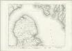
Arran - OS One-Inch map
1 : 63360 Topographic maps Ordnance Survey Ordnance Survey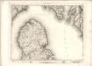
Arran - OS One-Inch map
1 : 63360 Topographic maps Ordnance Survey Ordnance Survey
PRÆFECTURA | RENFROANA | Vulgo dicta | BARONIA | THE BARONIE OF | RENFROW
Timotheus Pont Auctor. [Amsterdam : Joan Blaeu]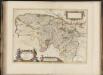
Praefectura Renfroana, vulgo, dicta Baronia. The Baronie of Renfrow / Timotheus Pont Auctor.
Pont, Timothy, 1560?-1614? Blaeu, Joan, 1596-1673
Island of Bute (71) - OS One-Inch map
1 : 63360 Topographic maps Ordnance Survey Ordnance Survey
Island of Bute (71) - OS One-Inch map
1 : 63360 Topographic maps Ordnance Survey Ordnance Survey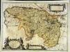
Præfectura Renfroana vulgo dicta Baronia
1 Karte : Kupferdruck ; 38 x 52 cm Blaeu; Pont Joan Blaeu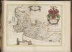
Cuninghamia / ex schedis Timotheo Pont ; Ioannis Blaeu excudebat. Cunningham.
Pont, Timothy, 1560?-1614? Blaeu, Joan, 1596-1673
Island of Arran (77) - OS One-Inch map
1 : 63360 Topographic maps Ordnance Survey Ordnance Survey