Maps of Highland

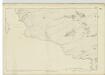
Ullapool - OS One-Inch map
1 : 63360 Topographic maps Ordnance Survey Ordnance Survey
Ullapool - OS One-Inch map
1 : 63360 Topographic maps Ordnance Survey Ordnance Survey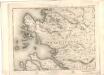
Ullapool - OS One-Inch map
1 : 63360 Topographic maps Ordnance Survey Ordnance Survey
Loch Inver to Loch Broom
Great Britain. Hydrographic Office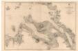
Lochs Broom
Great Britain. Hydrographic Office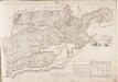
No. 14 - Plan of the Farm of Ledbeg.
Home, John, ca. 1733-1809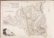
No. 11 - Plan of the Farms of Stroncruby [Stronecrubie] and Layn [Lyne].
Home, John, ca. 1733-1809
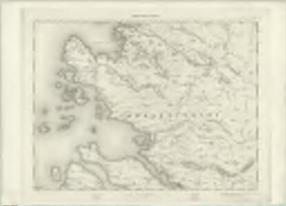
Sutherland, Sheet LXXX - OS 6 Inch map
1 : 10560 Topographic maps Ordnance Survey Ordnance Survey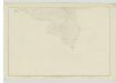
Sutherland, Sheet XCIXA - OS 6 Inch map
1 : 10560 Topographic maps Ordnance Survey Ordnance Survey
Sutherland, Sheet XCIA - OS 6 Inch map
1 : 10560 Topographic maps Ordnance Survey Ordnance Survey
Sutherland Sheet LXXX - OS 6 Inch map
1 : 10560 Topographic maps Ordnance Survey Ordnance Survey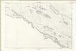
Sutherland Sheet LXXXI - OS 6 Inch map
1 : 10560 Topographic maps Ordnance Survey Ordnance Survey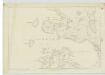
Ross-shire & Cromartyshire (Mainland), Sheet IIIA - OS 6 Inch map
1 : 10560 Topographic maps Ordnance Survey Ordnance Survey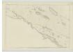
Sutherland, Sheet LXXXI - OS 6 Inch map
1 : 10560 Topographic maps Ordnance Survey Ordnance Survey
Sutherland Sheet XCIa - OS 6 Inch map
1 : 10560 Topographic maps Ordnance Survey Ordnance Survey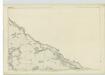
Ross-shire & Cromartyshire (Mainland), Sheet II - OS 6 Inch map
1 : 10560 Topographic maps Ordnance Survey Ordnance Survey
Sutherland Sheet LXXXII - OS 6 Inch map
1 : 10560 Topographic maps Ordnance Survey Ordnance Survey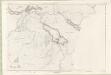
Sutherland Sheet XCI - OS 6 Inch map
1 : 10560 Topographic maps Ordnance Survey Ordnance Survey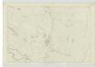
Sutherland, Sheet LXXXII - OS 6 Inch map
1 : 10560 Topographic maps Ordnance Survey Ordnance Survey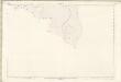
Sutherland Sheet XCIXa - OS 6 Inch map
1 : 10560 Topographic maps Ordnance Survey Ordnance Survey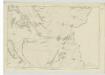
Ross-shire & Cromartyshire (Mainland), Sheet IV - OS 6 Inch map
1 : 10560 Topographic maps Ordnance Survey Ordnance Survey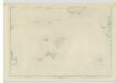
Ross-shire & Cromartyshire (Mainland), Sheet VI - OS 6 Inch map
1 : 10560 Topographic maps Ordnance Survey Ordnance Survey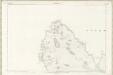
Ross and Cromarty Sheet Ib - OS 6 Inch map
1 : 10560 Topographic maps Ordnance Survey Ordnance Survey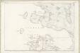
Ross and Cromarty Sheet IIIa - OS 6 Inch map
1 : 10560 Topographic maps Ordnance Survey Ordnance Survey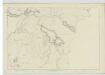
Sutherland, Sheet XCI - OS 6 Inch map
1 : 10560 Topographic maps Ordnance Survey Ordnance Survey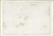
Ross and Cromarty Sheet VI - OS 6 Inch map
1 : 10560 Topographic maps Ordnance Survey Ordnance Survey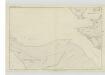
Ross-shire & Cromartyshire (Mainland), Sheet XIII - OS 6 Inch map
1 : 10560 Topographic maps Ordnance Survey Ordnance Survey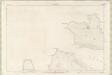
Ross and Cromarty Sheet XII - OS 6 Inch map
1 : 10560 Topographic maps Ordnance Survey Ordnance Survey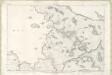
Ross and Cromarty Sheet Ic - OS 6 Inch map
1 : 10560 Topographic maps Ordnance Survey Ordnance Survey