Maps of Cumbria

Annan - OS One-Inch map
1 : 63360 Topographic maps Ordnance Survey Ordnance Survey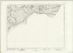
Annan - OS One-Inch map
1 : 63360 Topographic maps Ordnance Survey Ordnance Survey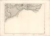
[Annan] - OS One-Inch map
1 : 63360 Topographic maps Ordnance Survey Ordnance Survey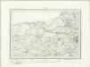
Carlisle (Outline) - OS One-Inch Revised New Series
1 : 63360 Topographic maps Ordnance Survey Ordnance Survey
Carlisle (Hills) - OS One-Inch Revised New Series
1 : 63360 Topographic maps Ordnance Survey Ordnance Survey
NY15 & Parts of NY05 - OS 1:25,000 Provisional Series Map
1 : 25000 Topographic maps Ordnance Survey Ordnance Survey
NY14 & Parts of NY04 - OS 1:25,000 Provisional Series Map
1 : 25000 Topographic maps Ordnance Survey Ordnance Survey
NY25 - OS 1:25,000 Provisional Series Map
1 : 25000 Topographic maps Ordnance Survey Ordnance Survey
NY24 - OS 1:25,000 Provisional Series Map
1 : 25000 Topographic maps Ordnance Survey Ordnance Survey
NY06 & Parts of NY05 - OS 1:25,000 Provisional Series Map
1 : 25000 Topographic maps Ordnance Survey Ordnance Survey
NY16 - OS 1:25,000 Provisional Series Map
1 : 25000 Topographic maps Ordnance Survey Ordnance Survey
NY26 - OS 1:25,000 Provisional Series Map
1 : 25000 Topographic maps Ordnance Survey Ordnance Survey
Kirkcudbrightshire, Sheet 41A (and inset) - OS 6 Inch map
1 : 10560 Topographic maps Ordnance Survey Ordnance Survey
Cumberland XIIIa - OS Six-Inch Map
1 : 10560 Topographic maps Ordnance Survey Ordnance Survey
Cumberland XX - OS Six-Inch Map
1 : 10560 Topographic maps Ordnance Survey Ordnance Survey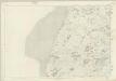
Cumberland XXVII - OS Six-Inch Map
1 : 10560 Topographic maps Ordnance Survey Ordnance Survey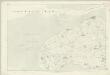
Cumberland XIV - OS Six-Inch Map
1 : 10560 Topographic maps Ordnance Survey Ordnance Survey
Cumberland XXI - OS Six-Inch Map
1 : 10560 Topographic maps Ordnance Survey Ordnance Survey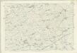
Cumberland XXVIII - OS Six-Inch Map
1 : 10560 Topographic maps Ordnance Survey Ordnance Survey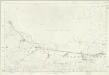
Cumberland XV - OS Six-Inch Map
1 : 10560 Topographic maps Ordnance Survey Ordnance Survey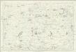
Cumberland XXII - OS Six-Inch Map
1 : 10560 Topographic maps Ordnance Survey Ordnance Survey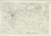
Cumberland XXIX - OS Six-Inch Map
1 : 10560 Topographic maps Ordnance Survey Ordnance Survey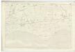
Dumfriesshire, Sheet LXIII - OS 6 Inch map
1 : 10560 Topographic maps Ordnance Survey Ordnance Survey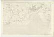
Dumfriesshire, Sheet LXI - OS 6 Inch map
1 : 10560 Topographic maps Ordnance Survey Ordnance Survey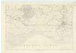
Dumfriesshire, Sheet LXII - OS 6 Inch map
1 : 10560 Topographic maps Ordnance Survey Ordnance Survey
Dumfriesshire, Sheet LXVIII & LXIX - OS 6 Inch map
1 : 10560 Topographic maps Ordnance Survey Ordnance Survey
Kirkcudbrightshire Sheet XLV.NE - OS 6 Inch map
1 : 10560 Topographic maps Ordnance Survey Ordnance Survey
Kirkcudbrightshire Sheet XLV.NE - OS 6 Inch map
1 : 10560 Topographic maps Ordnance Survey Ordnance Survey
Kirkcudbrightshire Sheet XLV.SE - OS 6 Inch map
1 : 10560 Topographic maps Ordnance Survey Ordnance Survey
![[Annan] - OS One-Inch map](https://images-2.georeferencer.com/images/iiif/937891634117/full/,300/0/native.jpg)

