Maps of Stirling
Perth and Clackmannan, Clackmannanshire Sheet CXXXIX.1 (Combined) - OS 25 Inch map
1 : 2500 Topographic maps Ordnance Survey Ordnance Survey
Perth and Clackmannan, Sheet CXXXIX.1 (with inset CXXXII.16) (Logie) - OS 25 Inch map
1 : 2500 Topographic maps Ordnance Survey Ordnance Survey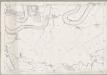
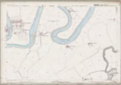
Stirling, Sheet XVII.4 (Combined) - OS 25 Inch map
1 : 2500 Topographic maps Ordnance Survey Ordnance Survey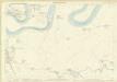
Stirlingshire, Sheet 017.04 - 25 Inch Map
1 : 2500 Topographic maps Ordnance Survey Ordnance Survey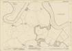
Stirlingshire, Sheet n017.04 - 25 Inch Map
1 : 2500 Topographic maps Ordnance Survey Ordnance Survey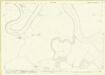
Stirlingshire, Sheet n017.04 - 25 Inch Map
1 : 2500 Topographic maps Ordnance Survey Ordnance Survey
Perth and Clackmannan Sheet CXXXIX.NW - OS 6 Inch map
1 : 10560 Topographic maps Ordnance Survey Ordnance Survey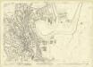
Stirlingshire, Sheet n017.03 - 25 Inch Map
1 : 2500 Topographic maps Ordnance Survey Ordnance Survey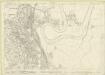
Stirlingshire, Sheet n017.03 - 25 Inch Map
1 : 2500 Topographic maps Ordnance Survey Ordnance Survey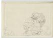
Stirlingshire, Sheet X (with inset of sheet XI) - OS 6 Inch map
1 : 10560 Topographic maps Ordnance Survey Ordnance Survey
Stirlingshire Sheet n XVII.NE - OS 6 Inch map
1 : 10560 Topographic maps Ordnance Survey Ordnance Survey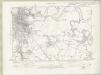
Stirlingshire Sheet n XVII.NE - OS 6 Inch map
1 : 10560 Topographic maps Ordnance Survey Ordnance Survey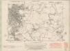
Stirlingshire Sheet XVII.NE - OS 6 Inch map
1 : 10560 Topographic maps Ordnance Survey Ordnance Survey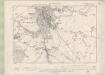
Stirlingshire Sheet XVII.NE - OS 6 Inch map
1 : 10560 Topographic maps Ordnance Survey Ordnance Survey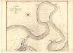
Plan of the Town of Stirling.
Wood, John, ca. 1780-1847
Stirling
Great Britain. Parliament. House of Commons.
Plan of the Town of Stirling from actual survey.
Wood, John, ca. 1780-1847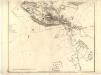
Plan of the Town of Stirling.
Wood, John, ca. 1780-1847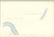
Stirling, Sheet XI.13 (with inset X.16) (St. Ninians) - OS 25 Inch map
1 : 2500 Topographic maps Ordnance Survey Ordnance Survey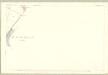
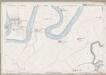
Stirling, Sheet X.16 (Logie) - OS 25 Inch map
1 : 2500 Topographic maps Ordnance Survey Ordnance Survey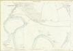
Stirlingshire, Sheet 010.16 - 25 Inch Map
1 : 2500 Topographic maps Ordnance Survey Ordnance Survey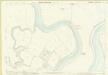
Stirlingshire, Sheet 018.01 - 25 Inch Map
1 : 2500 Topographic maps Ordnance Survey Ordnance Survey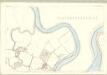
Stirling, Sheet XVIII.1 (St. Ninians) - OS 25 Inch map
1 : 2500 Topographic maps Ordnance Survey Ordnance Survey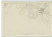
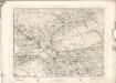
Perthshire, Sheet CXXXIX - OS 6 Inch map
1 : 10560 Topographic maps Ordnance Survey Ordnance Survey
NS89 - OS 1:25,000 Provisional Series Map
1 : 25000 Topographic maps Ordnance Survey Ordnance Survey
Perth and Clackmannan Sheet CXXXIX - OS 6 Inch map
1 : 10560 Topographic maps Ordnance Survey Ordnance Survey
Perth and Clackmannan Sheet CXXXIX - OS 6 Inch map
1 : 10560 Topographic maps Ordnance Survey Ordnance Survey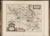
Sterlinensis praefectura, [vulgo], Sterlin-Shyr / Auct. Timoth. Pont.
Pont, Timothy, 1560?-1614? Blaeu, Joan, 1596-1673
Stirling - OS One-Inch map
1 : 63360 Topographic maps Ordnance Survey Ordnance Survey
Stirling - OS One-Inch map
1 : 63360 Topographic maps Ordnance Survey Ordnance Survey