Maps of East Ayrshire
Kirkcudbrightshire, Sheet 3 - OS 6 Inch map
1 : 10560 Topographic maps Ordnance Survey Ordnance Survey
Dumfriesshire, Sheet XX - OS 6 Inch map
1 : 10560 Topographic maps Ordnance Survey Ordnance Survey
Dumfriesshire Sheet XX.NW & NE - OS 6 Inch map
1 : 10560 Topographic maps Ordnance Survey Ordnance Survey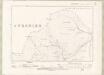
Kirkcudbrightshire Sheet IV.NE - OS 6 Inch map
1 : 10560 Topographic maps Ordnance Survey Ordnance Survey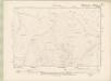
Ayrshire Sheet LIV.NE - OS 6 Inch map
1 : 10560 Topographic maps Ordnance Survey Ordnance Survey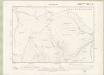
Ayrshire Sheet LIV.NE - OS 6 Inch map
1 : 10560 Topographic maps Ordnance Survey Ordnance Survey
Kirkcudbrightshire Sheet V.NW - OS 6 Inch map
1 : 10560 Topographic maps Ordnance Survey Ordnance Survey
Kirkcudbrightshire Sheet V.NW - OS 6 Inch map
1 : 10560 Topographic maps Ordnance Survey Ordnance Survey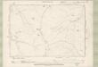
Dumfriesshire Sheet XII.SW - OS 6 Inch map
1 : 10560 Topographic maps Ordnance Survey Ordnance Survey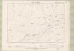
Dumfriesshire Sheet XII.SE - OS 6 Inch map
1 : 10560 Topographic maps Ordnance Survey Ordnance Survey
NS60 - OS 1:25,000 Provisional Series Map
1 : 25000 Topographic maps Ordnance Survey Ordnance Survey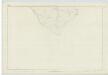
Ayrshire, Sheet LIV - OS 6 Inch map
1 : 10560 Topographic maps Ordnance Survey Ordnance Survey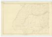
Dumfriesshire, Sheet XII - OS 6 Inch map
1 : 10560 Topographic maps Ordnance Survey Ordnance Survey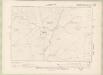
Kirkcudbrightshire Sheet IV.SE - OS 6 Inch map
1 : 10560 Topographic maps Ordnance Survey Ordnance Survey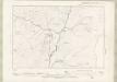
Kirkcudbrightshire Sheet IV.SE - OS 6 Inch map
1 : 10560 Topographic maps Ordnance Survey Ordnance Survey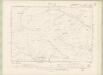
Kirkcudbrightshire Sheet V.SW - OS 6 Inch map
1 : 10560 Topographic maps Ordnance Survey Ordnance Survey
Kirkcudbrightshire Sheet V.SW - OS 6 Inch map
1 : 10560 Topographic maps Ordnance Survey Ordnance Survey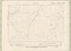
Ayrshire Sheet XLVIII.SE - OS 6 Inch map
1 : 10560 Topographic maps Ordnance Survey Ordnance Survey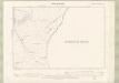
Ayrshire Sheet XLVIII.SE - OS 6 Inch map
1 : 10560 Topographic maps Ordnance Survey Ordnance Survey
NS70 - OS 1:25,000 Provisional Series Map
1 : 25000 Topographic maps Ordnance Survey Ordnance Survey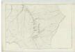
Ayrshire, Sheet XLVIII - OS 6 Inch map
1 : 10560 Topographic maps Ordnance Survey Ordnance Survey
NX69 - OS 1:25,000 Provisional Series Map
1 : 25000 Topographic maps Ordnance Survey Ordnance Survey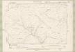
Dumfriesshire Sheet XX.SW & SE - OS 6 Inch map
1 : 10560 Topographic maps Ordnance Survey Ordnance Survey
Kirkcudbrightshire Sheet IV.NW - OS 6 Inch map
1 : 10560 Topographic maps Ordnance Survey Ordnance Survey
Ayrshire Sheet LIV.NW - OS 6 Inch map
1 : 10560 Topographic maps Ordnance Survey Ordnance Survey
Ayrshire Sheet LIV.NW - OS 6 Inch map
1 : 10560 Topographic maps Ordnance Survey Ordnance Survey
Ayrshire 4 S.
1 : 78000 Johnson, William, fl. 1806-1840
The Middle Part of Galloway : Contains The West P. of Kirkcudbright Shire / by H. Moll.
Moll, Herman, d. 1732
COILA PROVINCIA. | THE PROVINCE OF| KYLE.
Auct. Timoth: Pont. [Amsterdam : Joan Blaeu]