Maps of Aberdeenshire
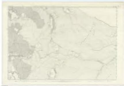
Inverness-shire (Mainland), Sheet XLVIA - OS 6 Inch map
1 : 10560 Topographic maps Ordnance Survey Ordnance Survey
Inverness-shire - Mainland Sheet XLVIa - OS 6 Inch map
1 : 10560 Topographic maps Ordnance Survey Ordnance Survey
Elginshire Sheet XXXIII.SW & SE - OS 6 Inch map
1 : 10560 Topographic maps Ordnance Survey Ordnance Survey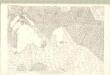
Inverness Mainland, Sheet XLVIa.1 - OS 25 Inch map
1 : 2500 Topographic maps Ordnance Survey Ordnance Survey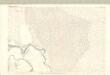
Inverness Mainland, Sheet XLVIa.13 - OS 25 Inch map
1 : 2500 Topographic maps Ordnance Survey Ordnance Survey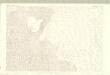
Inverness Mainland, Sheet XLVIa.5 - OS 25 Inch map
1 : 2500 Topographic maps Ordnance Survey Ordnance Survey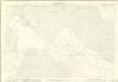
Inverness-shire - Mainland, Sheet 046a.01 - 25 Inch Map
1 : 2500 Topographic maps Ordnance Survey Ordnance Survey
Inverness-shire - Mainland, Sheet 046a.05 - 25 Inch Map
1 : 2500 Topographic maps Ordnance Survey Ordnance Survey
Inverness-shire - Mainland, Sheet 046a.13 - 25 Inch Map
1 : 2500 Topographic maps Ordnance Survey Ordnance Survey
Inverness-shire - Mainland, Sheet 046a.09 - 25 Inch Map
1 : 2500 Topographic maps Ordnance Survey Ordnance Survey
Inverness Mainland, Sheet XLVIa.9 - OS 25 Inch map
1 : 2500 Topographic maps Ordnance Survey Ordnance Survey
Elgin, Sheet XXXIII.15 (with inset XXXIII.14) (Cromdale, Inverallan & Advie) - OS 25 Inch map
1 : 2500 Topographic maps Ordnance Survey Ordnance Survey
Elginshire, Sheet 032.16 - 25 Inch Map
1 : 2500 Topographic maps Ordnance Survey Ordnance Survey
Elgin, Sheet XXXIII - OS 6 Inch map
1 : 10560 Topographic maps Ordnance Survey Ordnance Survey
Banffshire, Sheet XL (Inset XXXIX) - OS 6 Inch map
1 : 10560 Topographic maps Ordnance Survey Ordnance Survey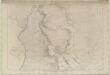
Banffshire Sheet XL - OS 6 Inch map
1 : 10560 Topographic maps Ordnance Survey Ordnance Survey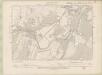
Elginshire Sheet XXXII.SE - OS 6 Inch map
1 : 10560 Topographic maps Ordnance Survey Ordnance Survey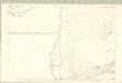
Elgin, Sheet XXXIII.10 (Detached No2) (with inset XXXIII.9) (Cromdale, Inverallan & Adv - OS 25 Inch map
1 : 2500 Topographic maps Ordnance Survey Ordnance Survey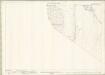
Elginshire, Sheet 033.10 - 25 Inch Map
1 : 2500 Topographic maps Ordnance Survey Ordnance Survey
Elgin, Sheet XXXIII.10 (Cromdale, Inverallan & Advie) - OS 25 Inch map
1 : 2500 Topographic maps Ordnance Survey Ordnance Survey
Elgin, Sheet XXXIII.11 (Cromdale, Inverallan & Advie) - OS 25 Inch map
1 : 2500 Topographic maps Ordnance Survey Ordnance Survey
Elgin, Sheet XXXII.12 (Combined) - OS 25 Inch map
1 : 2500 Topographic maps Ordnance Survey Ordnance Survey
Elginshire, Sheet 032.12 - 25 Inch Map
1 : 2500 Topographic maps Ordnance Survey Ordnance Survey
Inverness-shire - Mainland, Sheet 060.01 - 25 Inch Map
1 : 2500 Topographic maps Ordnance Survey Ordnance Survey
Inverness Mainland, Sheet LX.1 - OS 25 Inch map
1 : 2500 Topographic maps Ordnance Survey Ordnance Survey
Granton-on-Spey & Strath Dearn (38) - OS One-Inch map
1 : 63360 Topographic maps Ordnance Survey Ordnance Survey
Granton-on-Spey & Strath Dearn (38) - OS One-Inch map
1 : 63360 Topographic maps Ordnance Survey Ordnance Survey
Granton and Cairngorm - OS One-Inch Map
1 : 63360 Topographic maps Ordnance Survey Ordnance Survey
Balmoral - Bartholomew's 'Survey Atlas of Scotland'
1 : 126720 Topographic maps John Bartholomew & Son, Ltd John Bartholomew & Son, Ltd