Maps of Outer Hebrides
Inverness-shire (Hebrides), Sheet XXVI - OS 6 Inch map
1 : 10560 Topographic maps Ordnance Survey Ordnance Survey
Inverness-shire - Hebrides Sheet XXVI - OS 6 Inch map
1 : 10560 Topographic maps Ordnance Survey Ordnance Survey
Inverness-shire - Hebrides, Sheet 026.09 - 25 Inch Map
1 : 2500 Topographic maps Ordnance Survey Ordnance Survey
Inverness Hebrides, Sheet XXVI.9 (North Uist) - OS 25 Inch map
1 : 2500 Topographic maps Ordnance Survey Ordnance Survey
Inverness-shire - Hebrides, Sheet 026.04 - 25 Inch Map
1 : 2500 Topographic maps Ordnance Survey Ordnance Survey
Inverness Hebrides, Sheet XXVI.4 (Harris) - OS 25 Inch map
1 : 2500 Topographic maps Ordnance Survey Ordnance Survey
Inverness-shire - Hebrides, Sheet 026.13 - 25 Inch Map
1 : 2500 Topographic maps Ordnance Survey Ordnance Survey
Inverness Hebrides, Sheet XXVI.13 (North Uist) - OS 25 Inch map
1 : 2500 Topographic maps Ordnance Survey Ordnance Survey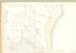
Inverness Hebrides, Sheet XXVI.8 (Harris) - OS 25 Inch map
1 : 2500 Topographic maps Ordnance Survey Ordnance Survey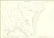
Inverness-shire - Hebrides, Sheet 026.08 - 25 Inch Map
1 : 2500 Topographic maps Ordnance Survey Ordnance Survey
Volume 3: Sheet 89 - Sollas
1 : 63360 Farquharson, J.
Sollas - OS One-Inch map
1 : 63360 Topographic maps Ordnance Survey Ordnance Survey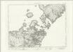
Sollas - OS One-Inch map
1 : 63360 Topographic maps Ordnance Survey Ordnance Survey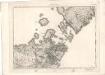
Sollas - OS One-Inch map
1 : 63360 Topographic maps Ordnance Survey Ordnance Survey
Sollas (22) - OS One-Inch map
1 : 63360 Topographic maps Ordnance Survey Ordnance Survey
Sollas (22) - OS One-Inch map
1 : 63360 Topographic maps Ordnance Survey Ordnance Survey
Sound of Harris
Great Britain. Hydrographic Office
North Uist - OS One-Inch Map
1 : 63360 Topographic maps Ordnance Survey Ordnance Survey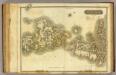
Western Isles Middle.
1 : 110000 Thomson, John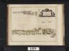
Vistus Insula, vulgo Viist, cum aliis minoribus ex Aebudarum numero ei ad meridiem adjacentibus / Auct. Timotheo Pont.
Pont, Timothy, 1560?-1614? Blaeu, Joan, 1596-1673
Vistvs insvla, vulgo Viist
1 Karte : Kupferdruck ; 44 x 56 cm Blaeu; Pont Joan Blaeu
Uist & Barra, Sheet 18 - Bartholomew's "Half Inch to the Mile Maps" of Scotland
1 : 126720 Topographic maps John Bartholomew & Son, Ltd John Bartholomew & Son, Ltd
North & South Uist, Sheet 18 - Bartholomew's "Half Inch to the Mile Maps" of Scotland
1 : 126720 Topographic maps Bartholomew, John George John Bartholomew & Co
Harris & The Lewis, Sheet 23 - Bartholomew's "Half Inch to the Mile Maps" of Scotland
1 : 126720 Topographic maps John Bartholomew & Son, Ltd John Bartholomew & Son, Ltd
Outer Hebrides, Sheet 23 - Bartholomew's "Half Inch to the Mile Maps" of Scotland
1 : 126720 Topographic maps Bartholomew, John George John Bartholomew & Co
VISTVS INSVLA, | vulgo VIIST, | cum aliis minoribus | EX ÆBVDARVM NVMERO | ei ad meridiem adjacentibus.
Auct. Timotheo Pont. [Amsterdam : Joan Blaeu]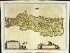
Leogvs et Haraia
1 Karte : Kupferdruck ; 38 x 51 cm Blaeu Joan Blaeu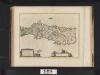
Leogus et Haraia insulae ex Aebudarum numero, quae quamquam isthmo cohaereant, pro diversis habentur. Lewis and Harray of the numbre of the Western Yles, which two although they ioyne be a necke of la
Blaeu, Joan, 1596-1673
Scotland / J. Ainslie, 1
1 Blatt : 64 x 58 cm Ainslie, Faden