Maps of Grampian Mountains
Fife, Sheet 27 - OS 6 Inch map
1 : 10560 Topographic maps Ordnance Survey Ordnance Survey
Fife and Kinross Sheet XXIII.SW - OS 6 Inch map
1 : 10560 Topographic maps Ordnance Survey Ordnance Survey
Fife and Kinross Sheet XXIII.SW - OS 6 Inch map
1 : 10560 Topographic maps Ordnance Survey Ordnance Survey
Fifeshire, Sheet 022.16 - 25 Inch Map
1 : 2500 Topographic maps Ordnance Survey Ordnance Survey
Fifeshire, Sheet 022.16 - 25 Inch Map
1 : 2500 Topographic maps Ordnance Survey Ordnance Survey
Fifeshire, Sheet 022.16 - 25 Inch Map
1 : 2500 Topographic maps Ordnance Survey Ordnance Survey
Fifeshire, Sheet 023.09 - 25 Inch Map
1 : 2500 Topographic maps Ordnance Survey Ordnance Survey
Fifeshire, Sheet 023.09 - 25 Inch Map
1 : 2500 Topographic maps Ordnance Survey Ordnance Survey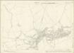
Fifeshire, Sheet 022.12 - 25 Inch Map
1 : 2500 Topographic maps Ordnance Survey Ordnance Survey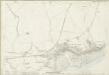
Fifeshire, Sheet 022.12 - 25 Inch Map
1 : 2500 Topographic maps Ordnance Survey Ordnance Survey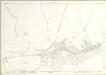
Fifeshire, Sheet 022.12 - 25 Inch Map
1 : 2500 Topographic maps Ordnance Survey Ordnance Survey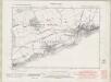
Fife and Kinross Sheet XXII.SE & XXX.NE - OS 6 Inch map
1 : 10560 Topographic maps Ordnance Survey Ordnance Survey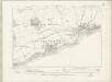
Fife and Kinross Sheet XXII.SE & XXX.NE - OS 6 Inch map
1 : 10560 Topographic maps Ordnance Survey Ordnance Survey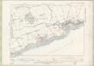
Fife and Kinross Sheet XXII.SE & XXX.NE - OS 6 Inch map
1 : 10560 Topographic maps Ordnance Survey Ordnance Survey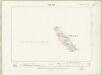
Fife and Kinross Sheet XXXI.NE - OS 6 Inch map
1 : 10560 Topographic maps Ordnance Survey Ordnance Survey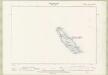
Fife and Kinross Sheet XXXI.NE - OS 6 Inch map
1 : 10560 Topographic maps Ordnance Survey Ordnance Survey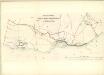
Pittenweem, West and East Anstruther, and Kilrenny
Great Britain. Parliament. House of Commons.
NO50 & Parts of NT59 - OS 1:25,000 Provisional Series Map
1 : 25000 Topographic maps Ordnance Survey Ordnance Survey
NO60 & Parts of NT69 - OS 1:25,000 Provisional Series Map
1 : 25000 Topographic maps Ordnance Survey Ordnance Survey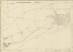
Fifeshire, Sheet 022.15 - 25 Inch Map
1 : 2500 Topographic maps Ordnance Survey Ordnance Survey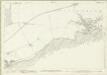
Fifeshire, Sheet 022.15 - 25 Inch Map
1 : 2500 Topographic maps Ordnance Survey Ordnance Survey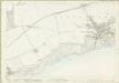
Fifeshire, Sheet 022.15 - 25 Inch Map
1 : 2500 Topographic maps Ordnance Survey Ordnance Survey
Fifeshire, Sheet 030.03 - 25 Inch Map
1 : 2500 Topographic maps Ordnance Survey Ordnance Survey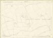
Fifeshire, Sheet 022.11 - 25 Inch Map
1 : 2500 Topographic maps Ordnance Survey Ordnance Survey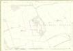
Fifeshire, Sheet 022.11 - 25 Inch Map
1 : 2500 Topographic maps Ordnance Survey Ordnance Survey
Fifeshire, Sheet 022.11 - 25 Inch Map
1 : 2500 Topographic maps Ordnance Survey Ordnance Survey
North Berwick - OS One-Inch map
1 : 63360 Topographic maps Ordnance Survey Ordnance Survey
North Berwick - OS One-Inch map
1 : 63360 Topographic maps Ordnance Survey Ordnance Survey
[North Berwick] - OS One-Inch map
1 : 63360 Topographic maps Ordnance Survey Ordnance Survey