Maps of Moray
Caithness, Sheet III (Inset IIIA) - OS 6 Inch map
1 : 10560 Topographic maps Ordnance Survey Ordnance Survey
Caithness-shire Sheet III & IIIa - OS 6 Inch map
1 : 10560 Topographic maps Ordnance Survey Ordnance Survey
Caithness-shire, Sheet 003.15 & 003.11 - 25 Inch Map
1 : 2500 Topographic maps Ordnance Survey Ordnance Survey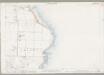
Caithness, Sheet III.1 (Combined) - OS 25 Inch map
1 : 2500 Topographic maps Ordnance Survey Ordnance Survey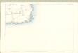
Caithness, Sheet III.5 - OS 25 Inch map
1 : 2500 Topographic maps Ordnance Survey Ordnance Survey
Caithness, Sheet III.10 (with inset III.9) - OS 25 Inch map
1 : 2500 Topographic maps Ordnance Survey Ordnance Survey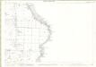
Caithness-shire, Sheet 003.01 - 25 Inch Map
1 : 2500 Topographic maps Ordnance Survey Ordnance Survey
Caithness-shire, Sheet 003.05 - 25 Inch Map
1 : 2500 Topographic maps Ordnance Survey Ordnance Survey
Caithness, Sheet III.13 - OS 25 Inch map
1 : 2500 Topographic maps Ordnance Survey Ordnance Survey
Caithness-shire, Sheet 003.14 - 25 Inch Map
1 : 2500 Topographic maps Ordnance Survey Ordnance Survey
Caithness-shire, Sheet 003.13 & 003.09 - 25 Inch Map
1 : 2500 Topographic maps Ordnance Survey Ordnance Survey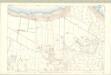
Caithness, Sheet III.14 - OS 25 Inch map
1 : 2500 Topographic maps Ordnance Survey Ordnance Survey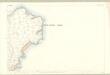
Caithness, Sheet III.15 - OS 25 Inch map
1 : 2500 Topographic maps Ordnance Survey Ordnance Survey
Orkney Sheet CXXVII - OS 6 Inch map
1 : 10560 Topographic maps Ordnance Survey Ordnance Survey
Orkney, Sheet CXXVII - OS 6 Inch map
1 : 10560 Topographic maps Ordnance Survey Ordnance Survey
ND37 & Parts of ND47 - OS 1:25,000 Provisional Series Map
1 : 25000 Topographic maps Ordnance Survey Ordnance Survey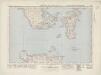
Orkney Islands (South) (7) - OS One-Inch map
1 : 63360 Topographic maps Ordnance Survey Ordnance Survey
Orkney Islands (South) (7) - OS One-Inch map
1 : 63360 Topographic maps Ordnance Survey Ordnance Survey
Pentland Firth - OS One-Inch Map
1 : 63360 Topographic maps Ordnance Survey Ordnance Survey
Cathenesia
1 Karte : Kupferdruck ; 37 x 51 cm Blaeu; Pont Joan Blaeu
Orkney, Sheet 28 - Bartholomew's "Half Inch to the Mile Maps" of Scotland
1 : 126720 Topographic maps John Bartholomew & Son, Ltd John Bartholomew & Son, Ltd
Orkney Islands, Sheet 28 - Bartholomew's "Half Inch to the Mile Maps" of Scotland
1 : 126720 Topographic maps Bartholomew, John George John Bartholomew & Co
Orkney Islands.
1 : 132000 Thomson, John
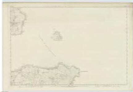
Dunbeath Harbour to Thurso Bay, Including the Pentland Firth
Great Britain. Hydrographic Office
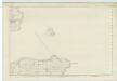
Orkney Islands.
Great Britain. Hydrographic Office
Die Orkney's oder die Orkadischen Inseln
1 : 410000 Orkneje (Skotsko)
Die Orkneys oder die Orkadischen Inseln
1 : 415000 Orkneje (Skotsko)
A chart of the Orkney Islands.
Aberdeen, William, fl. ca. 1742-1794
The Islands of Orkney / H. Moll, sculp.
Collins, Greenvile, fl. 1669-1698 Moll, Herman, d. 1732.