Maps of Outer Hebrides

Stornoway (14) - OS One-Inch map
1 : 63360 Topographic maps Ordnance Survey Ordnance Survey
Stornoway (14) - OS One-Inch map
1 : 63360 Topographic maps Ordnance Survey Ordnance Survey
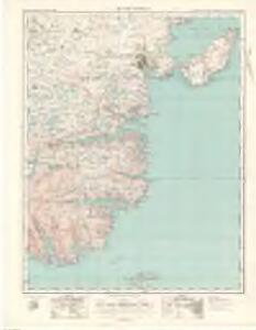
Tarbert - OS One-Inch map
1 : 63360 Topographic maps Ordnance Survey Ordnance Survey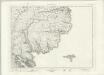
Tarbert - OS One-Inch map
1 : 63360 Topographic maps Ordnance Survey Ordnance Survey
Tarbert - OS One-Inch map
1 : 63360 Topographic maps Ordnance Survey Ordnance Survey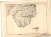
Isle of Lewis - OS One-Inch map
1 : 63360 Topographic maps Ordnance Survey Ordnance Survey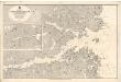
Lochs Erisort, Luirbost and Grimashadar.
Great Britain. Hydrographic Office
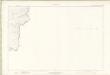
Ross-shire (Island of Lewis), Sheet 28 - OS 6 Inch map
1 : 10560 Topographic maps Ordnance Survey Ordnance Survey
Ross-shire (Island of Lewis), Sheet 27 - OS 6 Inch map
1 : 10560 Topographic maps Ordnance Survey Ordnance Survey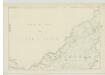
Ross-shire (Island of Lewis), Sheet 21 - OS 6 Inch map
1 : 10560 Topographic maps Ordnance Survey Ordnance Survey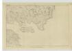
Ross-shire (Island of Lewis), Sheet 43 - OS 6 Inch map
1 : 10560 Topographic maps Ordnance Survey Ordnance Survey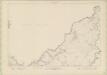
Ross and Cromarty - Isle of Lewis Sheet XXI - OS 6 Inch map
1 : 10560 Topographic maps Ordnance Survey Ordnance Survey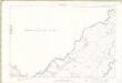
Ross and Cromarty - Isle of Lewis Sheet XXI - OS 6 Inch map
1 : 10560 Topographic maps Ordnance Survey Ordnance Survey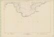
Ross and Cromarty - Isle of Lewis Sheet XXVIII - OS 6 Inch map
1 : 10560 Topographic maps Ordnance Survey Ordnance Survey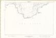
Ross and Cromarty - Isle of Lewis Sheet XXVIII - OS 6 Inch map
1 : 10560 Topographic maps Ordnance Survey Ordnance Survey
Ross-shire (Island of Lewis), Sheet 19 - OS 6 Inch map
1 : 10560 Topographic maps Ordnance Survey Ordnance Survey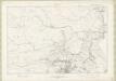
Ross and Cromarty - Isle of Lewis Sheet XX - OS 6 Inch map
1 : 10560 Topographic maps Ordnance Survey Ordnance Survey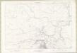
Ross and Cromarty - Isle of Lewis Sheet XX - OS 6 Inch map
1 : 10560 Topographic maps Ordnance Survey Ordnance Survey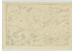
Ross-shire (Island of Lewis), Sheet 26 - OS 6 Inch map
1 : 10560 Topographic maps Ordnance Survey Ordnance Survey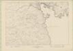
Ross and Cromarty - Isle of Lewis, 027 - OS 6 Inch map
1 : 10560 Topographic maps Ordnance Survey Ordnance Survey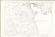
Ross and Cromarty - Isle of Lewis Sheet XXVII - OS 6 Inch map
1 : 10560 Topographic maps Ordnance Survey Ordnance Survey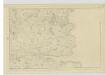
Ross-shire (Island of Lewis), Sheet 38 - OS 6 Inch map
1 : 10560 Topographic maps Ordnance Survey Ordnance Survey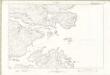
Ross and Cromarty - Isle of Lewis Sheet XXXIII - OS 6 Inch map
1 : 10560 Topographic maps Ordnance Survey Ordnance Survey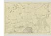
Ross-shire (Island of Lewis), Sheet 20 - OS 6 Inch map
1 : 10560 Topographic maps Ordnance Survey Ordnance Survey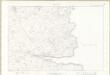
Ross and Cromarty - Isle of Lewis Sheet XXXVIII - OS 6 Inch map
1 : 10560 Topographic maps Ordnance Survey Ordnance Survey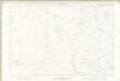
Ross and Cromarty - Isle of Lewis Sheet XIX - OS 6 Inch map
1 : 10560 Topographic maps Ordnance Survey Ordnance Survey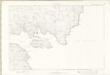
Ross and Cromarty - Isle of Lewis Sheet XLIII - OS 6 Inch map
1 : 10560 Topographic maps Ordnance Survey Ordnance Survey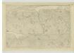
Ross-shire (Island of Lewis), Sheet 37 - OS 6 Inch map
1 : 10560 Topographic maps Ordnance Survey Ordnance Survey
Ross and Cromarty - Isle of Lewis Sheet XXVI - OS 6 Inch map
1 : 10560 Topographic maps Ordnance Survey Ordnance Survey