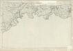
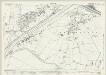
Maps of Trafford
Lancashire CX.9 (includes: Carrington; Irlam; Partington; Rixton With Glazebrook; Warburton) - 25 Inch Map
1 : 2500 Topographic maps Ordnance Survey Ordnance Survey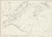
Lancashire CX.9 (includes: Carrington; Irlam; Partington; Rixton With Glazebrook; Warburton) - 25 Inch Map
1 : 2500 Topographic maps Ordnance Survey Ordnance Survey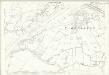
Lancashire CX.9 (includes: Carrington; Irlam; Partington; Rixton With Glazebrook; Warburton) - 25 Inch Map
1 : 2500 Topographic maps Ordnance Survey Ordnance Survey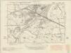
Cheshire VIII.SE - OS Six-Inch Map
1 : 10560 Topographic maps Ordnance Survey Ordnance Survey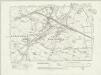
Cheshire VIII.SE - OS Six-Inch Map
1 : 10560 Topographic maps Ordnance Survey Ordnance Survey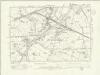
Cheshire VIII.SE - OS Six-Inch Map
1 : 10560 Topographic maps Ordnance Survey Ordnance Survey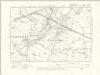
Cheshire VIII.SE - OS Six-Inch Map
1 : 10560 Topographic maps Ordnance Survey Ordnance Survey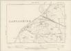
Cheshire VIII.SE - OS Six-Inch Map
1 : 10560 Topographic maps Ordnance Survey Ordnance Survey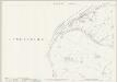
Cheshire VIII.15 (includes: Irlam; Partington; Rixton with Glazebrook; Warburton) - 25 Inch Map
1 : 2500 Topographic maps Ordnance Survey Ordnance Survey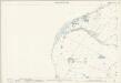
Cheshire VIII.15 (includes: Irlam; Partington; Rixton with Glazebrook; Warburton) - 25 Inch Map
1 : 2500 Topographic maps Ordnance Survey Ordnance Survey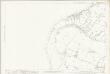
Cheshire VIII.15 (includes: Irlam; Partington; Rixton with Glazebrook; Warburton) - 25 Inch Map
1 : 2500 Topographic maps Ordnance Survey Ordnance Survey
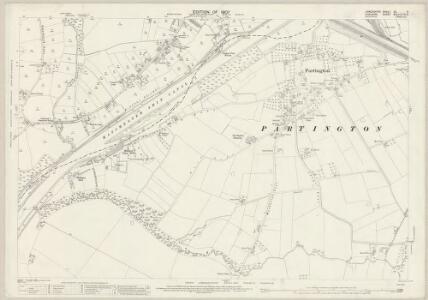
Cheshire VIII.16 (includes: Carrington; Dunham Massey; Partington; Warburton) - 25 Inch Map
1 : 2500 Topographic maps Ordnance Survey Ordnance Survey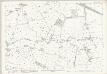
Cheshire VIII.16 (includes: Carrington; Dunham Massey; Partington; Warburton) - 25 Inch Map
1 : 2500 Topographic maps Ordnance Survey Ordnance Survey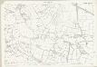
Cheshire VIII.16 (includes: Carrington; Dunham Massey; Partington; Warburton) - 25 Inch Map
1 : 2500 Topographic maps Ordnance Survey Ordnance Survey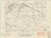
Lancashire CX.SW - OS Six-Inch Map
1 : 10560 Topographic maps Ordnance Survey Ordnance Survey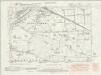
Lancashire CX.SW - OS Six-Inch Map
1 : 10560 Topographic maps Ordnance Survey Ordnance Survey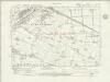
Lancashire CX.SW - OS Six-Inch Map
1 : 10560 Topographic maps Ordnance Survey Ordnance Survey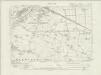
Lancashire CX.SW - OS Six-Inch Map
1 : 10560 Topographic maps Ordnance Survey Ordnance Survey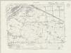
Lancashire CX.SW - OS Six-Inch Map
1 : 10560 Topographic maps Ordnance Survey Ordnance Survey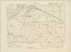
Lancashire CX.SW - OS Six-Inch Map
1 : 10560 Topographic maps Ordnance Survey Ordnance Survey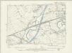
Lancashire CX.SW - OS Six-Inch Map
1 : 10560 Topographic maps Ordnance Survey Ordnance Survey
Lancashire CX.SW - OS Six-Inch Map
1 : 10560 Topographic maps Ordnance Survey Ordnance Survey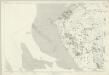
Cheshire VIII - OS Six-Inch Map
1 : 10560 Topographic maps Ordnance Survey Ordnance Survey
Cheshire VIII.11 (includes: Irlam; Partington; Rixton with Glazebrook) - 25 Inch Map
1 : 2500 Topographic maps Ordnance Survey Ordnance Survey
Cheshire VIII.11 (includes: Irlam; Partington; Rixton with Glazebrook) - 25 Inch Map
1 : 2500 Topographic maps Ordnance Survey Ordnance Survey
Cheshire VIII.11 (includes: Irlam; Partington; Rixton with Glazebrook) - 25 Inch Map
1 : 2500 Topographic maps Ordnance Survey Ordnance Survey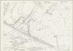
Cheshire VIII.12 (includes: Carrington; Flixton; Irlam; Partington) - 25 Inch Map
1 : 2500 Topographic maps Ordnance Survey Ordnance Survey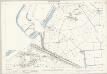
Cheshire VIII.12 (includes: Carrington; Flixton; Irlam; Partington) - 25 Inch Map
1 : 2500 Topographic maps Ordnance Survey Ordnance Survey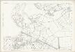
Cheshire VIII.12 (includes: Carrington; Flixton; Irlam; Partington) - 25 Inch Map
1 : 2500 Topographic maps Ordnance Survey Ordnance Survey