Maps of Lancashire
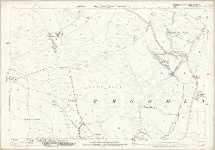
Yorkshire CLXXXIII.11 (includes: Barley With Wheatley Booth; Barnoldswick; Blacko; Brogden; Middop; Rimington) - 25 Inch Map
1 : 2500 Topographic maps Ordnance Survey Ordnance Survey
Yorkshire CLXXXIII.11 (includes: Barley With Wheatley Booth; Barnoldswick; Blacko; Brogden; Middop; Rimington) - 25 Inch Map
1 : 2500 Topographic maps Ordnance Survey Ordnance Survey
Yorkshire CLXXXIII.SE - OS Six-Inch Map
1 : 10560 Topographic maps Ordnance Survey Ordnance Survey
Yorkshire CLXXXIII.SE - OS Six-Inch Map
1 : 10560 Topographic maps Ordnance Survey Ordnance Survey
Lancashire XLVIII.11 (includes: Barnoldswick; Blacko; Brogden; Colne; Foulridge; Salterforth) - 25 Inch Map
1 : 2500 Topographic maps Ordnance Survey Ordnance Survey
Lancashire XLVIII.11 (includes: Barnoldswick; Blacko; Brogden; Colne; Foulridge; Salterforth) - 25 Inch Map
1 : 2500 Topographic maps Ordnance Survey Ordnance Survey
Lancashire XLVIII.11 (includes: Barnoldswick; Blacko; Brogden; Colne; Foulridge; Salterforth) - 25 Inch Map
1 : 2500 Topographic maps Ordnance Survey Ordnance Survey
Lancashire XLVIII - OS Six-Inch Map
1 : 10560 Topographic maps Ordnance Survey Ordnance Survey
Lancashire XLVIII.NE - OS Six-Inch Map
1 : 10560 Topographic maps Ordnance Survey Ordnance Survey
Lancashire XLVIII.NE - OS Six-Inch Map
1 : 10560 Topographic maps Ordnance Survey Ordnance Survey
Lancashire XLVIII.NE - OS Six-Inch Map
1 : 10560 Topographic maps Ordnance Survey Ordnance Survey
Lancashire XLVIII.SE - OS Six-Inch Map
1 : 10560 Topographic maps Ordnance Survey Ordnance Survey
Lancashire XLVIII.SE - OS Six-Inch Map
1 : 10560 Topographic maps Ordnance Survey Ordnance Survey
Lancashire XLVIII.SE - OS Six-Inch Map
1 : 10560 Topographic maps Ordnance Survey Ordnance Survey
Lancashire XLVIII.SE - OS Six-Inch Map
1 : 10560 Topographic maps Ordnance Survey Ordnance Survey
Lancashire XLVIII.6 (includes: Blacko; Brogden; Middop; Rimington; Twiston) - 25 Inch Map
1 : 2500 Topographic maps Ordnance Survey Ordnance Survey
Lancashire XLVIII.10 (includes: Barley With Wheatley Booth; Blacko; Brogden; Middop; Rimington; Twiston) - 25 Inch Map
1 : 2500 Topographic maps Ordnance Survey Ordnance Survey
Lancashire XLVIII.10 (includes: Barley With Wheatley Booth; Blacko; Brogden; Middop; Rimington; Twiston) - 25 Inch Map
1 : 2500 Topographic maps Ordnance Survey Ordnance Survey
Lancashire XLVIII.NW - OS Six-Inch Map
1 : 10560 Topographic maps Ordnance Survey Ordnance Survey
Lancashire XLVIII.NW - OS Six-Inch Map
1 : 10560 Topographic maps Ordnance Survey Ordnance Survey
Yorkshire 183 - OS Six-Inch Map
1 : 10560 Topographic maps Ordnance Survey Ordnance Survey
SD84 - OS 1:25,000 Provisional Series Map
1 : 25000 Topographic maps Ordnance Survey Ordnance Survey
Clitheroe (Hills) - OS One-Inch Revised New Series
1 : 63360 Topographic maps Ordnance Survey Ordnance Survey
Clitheroe (Outline) - OS One-Inch Revised New Series
1 : 63360 Topographic maps Ordnance Survey Ordnance Survey
Blackburn and Burnley - OS One-Inch Map
1 : 63360 Topographic maps Ordnance Survey Ordnance Survey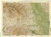
Harrogate, Sheet 6 - Bartholomew's "Half Inch to the Mile Maps" of England & Wales
1 : 126720 Topographic maps Bartholomew, John George John Bartholomew & Co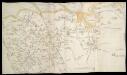
Map of Lancashire
This is a manuscript map of north Lancashire. It forms part of an atlas that belonged to William Cecil Lord Burghley, Elizabeth I’s Secretary of State. Burghley used this atlas to illustrate domestic matters. This period saw a threat to England from Spain, culminating in 1588 with the Spanish Armada. The map shows the area around the Kent sands. These are exaggerated in size to emphasise the areas where an enemy landing was likely and the tributaries of the estuary of the River Wyre are clearly delineated. What is significant about this map is that it has traditionally been said to mark the residences of the Catholic families in the area, each with a black cross. The fear expressed eloquently here is that the Spanish, under the Catholic Philip II, would forge alliances with these families in an effort to depose the Protestant Queen Elizabeth I. Another significant feature of the map is that the local beacon network is illustrated, if a little selectively. This network would be vital in an invasion scenario as it allowed the royal court and the surrounding area to be alerted. Rivers, which are also prominent, were the motorways of sixteenth century England. The red lines indicate the administrative districts or hundreds into which Lancashire was divided: these were important when mustering troops which could camp in the parks, indicated as circular fenced enclosures. All in all the map represents a means for dealing with almost anything that Philip II could throw at Elizabeth while, through the families which are not marked by a cross, ensuring that the administration of Lancashire remained in safe, loyal (i.e., Anglican) hands. William Cecil, Lord Burghley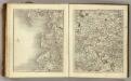
Sheets 49-50. (Cary's England, Wales, and Scotland).
1 : 360000 Cary, John, ca. 1754-1835
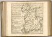
An accurate map of the county of Lancaster
1 Karte : Kupferdruck ; 67 x 51 cm Bowen; Hinton sold by I. Hinton at the Kings Arms in Newgate street