Maps of East Riding of Yorkshire
Yorkshire CXXVIII.2 (includes: Bempton; Reighton) - 25 Inch Map
1 : 2500 Topographic maps Ordnance Survey Ordnance Survey
Yorkshire CXXVIII.2 (includes: Bempton; Reighton) - 25 Inch Map
1 : 2500 Topographic maps Ordnance Survey Ordnance Survey
Yorkshire CXXVIII.2 (includes: Bempton; Reighton) - 25 Inch Map
1 : 2500 Topographic maps Ordnance Survey Ordnance Survey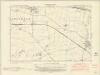
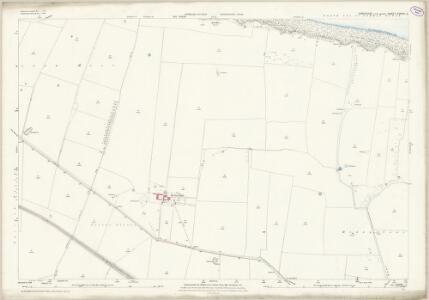
Yorkshire CXXVIII.NW - OS Six-Inch Map
1 : 10560 Topographic maps Ordnance Survey Ordnance Survey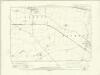
Yorkshire CXXVIII.NW - OS Six-Inch Map
1 : 10560 Topographic maps Ordnance Survey Ordnance Survey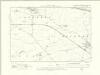
Yorkshire CXXVIII.NW - OS Six-Inch Map
1 : 10560 Topographic maps Ordnance Survey Ordnance Survey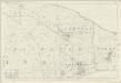
Yorkshire 128 - OS Six-Inch Map
1 : 10560 Topographic maps Ordnance Survey Ordnance Survey
TA17 - OS 1:25,000 Provisional Series Map
1 : 25000 Topographic maps Ordnance Survey Ordnance Survey
Flamborough (Outline) - OS One-Inch Revised New Series
1 : 63360 Topographic maps Ordnance Survey Ordnance Survey
Flamborough (Hills) - OS One-Inch Revised New Series
1 : 63360 Topographic maps Ordnance Survey Ordnance Survey
Scarborough - OS One-Inch Map
1 : 63360 Topographic maps Ordnance Survey Ordnance Survey
York & Scarborough, Sheet 7 - Bartholomew's "Half Inch to the Mile Maps" of England & Wales
1 : 126720 Topographic maps Bartholomew, John George John Bartholomew & Co
Dvcatvs Eboracensis pars orientalis
1 Karte : Kupferdruck ; 36 x 48 cm Valck; Schenk ex typographia Gerardi Valk et Petri Schenk
Dvcatvs Eboracensis pars orientalis
1 Karte : Kupferdruck ; 37 x 49 cm Blaeu Joan Blaeu
DVCATVS | EBORACENSIS | PARS ORIENTALIS; | The Eastriding of Yorkeshire.
[Amsterdam : Joan Blaeu]
Sheets 51-52. (Cary's England, Wales, and Scotland).
1 : 360000 Cary, John, ca. 1754-1835
Ducatus Eboracensis Pars Orientalis. The Eastriding of Yorke Shire. [Karte], in: Novus atlas absolutissimus, Bd. 8, S. 38.
1 Karte aus Atlas Janssonius Offizin
Ducatus Eboracensis Pars Orientalis; The Eastriding of Yorkeshire. [Karte], in: Theatrum orbis terrarum, sive, Atlas novus, Bd. 4, S. 453.
1 Karte aus Atlas Blaeu, Joan Blaeu, Willem Janszoon
Ducatus Eboracensis Pars Orientalis; The Eastriding of Yorkeshire [Karte], in: Le théâtre du monde, ou, Nouvel atlas contenant les chartes et descriptions de tous les païs de la terre, Bd. 4, S. 391.
1 Karte aus Atlas Blaeu, Willem Janszoon und Blaeu, Joan Blaeu, Willem Janszoon
Ducatus Eboracensis Pars Orientalis; The Eastriding of Yorkeshire. [Karte], in: Theatrum orbis terrarum, sive, Atlas novus, Bd. 4, S. 453.
1 Karte aus Atlas Blaeu, Joan Blaeu, Willem Janszoon
Generalkarte von Zentraleuropa
Nordsee
1 : 150000 Severní moře Reichs-Marine-Amt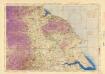
Ordnance Survey of England and Wales (Aeronautical map)
Great Britain. War Office. General Staff. Geographical Section [London] : [Air Ministry],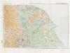
Sheet 3 England, North East, uit: Maps of England & Wales : scale 4 miles to 1 inch / Ordnance Survey
1 : 253440 titelvariant: Maps of England and Wales; Annotatie: Titel op cassette; Met bladoverzicht op de achterzijde van de cassette; Annotatie geografische gegevens: Hoogtelijneninterval 200 ft Ordnance Survey, United Kingdom Southampton : Ordnance Survey Office
England and Wales 1:253,440
Ordnance Survey
An accurate map of the County of York
1 Karte : Kupferdruck ; 52 x 69 cm Bowen; Hinton; Walker sold by J Hinton at the Kings Arms in St. Pauls Church Yard
Dvcatvs Eboracensis. anglice Yorkshire
1 Karte : Kupferdruck ; 37 x 47 cm Valck; Schenk venundantur â Gerardo Valk et Petro Schenk
Dvcatvs Eboracensis anglice York Shire
1 Karte : Kupferdruck ; 38 x 49 cm Blaeu Joan Blaeu
delineation of the strata of England and Wales, with part of Scotland
1 : 320000 Blatt 5 Smith, William Cary