Mapa catalogado
Shropshire VII.11 (includes: Bronington; Whitchurch Rural; Whitchurch Urban) - 25 Inch Map
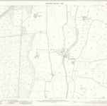

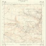
Título completo:Shropshire VII.11 (includes: Bronington; Whitchurch Rural; Whitchurch Urban) - 25 Inch Map
Año de ilustración:1899
Fecha de publicación:1901
Editorial:Ordnance Survey
Tamaño físico:20 x 30 cm
Escala del mapa:1:2 500
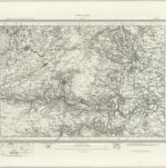
Wrexham (Outline) - OS One-Inch Revised New Series
1895
Ordnance Survey
1:63k
Wrexham (Hills) - OS One-Inch Revised New Series
1895
Ordnance Survey
1:63k
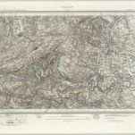
Oswestry (Outline) - OS One-Inch Revised New Series
1895
Ordnance Survey
1:63k
Oswestry (Hills) - OS One-Inch Revised New Series
1895
Ordnance Survey
1:63k
Actual survey of the county of Salop, 1
1752
John Rocque
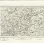
Cheshire, Sheet 12 - Bartholomew's "Half Inch to the Mile Maps" of England & Wales
1902
Bartholomew, John George
1:127k
Denbigiensis comitatus et comitatus Flintensis
1646
Blaeu
SJ15 - OS 1:25,000 Provisional Series Map
1938
Ordnance Survey
1:25k
SJ14 - OS 1:25,000 Provisional Series Map
1949
Ordnance Survey
1:25k
SJ13 - OS 1:25,000 Provisional Series Map
1949
Ordnance Survey
1:25k