Maps of Cheshire
Shropshire II.14 (includes: Dodcott Cum Wilkesley; Whitchurch Rural; Whitchurch Urban) - 25 Inch Map
1 : 2500 Topographic maps Ordnance Survey Ordnance Survey
Shropshire II.14 (includes: Dodcott Cum Wilkesley; Whitchurch Rural; Whitchurch Urban) - 25 Inch Map
1 : 2500 Topographic maps Ordnance Survey Ordnance Survey
Shropshire II.14 (includes: Dodcott Cum Wilkesley; Whitchurch Rural; Whitchurch Urban) - 25 Inch Map
1 : 2500 Topographic maps Ordnance Survey Ordnance Survey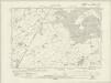
Shropshire II.SW - OS Six-Inch Map
1 : 10560 Topographic maps Ordnance Survey Ordnance Survey
Shropshire II.SW - OS Six-Inch Map
1 : 10560 Topographic maps Ordnance Survey Ordnance Survey
Shropshire II.SW - OS Six-Inch Map
1 : 10560 Topographic maps Ordnance Survey Ordnance Survey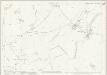
Cheshire LXV.7 (includes: Dodcott cum Wilkesley; Newhall; Whitchurch Rural) - 25 Inch Map
1 : 2500 Topographic maps Ordnance Survey Ordnance Survey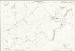
Cheshire LXV.7 (includes: Dodcott cum Wilkesley; Newhall; Whitchurch Rural) - 25 Inch Map
1 : 2500 Topographic maps Ordnance Survey Ordnance Survey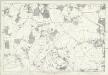
Cheshire LXV - OS Six-Inch Map
1 : 10560 Topographic maps Ordnance Survey Ordnance Survey
Cheshire LXV.NW - OS Six-Inch Map
1 : 10560 Topographic maps Ordnance Survey Ordnance Survey
Cheshire LXV.NW - OS Six-Inch Map
1 : 10560 Topographic maps Ordnance Survey Ordnance Survey
Cheshire LXV.NW - OS Six-Inch Map
1 : 10560 Topographic maps Ordnance Survey Ordnance Survey
Cheshire LXV.NW - OS Six-Inch Map
1 : 10560 Topographic maps Ordnance Survey Ordnance Survey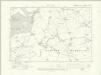
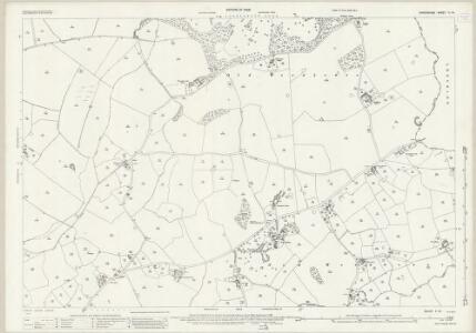
Cheshire LXV.NE - OS Six-Inch Map
1 : 10560 Topographic maps Ordnance Survey Ordnance Survey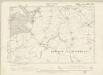
Cheshire LXV.NE - OS Six-Inch Map
1 : 10560 Topographic maps Ordnance Survey Ordnance Survey
SJ54 - OS 1:25,000 Provisional Series Map
1 : 25000 Topographic maps Ordnance Survey Ordnance Survey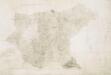
Wem
1 : 31680 This plan shows northern Shropshire and its border with Cheshire and Flintshire. The Ellesmere Canal is marked in blue. The draughtsman has recorded the individual locks, most notably on the section leading towards Whitchurch. An area calculation table survives in black ink in the right margin. Stevens, Henry
Combermere
1 : 31680 This drawing is formally titled at the top of the sheet. The draughtsman has made an annotation in ink along a yellow line, reading: 'Judged place of the North Edge of the Drayton sheet'. Sections of the Ellesmere Canal and the Birmingham and Chester Canal are shown in blue with individual locks indicated. Stevens, Henry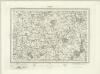
Nantwich (Outline) - OS One-Inch Revised New Series
1 : 63360 Topographic maps Ordnance Survey Ordnance Survey
Nantwich (Hills) - OS One-Inch Revised New Series
1 : 63360 Topographic maps Ordnance Survey Ordnance Survey
Actual survey of the county of Salop, 2
1 Blatt : 71 x 53 cm John Rocque
Actual Survey of the County of Salop
Rocque, John
Shrewsbury - OS One-Inch Map
1 : 63360 Topographic maps Ordnance Survey Ordnance Survey
Stoke on Trent - OS One-Inch Map
1 : 63360 Topographic maps Ordnance Survey Ordnance Survey
Stafford - OS One-Inch Map
1 : 63360 Topographic maps Ordnance Survey Ordnance Survey
Chester - OS One-Inch Map
1 : 63360 Topographic maps Ordnance Survey Ordnance Survey
Cheshire, Sheet 12 - Bartholomew's "Half Inch to the Mile Maps" of England & Wales
1 : 126720 Topographic maps Bartholomew, John George John Bartholomew & Co
An accurate map of Shrop Shire
1 Karte : Kupferdruck ; 51 x 68 cm Bowen; Hinton sold by J. Hinton at the Kings Arms in St. Pauls Church Yard
Comitatvs Salopiensis; anglice Shrop Shire
1 Karte : Kupferdruck ; 37 x 48 cm Blaeu Joan Blaeu