Maps of Stratford-on-Avon
Warwickshire XXXIII.13 (includes: Budbrooke; Warwick) - 25 Inch Map
1 : 2500 Topographic maps Ordnance Survey Ordnance Survey
Warwickshire XXXIII.13 (includes: Budbrooke; Warwick) - 25 Inch Map
1 : 2500 Topographic maps Ordnance Survey Ordnance Survey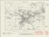
Warwickshire XXXIII.SW - OS Six-Inch Map
1 : 10560 Topographic maps Ordnance Survey Ordnance Survey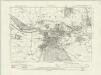
Warwickshire XXXIII.SW - OS Six-Inch Map
1 : 10560 Topographic maps Ordnance Survey Ordnance Survey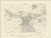
Warwickshire XXXIII.SW - OS Six-Inch Map
1 : 10560 Topographic maps Ordnance Survey Ordnance Survey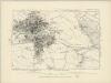
Warwickshire XXXIII.SW - OS Six-Inch Map
1 : 10560 Topographic maps Ordnance Survey Ordnance Survey
SP26 - OS 1:25,000 Provisional Series Map
1 : 25000 Topographic maps Ordnance Survey Ordnance Survey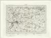
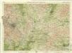
Warwick (Outline) - OS One-Inch Revised New Series
1 : 63360 Topographic maps Ordnance Survey Ordnance Survey
Warwick (Hills) - OS One-Inch Revised New Series
1 : 63360 Topographic maps Ordnance Survey Ordnance Survey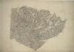
Henley-in-Arden
1 : 31680 This plan covers parts of Warwickshire and Worcestershire. Hill contours are described by brushwork interlining ('hachuring') combined with shaded bands of colour wash, which graduate to almost colourless at the summits. The order of ascending heights is expressed by rising numbers, a technique that became known as 'relative command'. Colour washes and symbols distinguish woods, meadows, common and arable land. Dawson, Robert
Warwick
1 : 31680 This,plan of,part of South Warwickshire shows the broad valley of the River Avon,to the,left of the sheet with the county town,shown at middle left along the riverbank. Major roads are highlighted in buff and feature tollgates and turnpikes along their routes. Turnpike Trusts were,established between the 17th and 19th centuries to raise money from travellers for the upkeep and maintenance of roads. Stevens, Henry
Coventry and Rugby - OS One-Inch Map
1 : 63360 Topographic maps Ordnance Survey Ordnance Survey
Birmingham - OS One-Inch Map
1 : 63360 Topographic maps Ordnance Survey Ordnance Survey
The counti of Warwick the shire towne and citie of Coventre described
1 : 1
An accurate map of the county of Worcester
1 Karte : Kupferdruck ; 51 x 68 cm Bowen; Tinney; Bowles; Sayer; Bowles; Bowles sold by I. Tinney at the Golden Lion and R. Sayer at the Golden Buck in Fleet street T. Bowles in St. Pauls Church Yard and I. Bowles and son at the Black Horse in Cornhill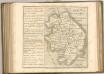
Birmingham, Leicester, Sheet 18 - Bartholomew's "Half Inch to the Mile Maps" of England & Wales
1 : 126720 Topographic maps Bartholomew, John George John Bartholomew & Co
Leicestrensis Comitatus. Leicester Shire. [Karte], in: Le théâtre du monde, ou, Nouvel atlas contenant les chartes et descriptions de tous les païs de la terre, Bd. 4, S. 287.
1 Karte aus Atlas Blaeu, Willem Janszoon und Blaeu, Joan Blaeu, Willem Janszoon
Wigorniensis Comitatus cum Warwicensi, nec non Conventriae Libertas
1 : 180000 Amstelodami : apud Joannem Janssonium
Leicestrensis Comitatus. Leicester Shire. [Karte], in: Theatrum orbis terrarum, sive, Atlas novus, Bd. 4, S. 327.
1 Karte aus Atlas Blaeu, Joan Blaeu, Willem Janszoon
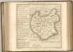
VIGORNIENSIS Comitatus Sheet 21
This map of Worcestershire is from the 1583 edition of the Saxton atlas of England and Wales.This atlas was first published as a whole in 1579. It consists of 35 coloured maps depicting the counties of England and Wales. The atlas is of great significance to British cartography as it set a standard of cartographic representation in Britain and the maps remained the basis for English county mapping, with few exceptions, until after 1750. During the reign of Elizabeth I map use became more common, with many government matters referring to increasingly accurate maps with consistent scales and symbols, made possible by advances in surveying techniques. Illustrating the increasing used of maps in government matters, Lord Burghley, Elizabeth I’s Secretary of State, who had been determined to have England and Wales mapped in detail from the 1550s, selected the cartographer Christopher Saxton to produce a detailed and consistent survey of the country. The financier of the project was Thomas Seckford Master of Requests at the Court of Elizabeth I, whose arms appear, along with the royal crest, on each map. Saxton, Christopher Ryther, Augustine
Leicestrensis Comitatus. Leicester Shire. [Karte], in: Theatrum orbis terrarum, sive, Atlas novus, Bd. 4, S. 327.
1 Karte aus Atlas Blaeu, Joan Blaeu, Willem Janszoon
Wigorniensis comitatus et comitatus Warwicensis; nec non Coventræ libertas
1 Karte : Kupferdruck ; 40 x 48 cm Blaeu Joan Blaeu

Wigorniensis Comitatus cum Warwicensi; nec non Conventriae Libertas. [Karte], in: Novus atlas absolutissimus, Bd. 7, S. 342.
1 Karte aus Atlas Janssonius Offizin
Map of Worcestershire
This is a manuscript map of Worcestershire. The date and draughtsman are not known. It forms part of an atlas that belonged to William Cecil Lord Burghley, Elizabeth I’s Secretary of State. Burghley used this atlas to illustrate domestic matters. The dominant features of the landscape are the waterways and the parks which are shown by symbols of fenced enclosures. These were of central importance to any military campaign. The fastest way to move a lot of men and weaponry was by river and parks provided somewhere for troops to set up camp and for horses to graze. Lord Burghley has annotated the map. In the left margin he has added a list of residents of the area and what lands and properties they are associated with, inserting some of these into the map itself. This is a good indication of how detailed was the knowledge accumulated by Burghley. William Cecil, Lord Burghley
WIGORNIENSIS | Comitatus et Comitatus | WARWICENSIS| nec non | COVENTRÆ LIBERTAS | WORCESTER, WARWIK SHIRE. | and THE LIBERTY OF COVENTRE.
[Amsterdam : Joan Blaeu]
COMITATVS | NORTHANTO- | NENSIS; | Vernacule | NORTHAMTON SHIRE.
[Amsterdam : Joan Blaeu]