Maps of Staffordshire Moorlands
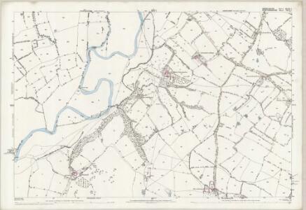
Derbyshire XLVII.7 (includes: Doveridge; Marston Montgomery; Rocester) - 25 Inch Map
1 : 2500 Topographic maps Ordnance Survey Ordnance Survey
Derbyshire XLVII.7 (includes: Doveridge; Marston Montgomery; Rocester) - 25 Inch Map
1 : 2500 Topographic maps Ordnance Survey Ordnance Survey
Derbyshire XLVII.7 (includes: Doveridge; Marston Montgomery; Rocester) - 25 Inch Map
1 : 2500 Topographic maps Ordnance Survey Ordnance Survey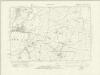
Derbyshire XLVII.NE - OS Six-Inch Map
1 : 10560 Topographic maps Ordnance Survey Ordnance Survey
Derbyshire XLVII.NE - OS Six-Inch Map
1 : 10560 Topographic maps Ordnance Survey Ordnance Survey
Derbyshire XLVII.NE - OS Six-Inch Map
1 : 10560 Topographic maps Ordnance Survey Ordnance Survey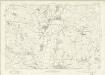
Derbyshire XLVII - OS Six-Inch Map
1 : 10560 Topographic maps Ordnance Survey Ordnance Survey
SK13 - OS 1:25,000 Provisional Series Map
1 : 25000 Topographic maps Ordnance Survey Ordnance Survey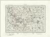
Ashbourne (Outline) - OS One-Inch Revised New Series
1 : 63360 Topographic maps Ordnance Survey Ordnance Survey
Ashbourne (Hills) - OS One-Inch Revised New Series
1 : 63360 Topographic maps Ordnance Survey Ordnance Survey
Sudbury Park
1 : 31680 The county boundary of Derbyshire and Staffordshire is indicated by a red pecked line. The boundary closely follows the River Dove. In the margins of the drawing several dots annotated with place names indicate observation stations. This is where the surveyor stood to take triangulation measurements. No indications of relief are given, suggesting that this is an outline plan, the midpoint between the original protraction and the finished drawing. The road network is precisely delineated. Major communication routes are coloured yellow, following military cartographic convention. Stevens, Henry
Burton upon Trent - OS One-Inch Map
1 : 63360 Topographic maps Ordnance Survey Ordnance Survey
Buxton and Matlock - OS One-Inch Map
1 : 63360 Topographic maps Ordnance Survey Ordnance Survey
An accurate map of the county of Derby
1 Karte : Kupferdruck ; 68 x 52 cm Bowen; Tinney; Bowles; Sayer; Bowles; Bowles sold by R. Sayer at the Golden Buck and I. Tinney at the Golden Lion in Fleet street T. Bowles in St. Pauls Church yard and I. Bowles and son in Cornhill
Darbiensis comitatvs vernacule Darbie Shire
1 Karte : Kupferdruck ; 37 x 48 cm Blaeu Joan Blaeu
An improved map of the county of Stafford
1 Karte : Kupferdruck ; 67 x 51 cm Bowen; Hinton sold by I. Hinton at the Kings Arms in St. Pauls Church Yard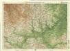
Derby & Nottingham, Sheet 13 - Bartholomew's "Half Inch to the Mile Maps" of England & Wales
1 : 126720 Topographic maps Bartholomew, John George John Bartholomew & Co
Staffordiensis comitatvs; vulgo Stafford Shire
1 Karte : Kupferdruck ; 39 x 49 cm Blaeu Joan Blaeu
Derbyshire. Designed and drawn by Ernest Clegg
1 : 285000 Clegg, Ernest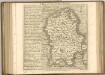

Leicestrensis Comitatus. Leicester Shire. [Karte], in: Le théâtre du monde, ou, Nouvel atlas contenant les chartes et descriptions de tous les païs de la terre, Bd. 4, S. 287.
1 Karte aus Atlas Blaeu, Willem Janszoon und Blaeu, Joan Blaeu, Willem Janszoon
CESTRIAE Comitatus
This map of Cheshire is by Christopher Saxton dating from 1577. It forms part of an atlas that belonged to William Cecil Lord Burghley, Elizabeth I’s Secretary of State. Burghley used this atlas to illustrate domestic matters. This map is actually a proof copy of one which forms part of Christopher Saxton’s Atlas of England and Wales. This atlas was first published as a whole in 1579. It consists of 35 coloured maps depicting the counties of England and Wales. The atlas is of great significance to British cartography as it set a standard of cartographic representation in Britain and the maps remained the basis for English county mapping, with few exceptions, until after 1750. During the reign of Elizabeth I, map use became more common, with many government matters referring to increasingly accurate maps with consistent scales and symbols, made possible by advances in surveying techniques. Illustrating the increasing use of maps in government matters, Lord Burghley, who had been determined to have England and Wales mapped in detail from the 1550s, selected the cartographer Christopher Saxton to produce a detailed and consistent survey of the country. The financier of the project was Thomas Seckford Master of Requests at the Court of Elizabeth I, whose arms appear, along with the royal crest, on each map.Here Burghley's annotations can be seen in the addition of place names, most densely around Liverpool Haven. Due to the coastal nature of the area it is possible that more information has been added as Burghley was concerned about the possibility of enemy landings in the area. This consideration must be seen in the context of the invasion threat from Spain which culminated in the events of the Spanish Armada in 1588. The map was engraved by Franciscus Scatterus, one of a team of English and Flemish engravers who worked on the atlas. Saxton, Christopher Scatterus, Franciscus
Comitatus Palatinus Cestriae
This is a map of Cheshire by William Smith. It dates from 1585. William Smith was Rouge Dragon at the College of Heralds/College of Arms, an institution that specialised in genealogical work, increasingly more so during the Elizabethan age as the gentry class rose in importance. The Rouge Dragon is the name of one of the Pursuivants, a heraldic officer attendant on the heralds, often attached to a particular nobleman, named so because of their badges. The prominent coat of arms on this plan reveals Smiths heraldic interests. In 1588 Smith completed "The Particuler Description of England. With the portratures of certaine of the cheiffest citties & townes". This work consisted of drawings of English cities and towns in a traditional bird's eye view style, drawings amalgamating bird's eye and plan. In the years 1602-03, William Smith anonymously published maps of Chester, Essex, Hertfordshire Lancashire, Leicester, Norfolk, Northamptonshire, Staffordshire, Suffolk, Surrey, Warwickshire and Worcestershire. These were probably engraved in Amsterdam and were intended to form sheets of a new atlas. After the publication of Saxton’s county maps in the 1570s, cartographers attempted to improve on Saxton’s atlas and replicate its success. Unfortunately for Smith, another cartographer, John Speed, was also preparing county maps at this time and competition proved too great, Speed being the victor. Smith, William
CESTRIAE
This map of Cheshire is from the 1583 edition of the Saxton atlas of England and Wales.This atlas was first published as a whole in 1579. It consists of 35 coloured maps depicting the counties of England and Wales. The atlas is of great significance to British cartography as it set a standard of cartographic representation in Britain and the maps remained the basis for English county mapping, with few exceptions, until after 1750. During the reign of Elizabeth I map use became more common, with many government matters referring to increasingly accurate maps with consistent scales and symbols, made possible by advances in surveying techniques. Illustrating the increasing used of maps in government matters, Lord Burghley, Elizabeth I’s Secretary of State, who had been determined to have England and Wales mapped in detail from the 1550s, selected the cartographer Christopher Saxton to produce a detailed and consistent survey of the country. The financier of the project was Thomas Seckford Master of Requests at the Court of Elizabeth I, whose arms appear, along with the royal crest, on each map. Saxton, Christopher Ryther, Augustine
Leicestrensis Comitatus. Leicester Shire. [Karte], in: Theatrum orbis terrarum, sive, Atlas novus, Bd. 4, S. 327.
1 Karte aus Atlas Blaeu, Joan Blaeu, Willem Janszoon
Leicestrensis Comitatus. Leicester Shire. [Karte], in: Theatrum orbis terrarum, sive, Atlas novus, Bd. 4, S. 327.
1 Karte aus Atlas Blaeu, Joan Blaeu, Willem Janszoon
Comitatvs Darbiensis
1 Karte : Kupferdruck ; 36 x 47 cm Valck; Schenk apud G. Valk et P. Schenk
Cestria Comitatus Palatinus. [Karte], in: Theatrum orbis terrarum, sive, Atlas novus, Bd. 4, S. 381.
1 Karte aus Atlas Blaeu, Joan Blaeu, Willem Janszoon
Cestria Comitatus Palatinus. [Karte], in: Theatrum orbis terrarum, sive, Atlas novus, Bd. 4, S. 381.
1 Karte aus Atlas Blaeu, Joan Blaeu, Willem Janszoon