Maps of Peterborough
Northamptonshire VIII.14 (includes: Orton Longueville; Orton Waterville; Peterborough) - 25 Inch Map
1 : 2500 Topographic maps Ordnance Survey Ordnance Survey
Northamptonshire VIII.14 (includes: Orton Longueville; Orton Waterville; Peterborough) - 25 Inch Map
1 : 2500 Topographic maps Ordnance Survey Ordnance Survey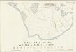
Northamptonshire VIII.14 (includes: Orton Longueville; Orton Waterville; Peterborough) - 25 Inch Map
1 : 2500 Topographic maps Ordnance Survey Ordnance Survey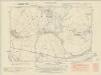
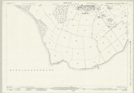
Northamptonshire VIII.SW - OS Six-Inch Map
1 : 10560 Topographic maps Ordnance Survey Ordnance Survey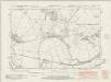
Northamptonshire VIII.SW - OS Six-Inch Map
1 : 10560 Topographic maps Ordnance Survey Ordnance Survey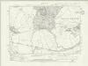
Northamptonshire VIII.SW - OS Six-Inch Map
1 : 10560 Topographic maps Ordnance Survey Ordnance Survey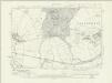
Northamptonshire VIII.SW - OS Six-Inch Map
1 : 10560 Topographic maps Ordnance Survey Ordnance Survey
Northamptonshire VIII.SW - OS Six-Inch Map
1 : 10560 Topographic maps Ordnance Survey Ordnance Survey
Northamptonshire VIII.SW - OS Six-Inch Map
1 : 10560 Topographic maps Ordnance Survey Ordnance Survey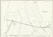
Huntingdonshire II.14 (includes: Alwalton; Castor; Orton Longueville; Orton Waterville; Peterborough) - 25 Inch Map
1 : 2500 Topographic maps Ordnance Survey Ordnance Survey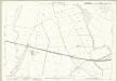
Huntingdonshire II.14 (includes: Alwalton; Castor; Orton Longueville; Orton Waterville; Peterborough) - 25 Inch Map
1 : 2500 Topographic maps Ordnance Survey Ordnance Survey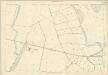
Huntingdonshire II.14 (includes: Alwalton; Castor; Orton Longueville; Orton Waterville; Peterborough) - 25 Inch Map
1 : 2500 Topographic maps Ordnance Survey Ordnance Survey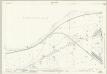
Huntingdonshire II.15 (includes: Orton Longueville; Peterborough; Woodston) - 25 Inch Map
1 : 2500 Topographic maps Ordnance Survey Ordnance Survey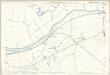
Huntingdonshire II.15 (includes: Orton Longueville; Peterborough; Woodston) - 25 Inch Map
1 : 2500 Topographic maps Ordnance Survey Ordnance Survey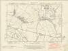
Huntingdonshire II.SW - OS Six-Inch Map
1 : 10560 Topographic maps Ordnance Survey Ordnance Survey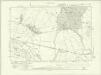
Huntingdonshire II.SW - OS Six-Inch Map
1 : 10560 Topographic maps Ordnance Survey Ordnance Survey
Huntingdonshire II.SW - OS Six-Inch Map
1 : 10560 Topographic maps Ordnance Survey Ordnance Survey
Huntingdonshire II.SW - OS Six-Inch Map
1 : 10560 Topographic maps Ordnance Survey Ordnance Survey
Cambridgeshire IX.SE - OS Six-Inch Map
1 : 10560 Topographic maps Ordnance Survey Ordnance Survey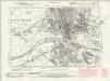
Cambridgeshire IX.SE - OS Six-Inch Map
1 : 10560 Topographic maps Ordnance Survey Ordnance Survey
Cambridgeshire IX.SE - OS Six-Inch Map
1 : 10560 Topographic maps Ordnance Survey Ordnance Survey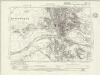
Cambridgeshire IX.SE - OS Six-Inch Map
1 : 10560 Topographic maps Ordnance Survey Ordnance Survey
Huntingdonshire II.SE - OS Six-Inch Map
1 : 10560 Topographic maps Ordnance Survey Ordnance Survey
Cambridgeshire IX.SE - OS Six-Inch Map
1 : 10560 Topographic maps Ordnance Survey Ordnance Survey
Huntingdonshire II.10 (includes: Castor; Orton Longueville; Orton Waterville; Peterborough) - 25 Inch Map
1 : 2500 Topographic maps Ordnance Survey Ordnance Survey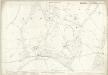
Huntingdonshire II.10 (includes: Castor; Orton Longueville; Orton Waterville; Peterborough) - 25 Inch Map
1 : 2500 Topographic maps Ordnance Survey Ordnance Survey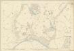
Huntingdonshire II.10 (includes: Castor; Orton Longueville; Orton Waterville; Peterborough) - 25 Inch Map
1 : 2500 Topographic maps Ordnance Survey Ordnance Survey
TL19 - OS 1:25,000 Provisional Series Map
1 : 25000 Topographic maps Ordnance Survey Ordnance Survey
Stamford
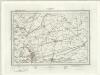
This plan details a section of the Welland and Nene Valleys running through Cambridgeshire and Lincolnshire. It depicts the system of man-made drains, ditches and sluices for draining the lowland area between Peterborough and Ely, offering a navigable route to the fenland rivers. Milton Park at the bottom right is a good example of 18th-century formal parkland, with grass, trees and lakes well detailed. Boyce
Peterborough (Hills) - OS One-Inch Revised New Series
1 : 63360 Topographic maps Ordnance Survey Ordnance Survey