Maps of Bristol
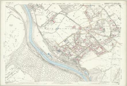
Gloucestershire LXXI.11 (includes: Abbots Leigh; Bristol) - 25 Inch Map
1 : 2500 Topographic maps Ordnance Survey Ordnance Survey
Gloucestershire LXXI.11 (includes: Abbots Leigh; Bristol) - 25 Inch Map
1 : 2500 Topographic maps Ordnance Survey Ordnance Survey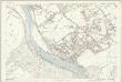
Gloucestershire LXXI.11 (includes: Abbots Leigh; Bristol) - 25 Inch Map
1 : 2500 Topographic maps Ordnance Survey Ordnance Survey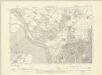
Somerset III.SW - OS Six-Inch Map
1 : 10560 Topographic maps Ordnance Survey Ordnance Survey
Somerset III.SW - OS Six-Inch Map
1 : 10560 Topographic maps Ordnance Survey Ordnance Survey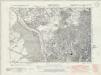
Gloucestershire LXXI.SE - OS Six-Inch Map
1 : 10560 Topographic maps Ordnance Survey Ordnance Survey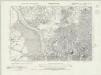
Gloucestershire LXXI.SE - OS Six-Inch Map
1 : 10560 Topographic maps Ordnance Survey Ordnance Survey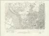
Gloucestershire LXXI.SE - OS Six-Inch Map
1 : 10560 Topographic maps Ordnance Survey Ordnance Survey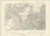
Gloucestershire LXXI.SE - OS Six-Inch Map
1 : 10560 Topographic maps Ordnance Survey Ordnance Survey
Gloucestershire LXXI.SE - OS Six-Inch Map
1 : 10560 Topographic maps Ordnance Survey Ordnance Survey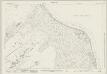
Somerset III.13 (includes: Abbots Leigh; Bristol; Long Ashton) - 25 Inch Map
1 : 2500 Topographic maps Ordnance Survey Ordnance Survey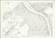
Somerset III.13 (includes: Abbots Leigh; Bristol; Long Ashton) - 25 Inch Map
1 : 2500 Topographic maps Ordnance Survey Ordnance Survey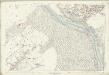
Somerset III.13 (includes: Abbots Leigh; Bristol; Long Ashton) - 25 Inch Map
1 : 2500 Topographic maps Ordnance Survey Ordnance Survey
Somerset III.9 (includes: Abbots Leigh; Bristol) - 25 Inch Map
1 : 2500 Topographic maps Ordnance Survey Ordnance Survey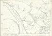
Somerset III.9 (includes: Abbots Leigh; Bristol) - 25 Inch Map
1 : 2500 Topographic maps Ordnance Survey Ordnance Survey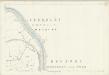
Somerset III.9 (includes: Abbots Leigh; Bristol) - 25 Inch Map
1 : 2500 Topographic maps Ordnance Survey Ordnance Survey
Somerset III - OS Six-Inch Map
1 : 10560 Topographic maps Ordnance Survey Ordnance Survey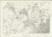
Gloucestershire LXXI - OS Six-Inch Map
1 : 10560 Topographic maps Ordnance Survey Ordnance Survey
ST57 - OS 1:25,000 Provisional Series Map
1 : 25000 Topographic maps Ordnance Survey Ordnance Survey
Bristol 9
1 : 31680 This hill sketch features an engraved outline reading 'Ordnance map of the environs of Bristol'. Military barracks and batteries protecting the Bristol Cannel are recorded at the mouth of the River Severn, at the top of the map. Grave mounds ('Tumuli'), hillforts, ancient camps and antiquities are noted in gothic script at Bitton and to the right of Dundry Hill. Otherwise, quarries, mills and pits dominate this industrial region of the county of Avon. Corrections in red ink and other additions were made at a later date. Dawson, Robert
Bedminster
This drawing covers the coastal area of the Bristol Channel. Pencil lines extending from a point adjacent to Honey Comb indicate the angular measurements taken to plot the coastline. Haven Military Battery is clearly marked at the mouth of the River Avon. Detail such as this is testimony to the military impetus behind the survey. A dotted red line running along the river Avon represents the old boundary between the counties of Somerset and Avon.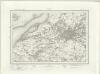
Bristol (Outline) - OS One-Inch Revised New Series
1 : 63360 Topographic maps Ordnance Survey Ordnance Survey
Bristol (Hills) - OS One-Inch Revised New Series
1 : 63360 Topographic maps Ordnance Survey Ordnance Survey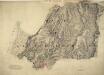
Chipping Sodbury
1 : 31680 The Avon barracks and battery are documented at the mouth of the River Severn, at the top of the map, protecting the Bristol Channel. Gravemounds ('Tumuli'), hill forts, ancient camps and antiquities are distinguished by the use of gothic lettering. The recording of archaeological details became obligatory in 1816. Quarries, kilns, mills, brickyards and pits dominate this industrial region of the West Midlands. According to a note in the Ordnance Survey Day Books, held in the National Archives, a one inch-to-the-mile reduction of this plan was delivered to Captain Gossett for engraving in the Drawing Office at the Tower of London in March 1830. Crocker, Edmund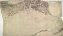
Newport 21
1 : 31680 This drawings depicts the winding course of the River Usk as it flows by the Roman town of Caerleon into the Severn Estuary and the Bristol Channel. Not far from the river mouth lies Newport. The Usk is not navigable except at this point, but the Monmouthshire and Brecon and Abergavenny canals, in part following the valley, carry a small trade up to Brecon. Cardiff, depicted at bottom left, was a town of only 6,000 inhabitants when this plan was produced. Budgen, Charles
Bristol and Newport - OS One-Inch Map
1 : 63360 Topographic maps Ordnance Survey Ordnance Survey
Bristol and Stroud - OS One-Inch Map
1 : 63360 Topographic maps Ordnance Survey Ordnance Survey
Weston-Super-Mare - OS One-Inch Map
1 : 63360 Topographic maps Ordnance Survey Ordnance Survey
Monvmethensis comitatvs vernacule Monmovth Shire
1 Karte : Kupferdruck ; 37 x 48 cm Blaeu Joan Blaeu