Maps of Forest of Dean
Gloucestershire X.10 (includes: Bromsberrow; Donnington; Dymock) - 25 Inch Map
1 : 2500 Topographic maps Ordnance Survey Ordnance Survey
Gloucestershire X.10 (includes: Bromsberrow; Donnington; Dymock) - 25 Inch Map
1 : 2500 Topographic maps Ordnance Survey Ordnance Survey
Gloucestershire X.10 (includes: Bromsberrow; Donnington; Dymock) - 25 Inch Map
1 : 2500 Topographic maps Ordnance Survey Ordnance Survey
Herefordshire XLII.13 (includes: Bromsberrow; Donnington; Dymock) - 25 Inch Map
1 : 2500 Topographic maps Ordnance Survey Ordnance Survey
Herefordshire XLII.13 (includes: Bromsberrow; Donnington; Dymock) - 25 Inch Map
1 : 2500 Topographic maps Ordnance Survey Ordnance Survey
Herefordshire XLI.16 & 11 (includes: Donnington; Dymock; Ledbury Rural; Little Marcle; Much Marcle) - 25 Inch Map
1 : 2500 Topographic maps Ordnance Survey Ordnance Survey
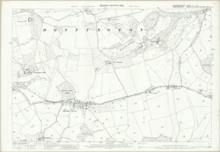
Herefordshire XLI.16 (includes: Donnington; Dymock) - 25 Inch Map
1 : 2500 Topographic maps Ordnance Survey Ordnance Survey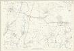
Herefordshire XLI.16 (includes: Donnington; Dymock) - 25 Inch Map
1 : 2500 Topographic maps Ordnance Survey Ordnance Survey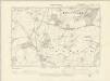
Gloucestershire X.SW - OS Six-Inch Map
1 : 10560 Topographic maps Ordnance Survey Ordnance Survey
Gloucestershire X.SW - OS Six-Inch Map
1 : 10560 Topographic maps Ordnance Survey Ordnance Survey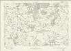
Gloucestershire X - OS Six-Inch Map
1 : 10560 Topographic maps Ordnance Survey Ordnance Survey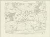
Herefordshire XLII.SW - OS Six-Inch Map
1 : 10560 Topographic maps Ordnance Survey Ordnance Survey
Herefordshire XLII.SW - OS Six-Inch Map
1 : 10560 Topographic maps Ordnance Survey Ordnance Survey
Herefordshire XLII.SW - OS Six-Inch Map
1 : 10560 Topographic maps Ordnance Survey Ordnance Survey
Herefordshire XLI.SE - OS Six-Inch Map
1 : 10560 Topographic maps Ordnance Survey Ordnance Survey
Herefordshire XLI.SE - OS Six-Inch Map
1 : 10560 Topographic maps Ordnance Survey Ordnance Survey
Herefordshire XLI.SE - OS Six-Inch Map
1 : 10560 Topographic maps Ordnance Survey Ordnance Survey
Herefordshire XLI.SE - OS Six-Inch Map
1 : 10560 Topographic maps Ordnance Survey Ordnance Survey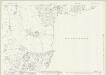
Herefordshire XLII.9 (includes: Bromsberrow; Donnington; Eastnor; Ledbury Rural) - 25 Inch Map
1 : 2500 Topographic maps Ordnance Survey Ordnance Survey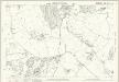
Herefordshire XLII.9 (includes: Bromsberrow; Donnington; Eastnor; Ledbury Rural) - 25 Inch Map
1 : 2500 Topographic maps Ordnance Survey Ordnance Survey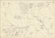
Herefordshire XLII.9 (includes: Bromsberrow; Donnington; Eastnor; Ledbury Rural) - 25 Inch Map
1 : 2500 Topographic maps Ordnance Survey Ordnance Survey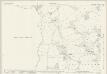
Herefordshire XLI.12 (includes: Donnington; Dymock; Ledbury Rural) - 25 Inch Map
1 : 2500 Topographic maps Ordnance Survey Ordnance Survey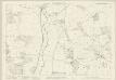
Herefordshire XLI.12 (includes: Donnington; Dymock; Ledbury Rural) - 25 Inch Map
1 : 2500 Topographic maps Ordnance Survey Ordnance Survey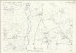
Herefordshire XLI.12 (includes: Donnington; Dymock; Ledbury Rural) - 25 Inch Map
1 : 2500 Topographic maps Ordnance Survey Ordnance Survey
SO73 - OS 1:25,000 Provisional Series Map
1 : 25000 Topographic maps Ordnance Survey Ordnance Survey
Great Malvern
1 : 31680 This plan of part of Worcestershire uses different shades of green wash to distinguish woods, meadows, commons and parks. To the left of the manuscript, the narrow ridge of the Malvern Hills rises above the Severn and Tern Valleys. At the centre of the drawing is a north-south ridge formed of igneous rock, with wooded hills rising abruptly above the Tern Valley to the north. There are gentler and more sweeping slopes to the south-west, and clusters of conifers, limes, oaks and other parkland trees to the south. Dawson, Robert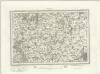
Tewksbury (Outline) - OS One-Inch Revised New Series
1 : 63360 Topographic maps Ordnance Survey Ordnance Survey
Tewksbury (Hills) - OS One-Inch Revised New Series
1 : 63360 Topographic maps Ordnance Survey Ordnance Survey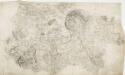
Hereford 22
1 : 31680 Below the city of Hereford, near the top of the sheet, the River Wye flows,through a winding river channel,across a broad floodplain with few major settlements. The floodplain is mostly farmland, dotted by,very small areas of woodland and marsh., The main river banks are lined irregularly with tall alder and willow trees, illustrated on this plan. Budgen, Thomas