Maps of Crondall
Hampshire and Isle of Wight XXVIII.3 (includes: Crondall; Farnham) - 25 Inch Map
1 : 2500 Topographic maps Ordnance Survey Ordnance Survey
Hampshire and Isle of Wight XXVIII.3 (includes: Crondall; Farnham) - 25 Inch Map
1 : 2500 Topographic maps Ordnance Survey Ordnance Survey
Surrey XXX.1 (includes: Crondall; Farnham) - 25 Inch Map
1 : 2500 Topographic maps Ordnance Survey Ordnance Survey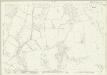
Surrey XXX.1 (includes: Crondall; Farnham) - 25 Inch Map
1 : 2500 Topographic maps Ordnance Survey Ordnance Survey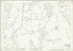
Surrey XXX.1 (includes: Crondall; Farnham) - 25 Inch Map
1 : 2500 Topographic maps Ordnance Survey Ordnance Survey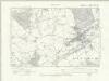
Hampshire & Isle of Wight XXVIII.NE - OS Six-Inch Map
1 : 10560 Topographic maps Ordnance Survey Ordnance Survey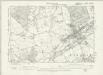
Hampshire & Isle of Wight XXVIII.NE - OS Six-Inch Map
1 : 10560 Topographic maps Ordnance Survey Ordnance Survey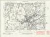
Surrey XXX.NW - OS Six-Inch Map
1 : 10560 Topographic maps Ordnance Survey Ordnance Survey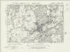
Surrey XXX.NW - OS Six-Inch Map
1 : 10560 Topographic maps Ordnance Survey Ordnance Survey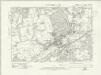
Surrey XXX.NW - OS Six-Inch Map
1 : 10560 Topographic maps Ordnance Survey Ordnance Survey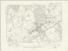
Surrey XXX.NW - OS Six-Inch Map
1 : 10560 Topographic maps Ordnance Survey Ordnance Survey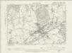
Surrey XXX.NW - OS Six-Inch Map
1 : 10560 Topographic maps Ordnance Survey Ordnance Survey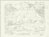
Surrey XXIX.NE - OS Six-Inch Map
1 : 10560 Topographic maps Ordnance Survey Ordnance Survey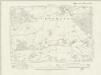
Surrey XXIX.NE - OS Six-Inch Map
1 : 10560 Topographic maps Ordnance Survey Ordnance Survey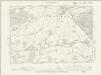
Surrey XXIX.NE - OS Six-Inch Map
1 : 10560 Topographic maps Ordnance Survey Ordnance Survey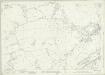
Surrey XXX.5 (includes: Farnham) - 25 Inch Map
1 : 2500 Topographic maps Ordnance Survey Ordnance Survey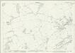
Surrey XXX.5 (includes: Farnham) - 25 Inch Map
1 : 2500 Topographic maps Ordnance Survey Ordnance Survey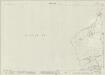
Surrey XXIX.8 (includes: Bentley; Crondall; Farnham) - 25 Inch Map
1 : 2500 Topographic maps Ordnance Survey Ordnance Survey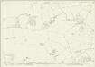
Surrey XXIX.8 (includes: Bentley; Crondall; Farnham) - 25 Inch Map
1 : 2500 Topographic maps Ordnance Survey Ordnance Survey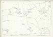
Surrey XXIX.8 (includes: Bentley; Crondall; Farnham) - 25 Inch Map
1 : 2500 Topographic maps Ordnance Survey Ordnance Survey
SU84 - OS 1:25,000 Provisional Series Map
1 : 25000 Topographic maps Ordnance Survey Ordnance Survey
Frogle
1 : 31680 This rough field sketch was drawn on three pieces of paper, subsequently joined and mounted on stiff card. Featuring corrections in black and red ink, it provides a good contrast with more finished drawings. The draughtsman has recorded relief and the layout of the settlements. An avenue of trees near Henwood is represented by individual trees drawn with their shadows falling to the right. "T.P.G" is written on some roads to indicate a turnpike gate.
Godalming
1 : 31680 .This map is in excellent condition and has retained its colour through two centuries. The turquoise wash, used to indicate water, remains particularly bright and vibrant. Commonland is the most prominent topographical feature in the drawing, denoted by open dotting. Large commons are shown at Frensham, Fernham, Thursley, Witley and Hinkley. Commons were carefully detailed by the surveyors, with a view to their possible use as military encampments. Although illustrating archaeological features did not become obligatory until 1816, this map notes a Bronze Age structure called the Devil's Jump, near Elstead at the centre of the map. Budgen, Thomas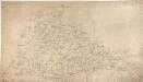
Alton
1 : 31680 This map depicts a part of Hampshire's North Downs, particularly the chalk hills to the south of Basingstoke. Buildings appear infilled and blocked in red ink at the main settlements of Basingstoke, at the top of the plan, and Alton, at the bottom. Hewitt, John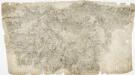
Odiham
1 : 31680 The most striking feature of this drawing is the triangulation web covering a large area around the East Hampstead Plain. According to manuscript sources, the different ground levels in this region made it an ideal case study for assistant engineers training for the Ordnance Survey under the tuition of Robert Dawson, the surveyor of this plan. Two circles on the main road through Hartford Bridge Flats represent triangulation points. Dawson, Robert
Map of Hampshire, including the Isle of Wight, 2
1 Blatt : 55 x 70 cm s.n.
London passenger transport map
Ordnance Survey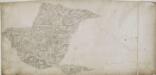
Alresford 19
1 : 31680 Relief is indicated on this plan by shading and interlining ('hachuring'). The concern with depicting relief accurately reflects the military emphasis of these drawings: knowledge of the lie of the land could greatly help the efficient movement of regiments. The right-hand side of the drawing is unfinished, featuring main roads only.
Map of Hampshire, including the Isle of Wight, 4
1 Blatt : 53 x 69 cm s.n.