Maps of Aylesbury Vale
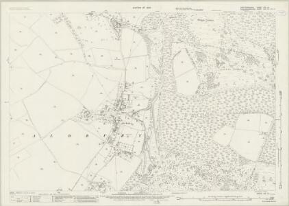
Hertfordshire XXV.12 (includes: Aldbury; Little Gaddesden; Northchurch; Pitstone) - 25 Inch Map
1 : 2500 Topographic maps Ordnance Survey Ordnance Survey
Hertfordshire XXV.12 (includes: Aldbury; Little Gaddesden; Northchurch; Pitstone) - 25 Inch Map
1 : 2500 Topographic maps Ordnance Survey Ordnance Survey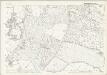
Buckinghamshire XXXV.2 (includes: Aldbury; Little Gaddesden; Northchurch) - 25 Inch Map
1 : 2500 Topographic maps Ordnance Survey Ordnance Survey
Hertfordshire XXV.SE - OS Six-Inch Map
1 : 10560 Topographic maps Ordnance Survey Ordnance Survey
Hertfordshire XXV.SE - OS Six-Inch Map
1 : 10560 Topographic maps Ordnance Survey Ordnance Survey
Hertfordshire XXV.SE - OS Six-Inch Map
1 : 10560 Topographic maps Ordnance Survey Ordnance Survey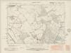
Buckinghamshire XXX.SW - OS Six-Inch Map
1 : 10560 Topographic maps Ordnance Survey Ordnance Survey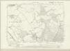
Buckinghamshire XXX.SW - OS Six-Inch Map
1 : 10560 Topographic maps Ordnance Survey Ordnance Survey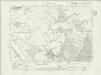
Buckinghamshire XXX.SW - OS Six-Inch Map
1 : 10560 Topographic maps Ordnance Survey Ordnance Survey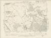
Buckinghamshire XXX.SW - OS Six-Inch Map
1 : 10560 Topographic maps Ordnance Survey Ordnance Survey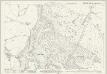
Buckinghamshire XXX.14 (includes: Aldbury; Ivinghoe; Little Gaddesden; Pitstone) - 25 Inch Map
1 : 2500 Topographic maps Ordnance Survey Ordnance Survey
Buckinghamshire XXX.14 (includes: Aldbury; Ivinghoe; Little Gaddesden; Pitstone) - 25 Inch Map
1 : 2500 Topographic maps Ordnance Survey Ordnance Survey
Buckinghamshire XXX.14 (includes: Aldbury; Ivinghoe; Little Gaddesden; Pitstone) - 25 Inch Map
1 : 2500 Topographic maps Ordnance Survey Ordnance Survey
Buckinghamshire XXX.13 (includes: Aldbury; Pitstone; Tring Urban) - 25 Inch Map
1 : 2500 Topographic maps Ordnance Survey Ordnance Survey
Buckinghamshire XXX.13 (includes: Aldbury; Pitstone; Tring Urban) - 25 Inch Map
1 : 2500 Topographic maps Ordnance Survey Ordnance Survey
Hertfordshire XXV - OS Six-Inch Map
1 : 10560 Topographic maps Ordnance Survey Ordnance Survey
SP91 - OS 1:25,000 Provisional Series Map
1 : 25000 Topographic maps Ordnance Survey Ordnance Survey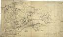
Aylesbury
1 : 31680 The chalk range of the Chiltern Hills reaches its highest point at Combe Hill, near Wendover, at the bottom left of this plan. Roughly drawn interlining ('hachuring') in black depicts relief with a recto inscription in pencil noting that "the irregular pencil lines are drawn too strong". The draughtsman has described earthworks, barrows, minor tributaries and a navigable feeder of the Grand Union Canal and a section of the prehistoric Icknield Way running from above Tring to "Pittlesthorn". Corrections in red ink are clearly visible, possibly dating from the 1831 revision of the plan. Boyce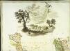
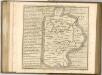
A topographical map of Hartford-Shire, 1
1 Blatt : 54 x 72 cm A. Dury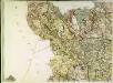
A topographical map of Hartford-Shire, 4
1 Blatt : 54 x 72 cm A. Dury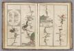
Watford to Rickmans Worth to Amersham, Watford to St. Albans.
1 : 63360 Cary, John
Aylesbury (Hills) - OS One-Inch Revised New Series
1 : 63360 Topographic maps Ordnance Survey Ordnance Survey
Aylesbury (Outline) - OS One-Inch Revised New Series
1 : 63360 Topographic maps Ordnance Survey Ordnance Survey
Hemel Hempstead
1 : 31680 This drawing describes a section of the Grand Junction Canal. The prehistoric Icknield Way appears at the top left of the plan. Hill-shading techniques and the attention given to communications routes conform to the military and cartographic standards employed by the Survey. Some name corrections are visible in faded ink in the centre of the map around Bovingdon. Harefield Common is also revised. Hyett, William
Luton
The boundaries of the counties of Bedfordshire, Buckinghamshire, and Hertfordshire are marked on this plan by pecked red lines. Red dots within circles indicate trigonometrical points from which the surveyor took angular measurements to plot topographical features of the landscape. Hyett, William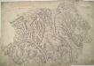
High Wycombe 20
1 : 31680 The county boundaries of Buckinghamshire, Hertfordshire and Oxfordshire are indicated by red pecked lines. The draughtsman has drawn individual trees in avenues at Hampden, and noted the location of the Old London Road at Fawley, to the extreme left. On the reverse of the drawing is written: "Mr Boyces High Wycombe No 154" and "Reduced [10 Aug]..." Boyce
London passenger transport map
Ordnance Survey
The Chilterns
1 : 63360 Ordnance Survey Office