Maps of Runnymede
Berkshire XL.10 & 14 (includes: Egham; Old Windsor) - 25 Inch Map
1 : 2500 Topographic maps Ordnance Survey Ordnance Survey
Berkshire XL.10 (includes: Egham; Old Windsor) - 25 Inch Map
1 : 2500 Topographic maps Ordnance Survey Ordnance Survey
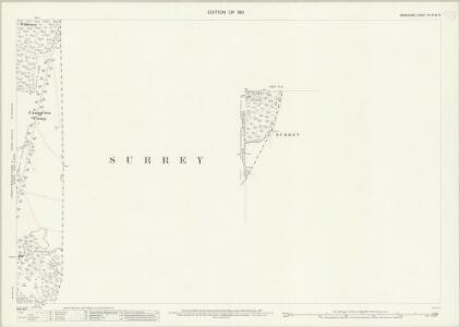
Surrey IV.SE - OS Six-Inch Map
1 : 10560 Topographic maps Ordnance Survey Ordnance Survey
Surrey IV.SE - OS Six-Inch Map
1 : 10560 Topographic maps Ordnance Survey Ordnance Survey
Surrey IV.SE - OS Six-Inch Map
1 : 10560 Topographic maps Ordnance Survey Ordnance Survey
Surrey IV.SE - OS Six-Inch Map
1 : 10560 Topographic maps Ordnance Survey Ordnance Survey
Surrey IV.SE - OS Six-Inch Map
1 : 10560 Topographic maps Ordnance Survey Ordnance Survey
Berkshire XL.SW - OS Six-Inch Map
1 : 10560 Topographic maps Ordnance Survey Ordnance Survey
Berkshire XL.SW - OS Six-Inch Map
1 : 10560 Topographic maps Ordnance Survey Ordnance Survey
Surrey IV.12 (includes: Egham) - 25 Inch Map
1 : 2500 Topographic maps Ordnance Survey Ordnance Survey
Surrey IV.12 (includes: Egham) - 25 Inch Map
1 : 2500 Topographic maps Ordnance Survey Ordnance Survey
Surrey IV.12 (includes: Egham) - 25 Inch Map
1 : 2500 Topographic maps Ordnance Survey Ordnance Survey
Surrey IV.16 (includes: Egham) - 25 Inch Map
1 : 2500 Topographic maps Ordnance Survey Ordnance Survey
Surrey IV.16 (includes: Egham) - 25 Inch Map
1 : 2500 Topographic maps Ordnance Survey Ordnance Survey
Surrey IV - OS Six-Inch Map
1 : 10560 Topographic maps Ordnance Survey Ordnance Survey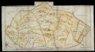
Map of Greate Parke
Map of Great Park from "A Description of the Honour of Windesor", John Norden's survey of Windsor. The title page states that the survey was "taken and performed by the perambulation view and delineation of John Norden In Anno 1607". The plans are the result of a survey conducted on foot by Norden. The maps in this volume show communication routes, individual buildings, field boundaries and parkland along with details of wildlife and human activity, such as stags in Windsor Park and people boating on the Thames. The scale at which the maps are presented varies throughout the volume, with feet, perches and miles being the units of measurement recorded by a scale bar. John Norden is best known for his work "Speculum Britainiae", literally a "Mirror of Britain", which in its attempt to include the road names and town plans, lacking on many county maps of the period, was a direct ancestor of the modern A-Z. As well as producing several county maps in the 1590s, Norden worked as a land surveyor producing surveys for landowners and was the author of a work which outlines principles of surveying, known as the "Surveyor's Dialogue". Norden, John
Surrey IV.11 (includes: Egham; Old Windsor) - 25 Inch Map
1 : 2500 Topographic maps Ordnance Survey Ordnance Survey
Surrey IV.11 (includes: Egham; Old Windsor) - 25 Inch Map
1 : 2500 Topographic maps Ordnance Survey Ordnance Survey
Surrey IV.11 (includes: Egham; Old Windsor) - 25 Inch Map
1 : 2500 Topographic maps Ordnance Survey Ordnance Survey
Surrey IV.15 (includes: Egham; Old Windsor; Sunningdale; Sunninghill) - 25 Inch Map
1 : 2500 Topographic maps Ordnance Survey Ordnance Survey
Surrey IV.15 (includes: Egham; Old Windsor; Sunningdale; Sunninghill) - 25 Inch Map
1 : 2500 Topographic maps Ordnance Survey Ordnance Survey
Surrey IV.15 (includes: Egham; Old Windsor; Sunningdale; Sunninghill) - 25 Inch Map
1 : 2500 Topographic maps Ordnance Survey Ordnance Survey
Berkshire XL - OS Six-Inch Map
1 : 10560 Topographic maps Ordnance Survey Ordnance Survey
The first sheet of an actual survey of Berkshire
1 Blatt : 68 x 52 cm publish'd according to act of parliament by John Rocque chorographer to their royal Highnesses the late and present Prince of Wales etc. in the Strand
Windsor (Outline) - OS One-Inch Revised New Series
1 : 63360 Topographic maps Ordnance Survey Ordnance Survey
Windsor (Hills) - OS One-Inch Revised New Series
1 : 63360 Topographic maps Ordnance Survey Ordnance Survey
Uxbridge, Windsor
1 : 31680 This plan of the Chiltern Hills runs from Beaconsfield and Harefield at the top to Windsor Park, Egham and Staines at the bottom. A section of the Grand Junction Canal, running from Harefield down to West Drayton, is shown in aquamarine. The paper carries the watermark "E ,amp; P", standing for Edmeads and Pine. Boyce
Chobham
1 : 31680 .This map is in poor repair. Its edges are dirty and damaged, and a join is visible where the drawing has been torn. Triangulation points can be seen at the map's boundaries, along with a series of stitch holes. Silk tape was wound through these holes to protect the map in the field. .The drawing details a large number of commons, including Pirbright, Ham Haw and Ockham. These are depicted by patterns of open dotting. Basingstoke Canal also features. It was completed in 1794, only a few years before this map was drawn. Blue washes, used to depict water, have faded. The town of Chertsey appears towards the top right, along with the ruins of Chertsey Abbey. The abbey was founded in AD666, as a house for the Benedictine Order, and dissolved in 1537. Budgen, Thomas
A new correct map of Middlesex
Warburton, John, Bland, Joseph and Smyth, Payler