Maps of Gravesham
Essex (New Series 1913-) n XCV.11 (includes: Northfleet; Thurrock) - 25 Inch Map
1 : 2500 Topographic maps Ordnance Survey Ordnance Survey
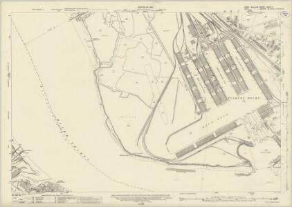
Kent X.2 (includes: Northfleet; Thurrock) - 25 Inch Map
1 : 2500 Topographic maps Ordnance Survey Ordnance Survey
Kent X.2 (includes: Northfleet; Thurrock) - 25 Inch Map
1 : 2500 Topographic maps Ordnance Survey Ordnance Survey
Kent X.2 (includes: Northfleet; Thurrock) - 25 Inch Map
1 : 2500 Topographic maps Ordnance Survey Ordnance Survey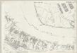
Essex (1st Ed/Rev 1862-96) LXXXVIII.4 (includes: Northfleet; Thurrock) - 25 Inch Map
1 : 2500 Topographic maps Ordnance Survey Ordnance Survey
Insurance Plan of London Vol. xi: sheet 367
1 : 480 This detailed 1891 plan of London is one of a series of forty seven sheets in an atlas originally produced to aid insurance companies in assessing fire risks. The building footprints, their use (commercial, residential, educational, etc.), the number of floors and the height of the building, as well as construction materials (and thus risk of burning) and special fire hazards (chemicals, kilns, ovens) were documented in order to estimate premiums. Names of individual businesses, property lines, and addresses were also often recorded. Together these maps provide a rich historical shapshot of the commercial activity and urban landscape of towns and cities at the time. The British Library holds a comprehensive collection of fire insurance plans produced by the London-based firm Charles E. Goad Ltd. dating back to 1885. These plans were made for most important towns and cities of the British Isles at the scales of 1:480 (1 inch to 40 feet), as well as many foreign towns at 1:600 (1 inch to 50 feet). Chas E Goad Limited Chas E Goad Limited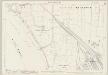
Essex (1st Ed/Rev 1862-96) LXXXIII.16 (includes: Thurrock) - 25 Inch Map
1 : 2500 Topographic maps Ordnance Survey Ordnance Survey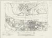
Essex nXCV.SE - OS Six-Inch Map
1 : 10560 Topographic maps Ordnance Survey Ordnance Survey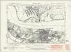
Essex nXCV.SE - OS Six-Inch Map
1 : 10560 Topographic maps Ordnance Survey Ordnance Survey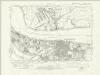
Essex nXCV.SE - OS Six-Inch Map
1 : 10560 Topographic maps Ordnance Survey Ordnance Survey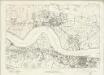
Essex nXCV - OS Six-Inch Map
1 : 10560 Topographic maps Ordnance Survey Ordnance Survey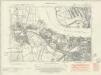
Kent X.NW - OS Six-Inch Map
1 : 10560 Topographic maps Ordnance Survey Ordnance Survey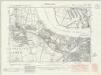
Kent X.NW - OS Six-Inch Map
1 : 10560 Topographic maps Ordnance Survey Ordnance Survey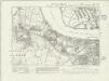
Kent X.NW - OS Six-Inch Map
1 : 10560 Topographic maps Ordnance Survey Ordnance Survey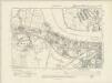
Kent X.NW - OS Six-Inch Map
1 : 10560 Topographic maps Ordnance Survey Ordnance Survey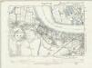
Kent X.NW - OS Six-Inch Map
1 : 10560 Topographic maps Ordnance Survey Ordnance Survey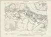
Essex LXXXVIII.NE - OS Six-Inch Map
1 : 10560 Topographic maps Ordnance Survey Ordnance Survey
Essex LXXXIII.SE - OS Six-Inch Map
1 : 10560 Topographic maps Ordnance Survey Ordnance Survey
Kent X.1 (includes: Northfleet; Swanscombe) - 25 Inch Map
1 : 2500 Topographic maps Ordnance Survey Ordnance Survey
Kent X.1 (includes: Northfleet; Swanscombe) - 25 Inch Map
1 : 2500 Topographic maps Ordnance Survey Ordnance Survey
Kent X.1 (includes: Northfleet; Swanscombe) - 25 Inch Map
1 : 2500 Topographic maps Ordnance Survey Ordnance Survey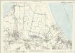
Kent X.1 (includes: Northfleet; Swanscombe) - 25 Inch Map
1 : 2500 Topographic maps Ordnance Survey Ordnance Survey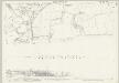
Essex (1st Ed/Rev 1862-96) LXXXIX.1 (includes: Gravesend; Thurrock) - 25 Inch Map
1 : 2500 Topographic maps Ordnance Survey Ordnance Survey
TQ67 - OS 1:25,000 Provisional Series Map
1 : 25000 Topographic maps Ordnance Survey Ordnance Survey
Rainham
1 : 21120 This is a roughly drawn field sketch of the north bank of the Thames, extending from West Thurrock, at the bottom, to Great Warley, at the top. The plan is made up of about 13 irregularly cut pieces of paper watermarked "1794". Some mismatch of detail is noticeable along the edges where the sheets have been joined, and the orientation of the lettering on the component parts is varied. Trigonometrical stations, from which the surveyors took angular readings, are marked 'flag', notably at 'Bulvan Fenn' and just above the low water mark for the Thames. Verron, Charles
East Tilbury, Essex
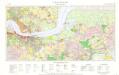
Great Britain [Second land utilisation survey] 1:25,000
Coleman, Alice Isle of Thanet Geographical Association
A topographical-map, of the county of Kent, 2
1 Blatt : 54 x 69 cm A. Dury, W. Herbert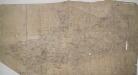
Dartford, Kent
Details of this drawing are corrected in heavy black ink with crosses placed over incorrect field boundaries and communication routes. Red pecked lines form a grid over the drawing. These are triangulation lines, which the draughtsman used to plot features of the landscape. A characteristically straight Roman road is shown leading from Dartford. In the bottom right, the scale is recorded and area calculations laid out.
Dartford (Hills) - OS One-Inch Revised New Series
1 : 63360 Topographic maps Ordnance Survey Ordnance Survey