Maps of St Edmundsbury
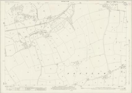
Essex (New Series 1913-) n IV.15 (includes: Cavendish; Pentlow) - 25 Inch Map
1 : 2500 Topographic maps Ordnance Survey Ordnance Survey
Suffolk LXXI.8 (includes: Belchamp St Paul; Cavendish; Clare; Pentlow) - 25 Inch Map
1 : 2500 Topographic maps Ordnance Survey Ordnance Survey
Suffolk LXXI.8 (includes: Belchamp St Paul; Cavendish; Clare; Pentlow) - 25 Inch Map
1 : 2500 Topographic maps Ordnance Survey Ordnance Survey
Essex (1st Ed/Rev 1862-96) VI.5 (includes: Foxearth; Pentlow) - 25 Inch Map
1 : 2500 Topographic maps Ordnance Survey Ordnance Survey
Essex nIV.SE - OS Six-Inch Map
1 : 10560 Topographic maps Ordnance Survey Ordnance Survey
Essex nIV - OS Six-Inch Map
1 : 10560 Topographic maps Ordnance Survey Ordnance Survey
Essex nIV - OS Six-Inch Map
1 : 10560 Topographic maps Ordnance Survey Ordnance Survey
Essex nIV - OS Six-Inch Map
1 : 10560 Topographic maps Ordnance Survey Ordnance Survey
Essex V.NE - OS Six-Inch Map
1 : 10560 Topographic maps Ordnance Survey Ordnance Survey
Suffolk LXXI.NE - OS Six-Inch Map
1 : 10560 Topographic maps Ordnance Survey Ordnance Survey
Suffolk LXXI.NE - OS Six-Inch Map
1 : 10560 Topographic maps Ordnance Survey Ordnance Survey
Suffolk LXXII.NW - OS Six-Inch Map
1 : 10560 Topographic maps Ordnance Survey Ordnance Survey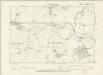
Essex VI.NW - OS Six-Inch Map
1 : 10560 Topographic maps Ordnance Survey Ordnance Survey
Essex VI.NW - OS Six-Inch Map
1 : 10560 Topographic maps Ordnance Survey Ordnance Survey
Suffolk LXXII.NW - OS Six-Inch Map
1 : 10560 Topographic maps Ordnance Survey Ordnance Survey
Suffolk LXXI.4 (includes: Cavendish; Clare; Pentlow) - 25 Inch Map
1 : 2500 Topographic maps Ordnance Survey Ordnance Survey
Suffolk LXXII.1 (includes: Cavendish; Foxearth; Glemsford; Pentlow) - 25 Inch Map
1 : 2500 Topographic maps Ordnance Survey Ordnance Survey
Suffolk LXXII.1 (includes: Cavendish; Foxearth; Glemsford; Pentlow) - 25 Inch Map
1 : 2500 Topographic maps Ordnance Survey Ordnance Survey
Suffolk LXXII.1 (includes: Cavendish; Foxearth; Glemsford; Pentlow) - 25 Inch Map
1 : 2500 Topographic maps Ordnance Survey Ordnance Survey
Boxstead
1 : 31680 The draughtsman used Balsham Steeple and West Wickham Steeple at the top left of this plan as triangulation points. From these positions, he made angular observations with a theodolite to measure the height of the land and to plot individual topographical features. Pencil rays radiating from these two points,record the measurement process. Verron Charles
Sudbury (Outline) - OS One-Inch Revised New Series
1 : 63360 Topographic maps Ordnance Survey Ordnance Survey
Sudbury (Hills) - OS One-Inch Revised New Series
1 : 63360 Topographic maps Ordnance Survey Ordnance Survey
Colchester - OS One-Inch Map
1 : 63360 Topographic maps Ordnance Survey Ordnance Survey
A New and Correct Mapp of Middlesex, Essex and Hertfordshire
Bland, Joseph, Parker, Samuel, Smyth, Payler and Warburton, John
Essex
1 : 200000
Suffolk, Sheet 20 - Bartholomew's "Half Inch to the Mile Maps" of England & Wales
1 : 126720 Topographic maps Bartholomew, John George John Bartholomew & Co
Langley's new map of Essex
1 : 488000
Essex actually surveyed with the several Roads from London &c. ...
1 : 191000
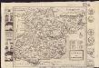
A mapp of ye county of Essex, with its hundreds
1 : 250000