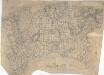
Maps of Barking and Dagenham
Essex (1st Ed/Rev 1862-96) LXXXII.3 (includes: Dagenham; Erith; Hornchurch) - 25 Inch Map
1 : 2500 Topographic maps Ordnance Survey Ordnance Survey
Kent III.1 (includes: Erith; Hornchurch; Rainham) - 25 Inch Map
1 : 2500 Topographic maps Ordnance Survey Ordnance Survey
Kent III.1 (includes: Erith; Hornchurch; Rainham) - 25 Inch Map
1 : 2500 Topographic maps Ordnance Survey Ordnance Survey
Kent III.1 (includes: Erith; Hornchurch; Rainham) - 25 Inch Map
1 : 2500 Topographic maps Ordnance Survey Ordnance Survey
Essex nLXXXVII.SW - OS Six-Inch Map
1 : 10560 Topographic maps Ordnance Survey Ordnance Survey
Essex nLXXXVII.SW - OS Six-Inch Map
1 : 10560 Topographic maps Ordnance Survey Ordnance Survey
Essex LXXXII.NE - OS Six-Inch Map
1 : 10560 Topographic maps Ordnance Survey Ordnance Survey
Essex (New Series 1913-) n LXXXVII.10 (includes: Dagenham; Hornchurch; Rainham) - 25 Inch Map
1 : 2500 Topographic maps Ordnance Survey Ordnance Survey
Essex (New Series 1913-) n LXXXVII.10 (includes: Dagenham; Hornchurch; Rainham) - 25 Inch Map
1 : 2500 Topographic maps Ordnance Survey Ordnance Survey
Essex (New Series 1913-) n LXXXVII.14 (includes: Erith; Hornchurch; Rainham) - 25 Inch Map
1 : 2500 Topographic maps Ordnance Survey Ordnance Survey
Essex (New Series 1913-) n LXXXVII.14 (includes: Erith; Hornchurch; Rainham) - 25 Inch Map
1 : 2500 Topographic maps Ordnance Survey Ordnance Survey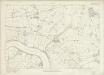
Essex nLXXXVII - OS Six-Inch Map
1 : 10560 Topographic maps Ordnance Survey Ordnance Survey
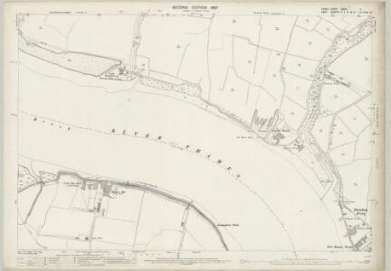
Rainham, Essex
Allen, William Thomas, Liley, George and Tutton, Alwyne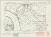
Kent III.NW - OS Six-Inch Map
1 : 10560 Topographic maps Ordnance Survey Ordnance Survey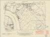
Kent III.NW - OS Six-Inch Map
1 : 10560 Topographic maps Ordnance Survey Ordnance Survey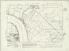
Kent III.NW - OS Six-Inch Map
1 : 10560 Topographic maps Ordnance Survey Ordnance Survey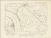
Kent III.NW - OS Six-Inch Map
1 : 10560 Topographic maps Ordnance Survey Ordnance Survey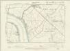
Kent III.NW - OS Six-Inch Map
1 : 10560 Topographic maps Ordnance Survey Ordnance Survey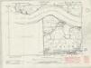
Kent II.NE - OS Six-Inch Map
1 : 10560 Topographic maps Ordnance Survey Ordnance Survey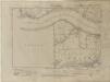
Kent II.NE - OS Six-Inch Map
1 : 10560 Topographic maps Ordnance Survey Ordnance Survey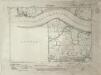
Kent II.NE - OS Six-Inch Map
1 : 10560 Topographic maps Ordnance Survey Ordnance Survey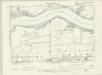
Kent IA.SE & II.NE - OS Six-Inch Map
1 : 10560 Topographic maps Ordnance Survey Ordnance Survey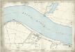
Kent II.4 (includes: Barking; Dagenham; Erith) - 25 Inch Map
1 : 2500 Topographic maps Ordnance Survey Ordnance Survey
Kent III.5 (includes: Erith; Hornchurch; Rainham; Wennington) - 25 Inch Map
1 : 2500 Topographic maps Ordnance Survey Ordnance Survey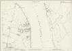
Kent III.5 (includes: Erith; Hornchurch; Rainham; Wennington) - 25 Inch Map
1 : 2500 Topographic maps Ordnance Survey Ordnance Survey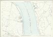
Kent III.5 (includes: Erith; Hornchurch; Rainham; Wennington) - 25 Inch Map
1 : 2500 Topographic maps Ordnance Survey Ordnance Survey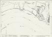
Essex (New Series 1913-) n LXXXVII.9 (includes: Barking; Dagenham; Erith) - 25 Inch Map
1 : 2500 Topographic maps Ordnance Survey Ordnance Survey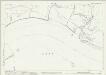
Essex (New Series 1913-) n LXXXVII.9 (includes: Barking; Dagenham; Erith) - 25 Inch Map
1 : 2500 Topographic maps Ordnance Survey Ordnance Survey
Essex LXXXII - OS Six-Inch Map
1 : 10560 Topographic maps Ordnance Survey Ordnance Survey