Maps of Basildon
Essex (1st Ed/Rev 1862-96) LXXVI.7 (includes: Billericay; Thurrock) - 25 Inch Map
1 : 2500 Topographic maps Ordnance Survey Ordnance Survey
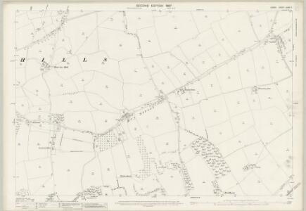
Essex (New Series 1913-) n LXXXI.14 (includes: Billericay; Thurrock) - 25 Inch Map
1 : 2500 Topographic maps Ordnance Survey Ordnance Survey
Essex (New Series 1913-) n LXXXI.14 (includes: Billericay; Thurrock) - 25 Inch Map
1 : 2500 Topographic maps Ordnance Survey Ordnance Survey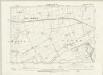
Essex LXXVI.NE - OS Six-Inch Map
1 : 10560 Topographic maps Ordnance Survey Ordnance Survey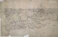
Hadleigh
This drawing covers Canvey Island. Red triangulation lines are marked, radiating from the centre of settlements and from trigonometrical stations, denoted by the word 'Flag', as at Canvey Point. The draughtsman has shown the channels and sandbanks of the Bemfleet Creek, noting that one bank is only dry at spring tides. A dominant feature of the coastline is the sea wall, represented by a thick grey angular line extending all the way up the creek. Built to protect vulnerable marshland from the sea, the wall benefited from Dutch reclamation work in the 17th century but did not withstand serious floods in 1791, after which further repair work was essential. An Act of Parliament in 1792 established a board of commissioners to build new sections of wall behind the existing one in the places where breaches had occurred. This can be seen on Fobbing Marsh and around Shell Haven Creek in this 1798 drawing. Area calculations appear in the bottom left.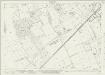
Essex (New Series 1913-) n LXXXIX.2 (includes: Billericay; Thurrock) - 25 Inch Map
1 : 2500 Topographic maps Ordnance Survey Ordnance Survey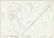
Essex (New Series 1913-) n LXXXIX.2 (includes: Billericay; Thurrock) - 25 Inch Map
1 : 2500 Topographic maps Ordnance Survey Ordnance Survey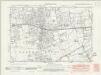
Essex nLXXXI.SW - OS Six-Inch Map
1 : 10560 Topographic maps Ordnance Survey Ordnance Survey
Essex nLXXXI.SW - OS Six-Inch Map
1 : 10560 Topographic maps Ordnance Survey Ordnance Survey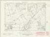
Essex nLXXXIX.NW - OS Six-Inch Map
1 : 10560 Topographic maps Ordnance Survey Ordnance Survey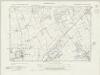
Essex nLXXXIX.NW - OS Six-Inch Map
1 : 10560 Topographic maps Ordnance Survey Ordnance Survey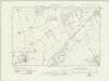
Essex nLXXXIX.NW - OS Six-Inch Map
1 : 10560 Topographic maps Ordnance Survey Ordnance Survey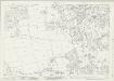
Essex (New Series 1913-) n LXXXI.13 (includes: Billericay; Thurrock) - 25 Inch Map
1 : 2500 Topographic maps Ordnance Survey Ordnance Survey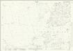
Essex (New Series 1913-) n LXXXI.13 (includes: Billericay; Thurrock) - 25 Inch Map
1 : 2500 Topographic maps Ordnance Survey Ordnance Survey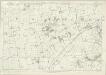
Essex LXXVI - OS Six-Inch Map
1 : 10560 Topographic maps Ordnance Survey Ordnance Survey
East Tilbury, Essex

Die Environs von London
Londýn (Anglie) Kitchin, Thomas Bowles, Carington
London N.E. - OS One-Inch Map
1 : 63360 Topographic maps Ordnance Survey Ordnance Survey
Southend-On-Sea - OS One-Inch Map
1 : 63360 Topographic maps Ordnance Survey Ordnance Survey
To the Nobility & Gentry of Essex
Pask, Joseph Robert Morden
REGIONIS, qvae est circa LONDINVM, specialis repraesentatio geographica
1 : 190000 Bowles, Thomas curantibus Homan[n]ianis Heredibus
Environs of London.
1 : 93000 Colton, G.W.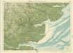
Essex, Sheet 26 - Bartholomew's "Half Inch to the Mile Maps" of England & Wales
1 : 126720 Topographic maps Bartholomew, John George John Bartholomew & Co
Essex
1 : 200000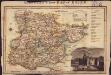
Langley's new map of Essex
1 : 488000
Bedford, Hertford, Sheet 25 - Bartholomew's "Half Inch to the Mile Maps" of England & Wales
1 : 126720 Topographic maps Bartholomew, John George John Bartholomew & Co
Essex actually surveyed with the several Roads from London &c. ...
1 : 191000
A mapp of ye county of Essex, with its hundreds
1 : 250000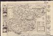
Essex
1 : 335000