Maps of Brentwood
Essex (1st Ed/Rev 1862-96) LIX.15 (includes: Brentwood; Doddinghurst) - 25 Inch Map
1 : 2500 Topographic maps Ordnance Survey Ordnance Survey
Essex LIX.SE - OS Six-Inch Map
1 : 10560 Topographic maps Ordnance Survey Ordnance Survey
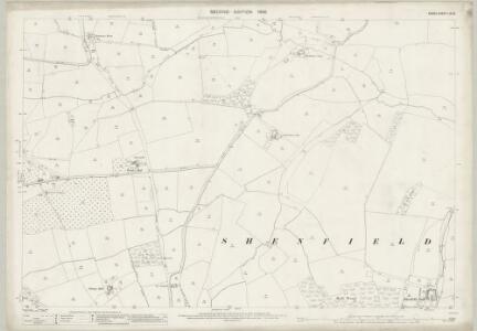
Essex (New Series 1913-) n LXXI.6 (includes: Brentwood; Doddinghurst) - 25 Inch Map
1 : 2500 Topographic maps Ordnance Survey Ordnance Survey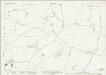
Essex (New Series 1913-) n LXXI.6 (includes: Brentwood; Doddinghurst) - 25 Inch Map
1 : 2500 Topographic maps Ordnance Survey Ordnance Survey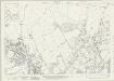
Essex (New Series 1913-) n LXXI.10 (includes: Brentwood) - 25 Inch Map
1 : 2500 Topographic maps Ordnance Survey Ordnance Survey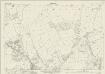
Essex (New Series 1913-) n LXXI.10 (includes: Brentwood) - 25 Inch Map
1 : 2500 Topographic maps Ordnance Survey Ordnance Survey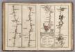
London to Rochester.
1 : 63360 Cary, John
Essex nLXXI.NW - OS Six-Inch Map
1 : 10560 Topographic maps Ordnance Survey Ordnance Survey
Essex nLXXI.NW - OS Six-Inch Map
1 : 10560 Topographic maps Ordnance Survey Ordnance Survey
Essex nLXXI.NW - OS Six-Inch Map
1 : 10560 Topographic maps Ordnance Survey Ordnance Survey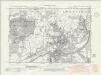
Essex nLXXI.SW - OS Six-Inch Map
1 : 10560 Topographic maps Ordnance Survey Ordnance Survey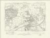
Essex nLXXI.SW - OS Six-Inch Map
1 : 10560 Topographic maps Ordnance Survey Ordnance Survey
Essex (New Series 1913-) n LXXI.5 (includes: Brentwood; Doddinghurst) - 25 Inch Map
1 : 2500 Topographic maps Ordnance Survey Ordnance Survey
Essex (New Series 1913-) n LXXI.5 (includes: Brentwood; Doddinghurst) - 25 Inch Map
1 : 2500 Topographic maps Ordnance Survey Ordnance Survey
Essex (New Series 1913-) n LXXI.9 (includes: Brentwood) - 25 Inch Map
1 : 2500 Topographic maps Ordnance Survey Ordnance Survey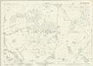
Essex (New Series 1913-) n LXXI.9 (includes: Brentwood) - 25 Inch Map
1 : 2500 Topographic maps Ordnance Survey Ordnance Survey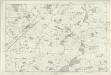
Essex LIX - OS Six-Inch Map
1 : 10560 Topographic maps Ordnance Survey Ordnance Survey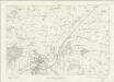
Essex nLXXI - OS Six-Inch Map
1 : 10560 Topographic maps Ordnance Survey Ordnance Survey
Brentwood, Essex
This drawing covers the settlements and surrounding country of part of Essex. Brentwood is the largest of these settlements. The layout of the town is indicated by red blocks. The straight line of the road leading to the town reveals its Roman origin, although the draughtsman, unusually, does not label it as such. The main communication routes are coloured yellow, conforming to military cartographic standards. The meanderings of the River Crouch are painstakingly plotted, with the surrounding open land represented by dots. Budgen, Charles
Ordnance Survey of England. Sheet 257, Romford
1 : 63360 Ordnance survey. GB Southampton : Ordnance Survey Office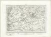
Romford (Outline) - OS One-Inch Revised New Series
1 : 63360 Topographic maps Ordnance Survey Ordnance Survey
Romford (Hills) - OS One-Inch Revised New Series
1 : 63360 Topographic maps Ordnance Survey Ordnance Survey
Die Environs von London
Londýn (Anglie) Kitchin, Thomas Bowles, Carington
London passenger transport map
Ordnance Survey
Ordnance Survey of England and Wales (Sheet 7), South Wales
Ordnance Survey, Great Britain
Delineatio ac finitima regio Magnae Brittaniae metropoleos Londini
Londýn (Anglie) Seutter, Matthäus a Matt. Seutter
London N.E. - OS One-Inch Map
1 : 63360 Topographic maps Ordnance Survey Ordnance Survey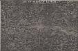
THE ENVIRONS OF LONDON
This map of London and part of the Home Counties was published in Pinnock's 'Guide to Knowledge'. Reduced from an original Ordnance Survey drawing, the map is printed in white on black, with the title in inset table at top centre. Though none of the sheets of the first edition of the Ordnance Survey covered London, part of the metropolitan area was contained in the maps of Middlesex, Essex, Surrey and Kent issued between 1805 and 1822. Archer, Joshua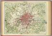
London.
1 : 126720 John Bartholomew & Co.